File:Manchester and bolton railway map.gif
Jump to navigation
Jump to search
Size of this preview: 610 × 600 pixels. Other resolutions: 244 × 240 pixels | 488 × 480 pixels | 781 × 768 pixels | 1,042 × 1,024 pixels | 1,934 × 1,901 pixels.
Original file (1,934 × 1,901 pixels, file size: 85 KB, MIME type: image/gif)
Captions
Captions
Add a one-line explanation of what this file represents
Summary
[edit]
| Description |
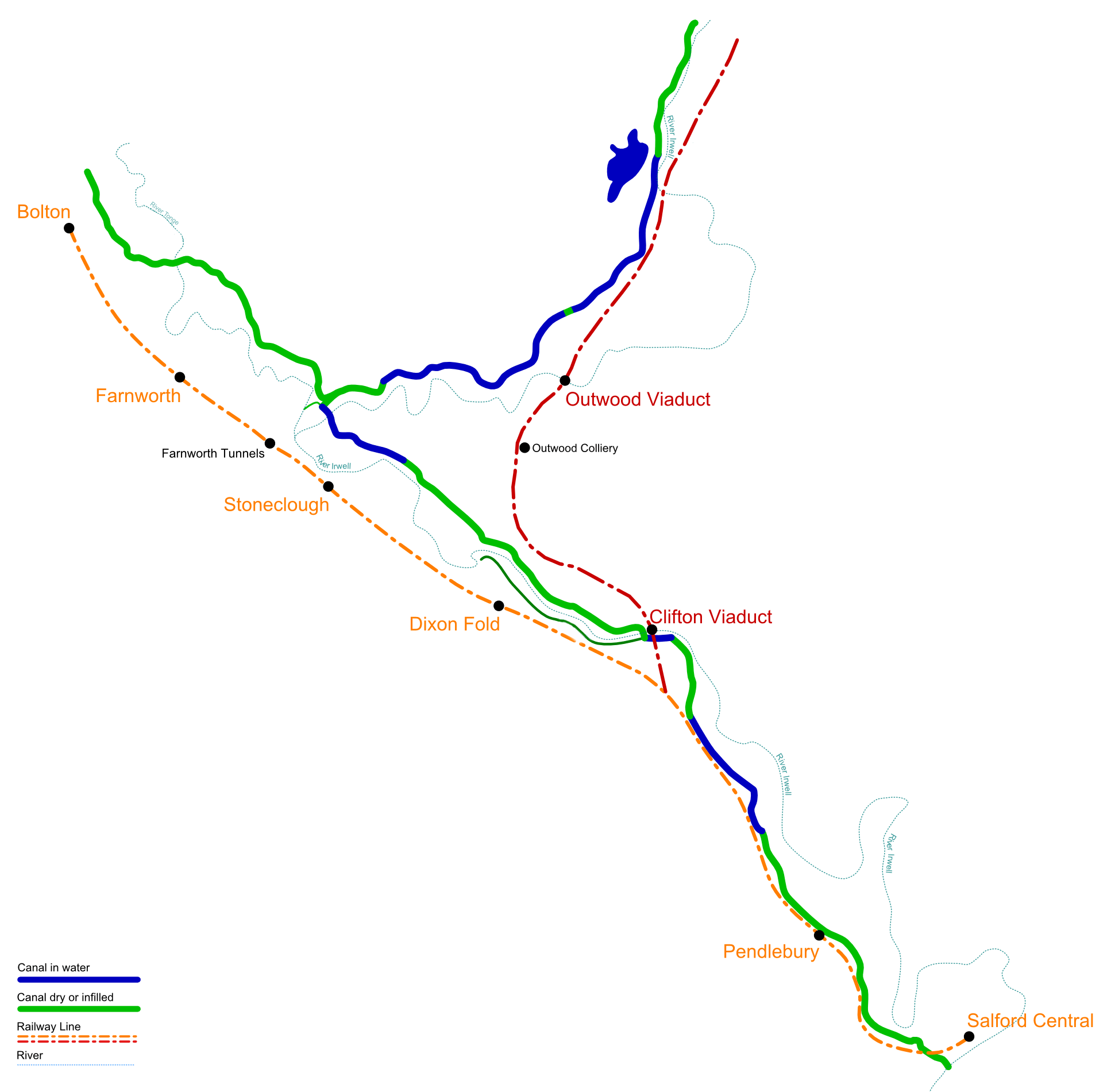
English: A map of the original layout and stations for the Manchester and Bolton Railway, with the East Lancs line added for reference. The Manchester Bolton & Bury Canal is also shown, blue areas are in water, green areas are dry/infilled/demolished. |
| Date | |
| Source | Own work |
| Author | Parrot of Doom |
Licensing
[edit]
| I, the copyright holder of this work, release this work into the public domain. This applies worldwide. In some countries this may not be legally possible; if so: I grant anyone the right to use this work for any purpose, without any conditions, unless such conditions are required by law. |
File history
Click on a date/time to view the file as it appeared at that time.
| Date/Time | Thumbnail | Dimensions | User | Comment | |
|---|---|---|---|---|---|
| current | 01:29, 4 December 2008 | | 1,934 × 1,901 (85 KB) | Parrot of Doom (talk | contribs) | {{Information |Description= |Source= |Date= |Author= |Permission= |other_versions= }} |
| 01:23, 4 December 2008 |  | 1,934 × 1,901 (87 KB) | Parrot of Doom (talk | contribs) | {{Information |Description={{en|1=A map of the original layout and stations for the Manchester and Bolton Railway, with the East Lancs line added for reference. The Manchester Bolton & Bury Canal is also shown, blue areas are in water, green areas are dr |
You cannot overwrite this file.
File usage on Commons
There are no pages that use this file.
File usage on other wikis
The following other wikis use this file:
- Usage on en.wikipedia.org