File:Maluku Islands de.png
Jump to navigation
Jump to search

Size of this preview: 545 × 600 pixels. Other resolutions: 218 × 240 pixels | 436 × 480 pixels | 698 × 768 pixels | 930 × 1,024 pixels | 1,499 × 1,650 pixels.
Original file (1,499 × 1,650 pixels, file size: 1.08 MB, MIME type: image/png)
Captions
Captions
Add a one-line explanation of what this file represents
Summary
[edit]| Description |
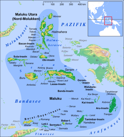
Deutsch: Karte der Molukken
English: Map of Maluku Islands |
| Date | |
| Source |
own work, used: |
| Author | Lencer |
| Other versions |
|


|
This map has been made or improved in the German Kartenwerkstatt (Map Lab). You can propose maps to improve as well.
|
Licensing
[edit]
I, the copyright holder of this work, hereby publish it under the following license:
This file is licensed under the Creative Commons Attribution-Share Alike 3.0 Unported license.
- You are free:
- to share – to copy, distribute and transmit the work
- to remix – to adapt the work
- Under the following conditions:
- attribution – You must give appropriate credit, provide a link to the license, and indicate if changes were made. You may do so in any reasonable manner, but not in any way that suggests the licensor endorses you or your use.
- share alike – If you remix, transform, or build upon the material, you must distribute your contributions under the same or compatible license as the original.
File history
Click on a date/time to view the file as it appeared at that time.
| Date/Time | Thumbnail | Dimensions | User | Comment | |
|---|---|---|---|---|---|
| current | 13:03, 28 March 2013 | | 1,499 × 1,650 (1.08 MB) | Lencer (talk | contribs) | + Kayoa, fixed Neuguinea |
| 18:10, 24 March 2013 |  | 1,499 × 1,650 (1.07 MB) | Lencer (talk | contribs) | + Manuk, + Serua, + Teun, Haruku fixed | |
| 09:45, 12 February 2013 |  | 1,500 × 1,651 (1.07 MB) | Lencer (talk | contribs) | + Lease-Inseln | |
| 14:34, 11 February 2013 |  | 1,500 × 1,651 (1.07 MB) | Lencer (talk | contribs) | + Seramsee, + Halmaherasee | |
| 12:41, 6 February 2013 |  | 1,500 × 1,651 (1.06 MB) | Lencer (talk | contribs) | == {{int:filedesc}} == {{Information |Description= {{de|Karte der Molukken}} {{en|Map of Muluku Islands}} |Source=own work, used: * Maluku Locator Topography.png by [[User:... |
You cannot overwrite this file.
File usage on Commons
The following page uses this file:
File usage on other wikis
The following other wikis use this file:
- Usage on ceb.wikipedia.org
- Usage on de.wikipedia.org
- Molukken
- Maluku Utara
- Maluku
- Bandasee
- Tanimbarinseln
- Benutzer:Lencer
- Sula-Inseln
- Tanahbesar
- Obi-Inseln
- Seramsee
- Halmaherasee
- Lease-Inseln
- Bandabogen
- Wikipedia:Kartenwerkstatt/Archiv/2013-03
- Watubela-Inseln
- Kasiui
- Teor (Insel)
- Watubela (Insel)
- Ingar
- Baam
- Pulau Uran
- Kurkap
- Gorominseln
- Gorom (Insel)
- Panjang
- Manawoka
- Zentralmolukken
- Nördliche Loloda-Inseln
- Obiparadieskrähe
- Geiselnahme in Wijster
- Obira
- Japanische Invasion der Molukken
- Usage on de.wikivoyage.org
- Usage on de.wiktionary.org
- Usage on en.wikipedia.org
- Usage on frr.wikipedia.org
- Usage on fr.wiktionary.org
- Usage on pnb.wikipedia.org
- Usage on sv.wikipedia.org
View more global usage of this file.