File:Maastricht, Plan tot aanleg van straten op de vestingterreinen te Wyk, 1882 (cropped).jpg

Original file (1,872 × 1,528 pixels, file size: 1.89 MB, MIME type: image/jpeg)
Captions
Captions
Summary
[edit]| Description |
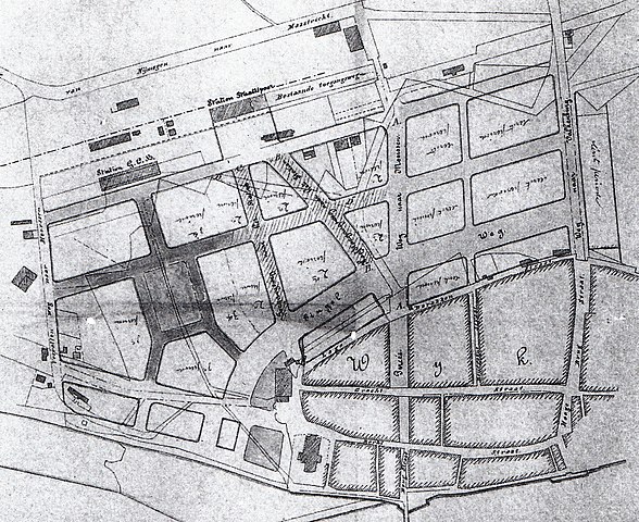
Nederlands: "Plan tot aanleg van straten op de vestingterreinen te Wyk". Stratenplan uit 1882 van de aan te leggen Stationsbuurt in Maastricht door ir. A. Brender à Brandis. Collectie Gemeente Archief Maastricht. |
| Date | |
| Source | M. Martin (2000): Opkomst van de moderne stad. Ruimtelijke veranderingen in Maastricht 1660-1905, page 225. Waanders Uitgevers, Zwolle. Rijksdienst voor de Monumentenzorg, Zeist. ISBN 90-400-9323-7 |
| Author | A. Brender à Brandis |
| Other versions |

.jpg&action=edit§ion=1)
Licensing
[edit].jpg&action=edit§ion=2)
|
This work is in the public domain in its country of origin and other countries and areas where the copyright term is the author's life plus 70 years or fewer.
| |
| This file has been identified as being free of known restrictions under copyright law, including all related and neighboring rights. | |
File history
Click on a date/time to view the file as it appeared at that time.
| Date/Time | Thumbnail | Dimensions | User | Comment | |
|---|---|---|---|---|---|
| current | 07:33, 12 November 2020 | | 1,872 × 1,528 (1.89 MB) | Kleon3 (talk | contribs) | File:Maastricht, Plan tot aanleg van straten op de vestingterreinen te Wyk, 1882.jpg cropped 6 % horizontally, 28 % vertically using CropTool with precise mode. |
You cannot overwrite this file.
File usage on Commons
The following page uses this file:
File usage on other wikis
The following other wikis use this file:
- Usage on nl.wikipedia.org
Metadata
.jpg&oldid=516557369)
- March 1882 in the Netherlands
- 1882 in Maastricht
- 19th-century maps of Maastricht
- History of Wyck (Maastricht)
- Train stations in Maastricht
- Housing subdivision
- Stationsstraat (Maastricht)
- Wilhelminasingel (Maastricht)
- Sint Maartenslaan (Maastricht)
- Sterreplein (Maastricht)
- Sint Antoniuslaan (Maastricht)
- Franciscus Romanusweg (Maastricht)
- Meerssenerweg (Maastricht)
- Akerstraat (Maastricht)
- Bourgognestraat (Maastricht)
- Alexander Battalaan (Maastricht)