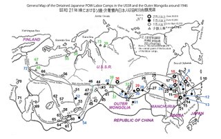
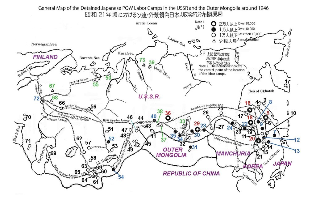
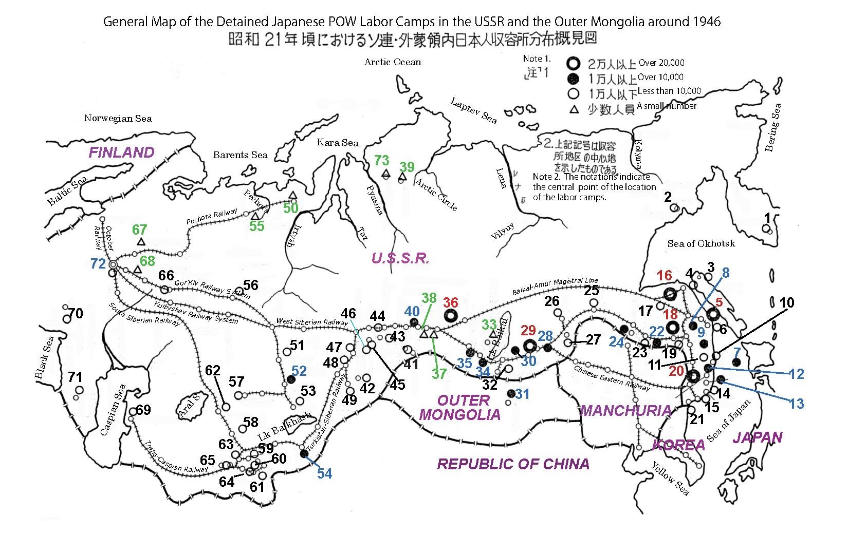
File:MAP General location of the Japanese POW Laborers’ camps in the Soviet Union and in Outer Mongolia around 1946.pdf
Jump to navigation
Jump to search

Size of this JPG preview of this PDF file: 800 × 505 pixels. Other resolutions: 320 × 202 pixels | 640 × 404 pixels | 1,024 × 646 pixels | 1,280 × 808 pixels | 1,650 × 1,041 pixels.
Original file (1,650 × 1,041 pixels, file size: 6.81 MB, MIME type: application/pdf)
Captions
Captions
Add a one-line explanation of what this file represents

|
File:MAP General location of the Japanese POW Laborers’ camps in the Soviet Union and in Outer Mongolia around 1946.svg is a vector version of this file. It should be used in place of this PDF file.
File:MAP General location of the Japanese POW Laborers’ camps in the Soviet Union and in Outer Mongolia around 1946.pdf → File:MAP General location of the Japanese POW Laborers’ camps in the Soviet Union and in Outer Mongolia around 1946.svg
For more information, see Help:SVG. |
 |
Summary
[edit]| Description |
English: Created by using
|
| Date | |
| Source | Own work |
| Author | Sey Nishimura |
Licensing
[edit]I, the copyright holder of this work, hereby publish it under the following license:
This file is licensed under the Creative Commons Attribution-Share Alike 4.0 International license.
- You are free:
- to share – to copy, distribute and transmit the work
- to remix – to adapt the work
- Under the following conditions:
- attribution – You must give appropriate credit, provide a link to the license, and indicate if changes were made. You may do so in any reasonable manner, but not in any way that suggests the licensor endorses you or your use.
- share alike – If you remix, transform, or build upon the material, you must distribute your contributions under the same or compatible license as the original.
File history
Click on a date/time to view the file as it appeared at that time.
| Date/Time | Thumbnail | Dimensions | User | Comment | |
|---|---|---|---|---|---|
| current | 20:06, 1 August 2017 |  | 1,650 × 1,041 (6.81 MB) | Seynishim (talk | contribs) | User created page with UploadWizard |
You cannot overwrite this file.
File usage on Commons
There are no pages that use this file.