File:Low Street, Londesborough - geograph.org.uk - 1231288.jpg
Jump to navigation
Jump to search
Size of this preview: 475 × 600 pixels. Other resolutions: 190 × 240 pixels | 507 × 640 pixels.
Original file (507 × 640 pixels, file size: 168 KB, MIME type: image/jpeg)
Captions
Captions
Add a one-line explanation of what this file represents
Summary
[edit]
| Description |
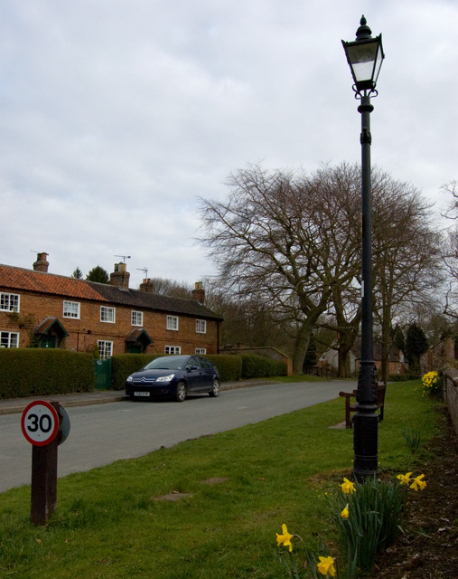
English: Low Street, Londesborough, East Riding of Yorkshire, England. Londesborough remains an estate village. The estate was bought by Lord Albert Denison in 1850. Before this, Londesborough had passed down through the Clifford and Boyle families. In the 17th century, Richard Boyle employed the architect Robert Hooke to build a 'Wren-style country house'. He also built new stables and gardens and made improvements to the village, including a hospital for 12 poor people of the parish - this still exists (1231297). His great-grandson (also Richard) rebuilt Londesborough in the 1730s. The estates became neglected in the late 18th century after they came into the possession of the dukes of Devonshire. The sixth duke of Devonshire demolished the house in 1818, and built a new one in 1839. He sold this, along with the estate, in 1845 to railway entrepreneur George Hudson. Following Hudson's disgrace the estate remained in the Denison family until 1923. Since 1935 it has been owned by the Ashwin family. |
| Date | |
| Source | From geograph.org.uk |
| Author | Paul Harrop |
| Permission (Reusing this file) |
Creative Commons Attribution Share-alike license 2.0 |
| Attribution (required by the license) | Paul Harrop / Low Street, Londesborough / |
| Camera location | | View this and other nearby images on: OpenStreetMap |
|---|
_heading:22.00&language=en)
| Object location | | View this and other nearby images on: OpenStreetMap |
|---|
_heading:22.00&language=en)
Licensing
[edit]

|
This image was taken from the Geograph project collection. See this photograph's page on the Geograph website for the photographer's contact details. The copyright on this image is owned by Paul Harrop and is licensed for reuse under the Creative Commons Attribution-ShareAlike 2.0 license.
|
This file is licensed under the Creative Commons Attribution-Share Alike 2.0 Generic license.
Attribution: Paul Harrop
- You are free:
- to share – to copy, distribute and transmit the work
- to remix – to adapt the work
- Under the following conditions:
- attribution – You must give appropriate credit, provide a link to the license, and indicate if changes were made. You may do so in any reasonable manner, but not in any way that suggests the licensor endorses you or your use.
- share alike – If you remix, transform, or build upon the material, you must distribute your contributions under the same or compatible license as the original.
File history
Click on a date/time to view the file as it appeared at that time.
| Date/Time | Thumbnail | Dimensions | User | Comment | |
|---|---|---|---|---|---|
| current | 13:39, 26 February 2011 | | 507 × 640 (168 KB) | GeographBot (talk | contribs) | == {{int:filedesc}} == {{Information |description={{en|1=Low Street, Londesborough Londesborough remains an estate village. The estate was bought by Lord Albert Denison in 1850. Before this, Londesborough had passed down through the Clifford and Boyle fam |
You cannot overwrite this file.
File usage on Commons
There are no pages that use this file.
Metadata
Categories:
- Londesborough
- Streets in the East Riding of Yorkshire
- Houses in the East Riding of Yorkshire
- Lanterns in the East Riding of Yorkshire
- Hedges in the East Riding of Yorkshire
- Trees in the East Riding of Yorkshire
- 30 mph speed limit road signs in the East Riding of Yorkshire
- March 2009 in the East Riding of Yorkshire