File:Locator-map-Puerto-Rico.svg
Jump to navigation
Jump to search

Size of this PNG preview of this SVG file: 800 × 216 pixels. Other resolutions: 320 × 86 pixels | 640 × 173 pixels | 1,024 × 277 pixels | 1,280 × 346 pixels | 2,560 × 692 pixels | 1,332 × 360 pixels.
Original file (SVG file, nominally 1,332 × 360 pixels, file size: 38 KB)
Captions
Captions
Add a one-line explanation of what this file represents
Summary
[edit]
| Description |
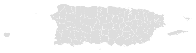
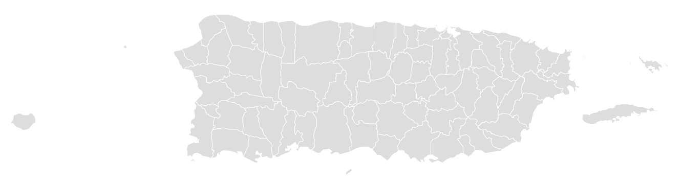
English: This map shows all municipalities of Puerto Rico. Due to the disgarbaging with SVGomg, all the pathes are combined to only one – so the highlighting if single municipalities is much more difficult; this form is not useful as a sample for generating the series of highlighted locator maps, and needs to be changed (broken up again into single pathes). |
| Date | |
| Source | Own work based on: Locator-map-Puerto-Rico-Adjuntas.svg |
| Author | Sarang |
| SVG development |
Licensing
[edit]
| I, the copyright holder of this work, release this work into the public domain. This applies worldwide. In some countries this may not be legally possible; if so: I grant anyone the right to use this work for any purpose, without any conditions, unless such conditions are required by law. |
File history
Click on a date/time to view the file as it appeared at that time.
| Date/Time | Thumbnail | Dimensions | User | Comment | |
|---|---|---|---|---|---|
| current | 14:32, 27 October 2020 | 1,332 × 360 (38 KB) | Sarang (talk | contribs) | {{Information |Description={{en|This map shows all {{C|Locator maps of municipalities of Puerto Rico|municipalities of Puerto Rico}}.}} |Date=2020-10 |Source={{Own using|}} SVG omg |Author={{U|Sarang}} }} == {{int:license-header}} == {{PD-self}} Category:Maps of municipalities in Puerto Rico |
You cannot overwrite this file.
File usage on Commons
The following page uses this file: