File:Location map Sri Lanka Northern Province EN.svg
Jump to navigation
Jump to search

Size of this PNG preview of this SVG file: 552 × 540 pixels. Other resolutions: 245 × 240 pixels | 491 × 480 pixels | 785 × 768 pixels | 1,047 × 1,024 pixels | 2,094 × 2,048 pixels.
Original file (SVG file, nominally 552 × 540 pixels, file size: 196 KB)
Captions
Captions
sudarnan sudar
| Description |
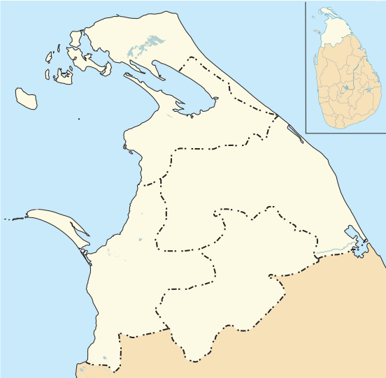
English: Location map of Northern District Sri Lanka |
| Date | |
| Source | Own work Includes derivative version of Sri_Lanka_location_map.svg |
| Author | Philg88; Attribution: Wikimedia Foundation (www.wikimedia.org) |
W3C-validity not checked.
This W3C-unspecified vector image was created with Adobe Illustrator.
This file is licensed under the Creative Commons Attribution 4.0 International license.
- You are free:
- to share – to copy, distribute and transmit the work
- to remix – to adapt the work
- Under the following conditions:
- attribution – You must give appropriate credit, provide a link to the license, and indicate if changes were made. You may do so in any reasonable manner, but not in any way that suggests the licensor endorses you or your use.
| This work contains information from OpenStreetMap, which is made available under the Open Database License (ODbL).
The ODbL does not require any particular license for maps produced from ODbL data. Prior to 1 August 2020, map tiles produced by the OpenStreetMap Foundation were licensed under the CC-BY-SA-2.0 license. Maps produced by other people may be subject to other licences. |
File history
Click on a date/time to view the file as it appeared at that time.
| Date/Time | Thumbnail | Dimensions | User | Comment | |
|---|---|---|---|---|---|
| current | 05:17, 8 June 2014 | | 552 × 540 (196 KB) | Philg88 (talk | contribs) | User requested changes |
| 06:00, 7 June 2014 |  | 574 × 657 (266 KB) | Philg88 (talk | contribs) | {{Information |Description ={{en|1=Location map of Northern District Sri Lanka }} |Source ={{own}} Includes derivative version of [[https://en.wikipedia.org/wiki/Northern_Province,_Sri_Lanka#mediaviewer/File:Sri_Lanka_location_map.svg Sri_La... |
You cannot overwrite this file.
File usage on Commons
The following page uses this file:
- File:Location map Sri Lanka Northern District EN.svg (file redirect)
File usage on other wikis
The following other wikis use this file:
- Usage on ar.wikipedia.org
- Usage on bn.wikipedia.org
- Usage on en.wikipedia.org
- Kilinochchi
- Point Pedro
- Elephant Pass
- Vavuniya
- Ketheeswaram temple
- Keerimalai
- Mannar Island
- Mullaitivu
- Vallipuram
- Thunnalai
- Navaly church bombing
- Velanai
- Kayts
- Inuvil
- 1984 Kokkilai massacre (LTTE)
- Puttur, Sri Lanka
- Jaffna International Airport
- Nallur, Jaffna
- Kokkuvil
- Kondavil
- Uduvil
- Palaly, Sri Lanka
- Chunnakam
- Omanthai
- Nagar Kovil
- Mirusuvil
- Kankesanthurai
- Maviddapuram
- Vaddukoddai
- Colombuthurai
- Kaithady
- Kachchai
- Neduntheevu
- Vankalai
- Allaippiddi
- Pesalai
- Battle of Mullaitivu (1996)
- Second Battle of Elephant Pass
- Nainativu
- Pungudutivu
- Analaitivu
- Mandaitivu
- Eluvaitivu
- Manipay
- Pandatharippu
View more global usage of this file.