File:Lindholz Plan von Berlin und Koeln um 1660.jpg
Original file (1,008 × 770 pixels, file size: 202 KB, MIME type: image/jpeg)
Captions
Captions
Summary
[edit]| Title |
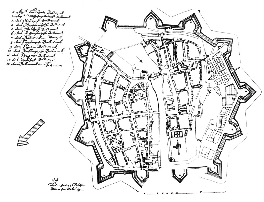
Plan von Berlin und Cölln (sog. Lindholz-Plan) |
| Description |
Deutsch: Links oben die Namen der 13 Bastionen. Links unten: "NB Berlin hat 476 Ruthen Cöllen hat 650 Ruthen" (Länge der Befestigungswälle).
Aus Clauswitz/Zögner Die Pläne von Berlin (S. 13):
|
| Date | circa 1660 |
| Source | bildindex.de (20484751) |
| Creator |
Unknown author |
| Geotemporal data | |
| Map location | Berlin |
| Map type | Festungsplan |
| Scale | 1:4,200 |
| Heading |
 |
| Georeferencing | |
| Bibliographic data | |
| Language | German |
| Archival data | |
| Collection | Geheimes Staatsarchiv Preußischer Kulturbesitz (Secret State Archives Prussian Cultural Heritage Foundation) |
| Accession number |
XI. HA, F 53508 |
| Dimensions | height: 35 cm (13.7 in); width: 47 cm (18.5 in) |
| Inscriptions |
Deutsch: Beschriftung auf der Rückseite: "Aus den Lindholz'schen Papieren." |
| Other versions |
|
.png)
Licensing
[edit]
|
This work is in the public domain in its country of origin and other countries and areas where the copyright term is the author's life plus 70 years or fewer.
| |
| This file has been identified as being free of known restrictions under copyright law, including all related and neighboring rights. | |
File history
Click on a date/time to view the file as it appeared at that time.
| Date/Time | Thumbnail | Dimensions | User | Comment | |
|---|---|---|---|---|---|
| current | 19:49, 13 November 2010 | | 1,008 × 770 (202 KB) | Alexrk2 (talk | contribs) | {{Information |Description=''Plan von Berlin und Koeln'' * Format: 47,0 x 35,0 cm * Maßstab: 1:4200 * Orient.: SSO Links oben die Namen der 15 Bastionen. Links unten: "NB Berlin hat 476 Ruthen Cöllen hat 650 Ruthen" (Länge der Befestigungswälle). |So |
You cannot overwrite this file.
File usage on Commons
The following 2 pages use this file: