File:Lignes ferroviaires de Chambéry (2014).png
Jump to navigation
Jump to search

Size of this preview: 800 × 567 pixels. Other resolutions: 320 × 227 pixels | 640 × 453 pixels | 1,024 × 725 pixels | 1,280 × 907 pixels | 1,550 × 1,098 pixels.
Original file (1,550 × 1,098 pixels, file size: 1.71 MB, MIME type: image/png)
Captions
Captions
Add a one-line explanation of what this file represents
Summary
[edit]| Description | ||||
| Date | ||||
| Source | Own work | |||
| Author |
Florian Pépellin Open Street Map contributors / Contributeurs à Open Street Map |
|||
| Permission (Reusing this file) |
OpenStreetMap data is available under the Open Database License (details). Map tiles are licensed under the Creative Commons Attribution-ShareAlike 2.0 license (CC-BY-SA 2.0).
|
Licensing
[edit]This file is licensed under the Creative Commons Attribution-Share Alike 2.0 Generic license.
- You are free:
- to share – to copy, distribute and transmit the work
- to remix – to adapt the work
- Under the following conditions:
- attribution – You must give appropriate credit, provide a link to the license, and indicate if changes were made. You may do so in any reasonable manner, but not in any way that suggests the licensor endorses you or your use.
- share alike – If you remix, transform, or build upon the material, you must distribute your contributions under the same or compatible license as the original.
| Annotations | This image is annotated: View the annotations at Commons |
.JPG)
.JPG)
.JPG)
.JPG)
.JPG)
.JPG)
.png&action=edit§ion=1)
.png&action=edit§ion=2)
.png)
File history
Click on a date/time to view the file as it appeared at that time.
| Date/Time | Thumbnail | Dimensions | User | Comment | |
|---|---|---|---|---|---|
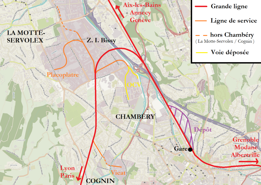
| current | 09:23, 13 July 2014 | | 1,550 × 1,098 (1.71 MB) | Floflo (talk | contribs) | {{Information |Description ={{en|1=Map of the railway lines and tracks in Chambéry, Savoie, France. In red are the main lines, in orange the service lines (dotted : out of Chambéry) and in yellow the removed tracks.}} {{fr|1=Carte des... |
| 17:09, 12 July 2014 |  | 1,550 × 1,098 (1.71 MB) | Floflo (talk | contribs) | {{Information |Description ={{en|1=Map of the railway lines and tracks in Chambéry, Savoie, France. In red are the main lines, in orange the service lines (dotted : out of Chambéry) and in yellow the removed tracks.}} {{fr|1=Carte des... | |
| 16:56, 12 July 2014 |  | 1,550 × 1,098 (1.71 MB) | Floflo (talk | contribs) | {{Information |Description ={{en|1=Map of the railway lines and tracks in Chambéry, Savoie, France. In red are the main lines, in orange the service lines (dotted : out of Chambéry) and in yellow the removed tracks.}} {{fr|1=Carte des... |
You cannot overwrite this file.
File usage on Commons
The following page uses this file:
.png&oldid=719188330)