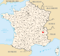
Category:Maps of Chambéry
Jump to navigation
Jump to search
Wikimedia category | |||||
| Upload media | |||||
| Instance of | |||||
|---|---|---|---|---|---|
| Category combines topics | |||||
| Chambéry | |||||
commune in Savoie, France | |||||
| Instance of | |||||
| Location | |||||
| Head of government |
| ||||
| Population |
| ||||
| Area |
| ||||
| Elevation above sea level |
| ||||
| Different from | |||||
| official website | |||||
 | |||||
Subcategories
This category has the following 2 subcategories, out of 2 total.
C
- Cantons of Chambéry (13 F)
G
- Geological maps of Chambéry (10 F)
Media in category "Maps of Chambéry"
The following 46 files are in this category, out of 46 total.
-
38 ISERE carte grille communale densite INSEE.png 3,507 × 2,480; 3.61 MB
-
73 SAVOIE carte grille communale densite INSEE.png 3,507 × 2,480; 2.19 MB
-
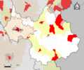
73-AAV2020-Chambéry.png 3,519 × 2,930; 1.68 MB
-
73-Chambéry-AAV2020.png 3,519 × 2,930; 2.53 MB
-
73031-Bassens-Hydro.png 7,015 × 4,960; 10.96 MB
-
73065-Chambéry - Localisation.png 3,507 × 2,480; 1.1 MB
-
73065-Chambéry-Cadastre.png 7,015 × 4,960; 20.29 MB
-
73065-Chambéry-Hydro.jpeg 5,846 × 4,133; 3.79 MB
-
73065-Chambéry-Hydro.png 7,015 × 4,960; 14.32 MB
-
73065-Chambéry-Natura 2000.png 7,015 × 4,960; 9.3 MB
-
73065-Chambéry-Orthophoto.png 7,015 × 4,960; 18.61 MB
-
73065-Chambéry-Sols.png 7,015 × 4,960; 14.73 MB
-
73065-Chambéry-ZNIEFF1.png 7,015 × 4,960; 9.66 MB
-
73065-Chambéry-ZNIEFF2.png 7,015 × 4,960; 9.48 MB
-
Aire urbaine Chambéry - Savoie.png 4,704 × 3,792; 14.37 MB
-
Bissy 1921 map.svg 968 × 726; 108 KB
-
Carte Chambéry Quartiers.png 505 × 673; 426 KB
-
Carte Quartiers Chambéry (2015).png 1,788 × 2,444; 3.79 MB
-
Carte-centre-ville-chambery.png 1,464 × 1,291; 1.07 MB
-
Chambe centre trace rue parcs eglises.PNG 852 × 671; 93 KB
-
Chambery metropole decoupage communal.jpg 234 × 213; 8 KB
-
Chambéry dot.png 1,804 × 1,689; 230 KB
-
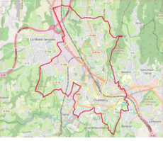
Chambéry OSM 01.png 717 × 621; 350 KB
-
Chambéry OSM 02.png 717 × 621; 640 KB
-
Circuit du Grand prix de Chambéry.png 1,438 × 1,932; 2.03 MB
-
Couvent des bernardines de Chambéry.jpg 707 × 401; 105 KB
-
Dicesi di Chambery.png 2,959 × 2,463; 663 KB
-
Diocèse Chambéry 1789.svg 2,000 × 1,922; 801 KB
-
Lignes ferroviaires de Chambéry (2014).png 1,550 × 1,098; 1.71 MB
-
Localisation de Chambéry (73).svg 588 × 550; 296 KB
-
Map commune FR insee code 73065.png 756 × 605; 102 KB
-
Plan Centre Chambéry.gif 854 × 671; 112 KB
-
Plan Chambéry 2013 (Open Street Map).png 1,788 × 2,444; 3.7 MB
-
Plan Chambéry 2014 (Open Street Map).png 1,788 × 2,444; 4.06 MB
-
Plan Chambéry 2015 (Open Street Map).png 1,788 × 2,444; 4.68 MB
-
Plan Chambéry 2016 (Open Street Map).png 1,788 × 2,444; 4.78 MB
-
Plan Chambéry 2017 (Open Street Map).png 1,788 × 2,444; 4.82 MB
-
Plan Chambéry 2018 (Open Street Map).png 1,788 × 2,444; 4.88 MB
-
Plan Chambéry 2019 (Open Street Map).png 1,788 × 2,444; 4.92 MB
-
Plan Chambéry 2020 (Open Street Map).png 1,788 × 2,444; 4.98 MB
-
Plan Chambéry 2021 (Open Street Map).png 1,788 × 2,444; 5.1 MB
-
Plan Chambéry 2022 (Open Street Map).png 1,788 × 2,444; 5.14 MB
-
Plan Chambéry 2023 (Open Street Map).png 1,788 × 2,444; 5.18 MB
-
Plan Échangeur de la Boisse (OSM) 2015.png 1,117 × 816; 741 KB
-
Tour de la Marche 2015 à Chambéry.png 681 × 628; 576 KB
-
Traces rues chambe centre.svg 2,303 × 1,665; 44 KB
