File:Latin American States, 1823.jpg
Jump to navigation
Jump to search
Size of this preview: 400 × 600 pixels. Other resolutions: 160 × 240 pixels | 320 × 480 pixels | 904 × 1,355 pixels.
Original file (904 × 1,355 pixels, file size: 403 KB, MIME type: image/jpeg)
Captions
Captions
Add a one-line explanation of what this file represents
Summary
[edit]
| Description |
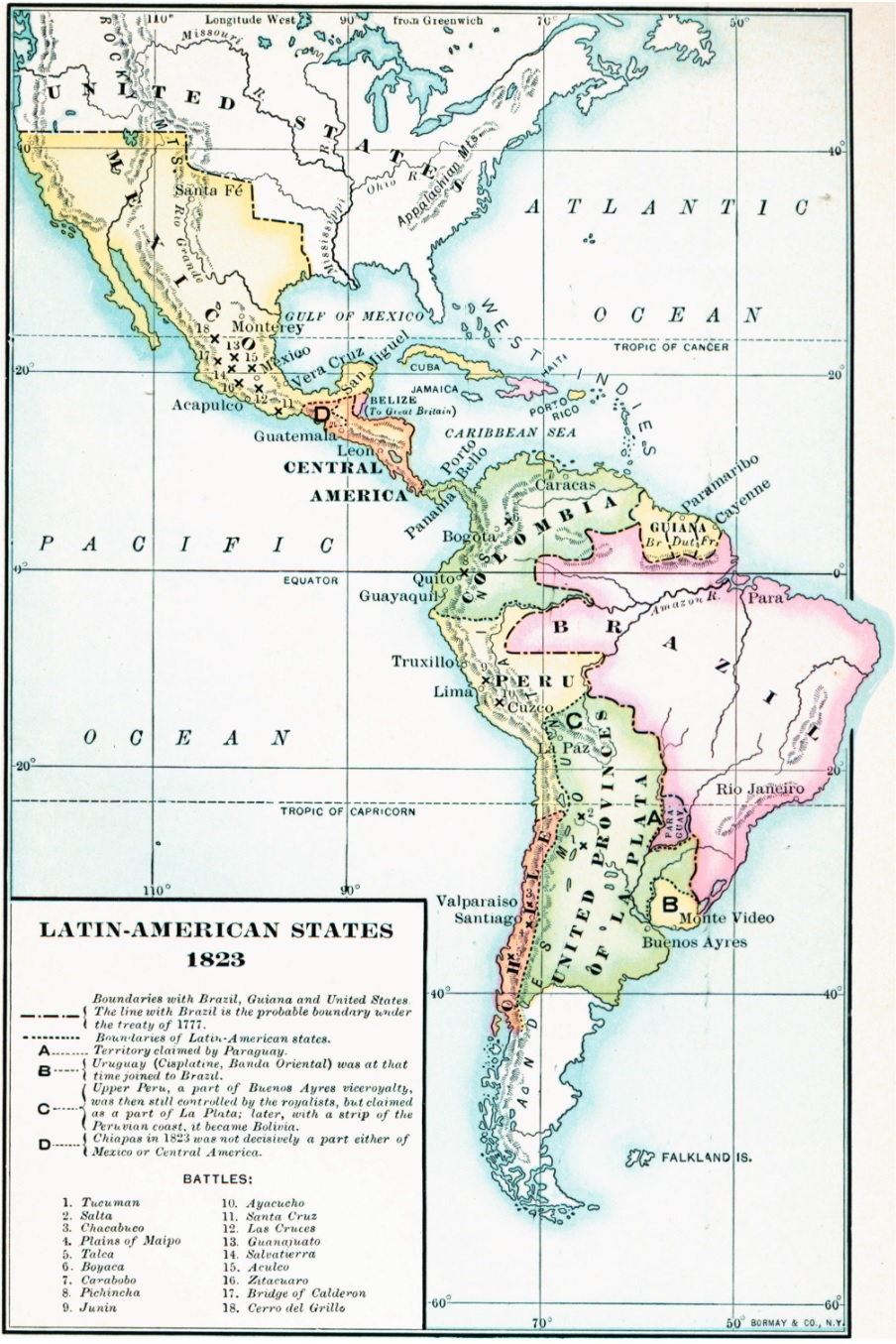
Español: Un mapa de 1906 mostrando las fronteras en Latinoamérica en 1823. El mapa también muestra los sitios de batallas significativas en Latinoamérica.
De The American Nation Vol. 13 English: A map from 1906 showing the boundaries in Latin America in 1823. The map also shows the sites of significant battles in Latin America. From The American Nation Vol. 13 |
| Date | |
| Source | etc.usf.edu |
| Author | Albert Bushnell Hart |
Licensing
[edit]
|
This work is in the public domain in its country of origin and other countries and areas where the copyright term is the author's life plus 70 years or fewer. | |
| This file has been identified as being free of known restrictions under copyright law, including all related and neighboring rights. | |
File history
Click on a date/time to view the file as it appeared at that time.
| Date/Time | Thumbnail | Dimensions | User | Comment | |
|---|---|---|---|---|---|
| current | 20:15, 31 May 2024 | | 904 × 1,355 (403 KB) | Babelia (talk | contribs) | Uploaded a work by Albert Bushnell Hart from etc.usf.edu with UploadWizard |
You cannot overwrite this file.
File usage on Commons
The following page uses this file: