File:Laptev Sea map pl.svg
Jump to navigation
Jump to search

Size of this PNG preview of this SVG file: 800 × 448 pixels. Other resolutions: 320 × 179 pixels | 640 × 358 pixels | 1,024 × 574 pixels | 1,280 × 717 pixels | 2,560 × 1,434 pixels | 1,498 × 839 pixels.
Original file (SVG file, nominally 1,498 × 839 pixels, file size: 304 KB)
Captions
Captions
Add a one-line explanation of what this file represents
Summary
[edit]
| Description |
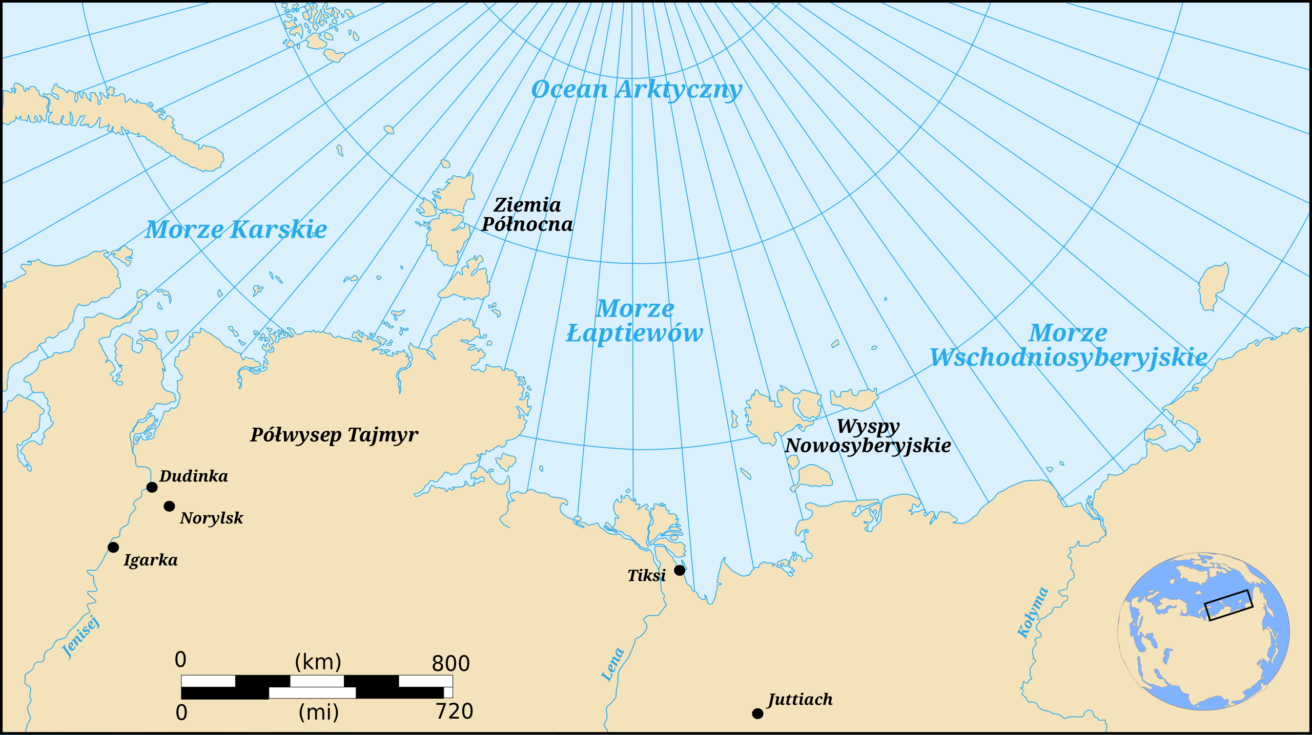
English: Map showing the location of the Laptev Sea, part of the Arctic Ocean : Polish Version Français : Carte donnant la localisation de la mer de Laptev, une partie de l'océan Arctique : version polonaise Polski: Mapa Morza Łaptiewów i części Oceanu Arktycznego: wersja polska |
| Date | (UTC) |
| Source |
This file was derived from: Laptev Sea map-fr.svg: |
| Author |
|
| This is a retouched picture, which means that it has been digitally altered from its original version. Modifications: Polish translation. The original can be viewed here: Laptev Sea map-fr.svg:
|
Licensing
[edit]
I, the copyright holder of this work, hereby publish it under the following licenses:
This file is licensed under the Creative Commons Attribution-Share Alike 3.0 Unported, 2.5 Generic, 2.0 Generic and 1.0 Generic license.
- You are free:
- to share – to copy, distribute and transmit the work
- to remix – to adapt the work
- Under the following conditions:
- attribution – You must give appropriate credit, provide a link to the license, and indicate if changes were made. You may do so in any reasonable manner, but not in any way that suggests the licensor endorses you or your use.
- share alike – If you remix, transform, or build upon the material, you must distribute your contributions under the same or compatible license as the original.

|
Permission is granted to copy, distribute and/or modify this document under the terms of the GNU Free Documentation License, Version 1.2 or any later version published by the Free Software Foundation; with no Invariant Sections, no Front-Cover Texts, and no Back-Cover Texts. A copy of the license is included in the section entitled GNU Free Documentation License. |
You may select the license of your choice.
Original upload log
[edit]
This image is a derivative work of the following images:
- File:Laptev Sea map-fr.svg licensed with Cc-by-sa-3.0,2.5,2.0,1.0, GFDL
- 2007-12-04T17:40:19Z Pinpin 1498x839 (312075 Bytes) {{Information |Description={{en|Map showing the location of the Laptev Sea, part of the Arctic Ocean : French Version}} {{fr|Carte donnant la localisation de la mer de Laptev, une partie de l'océan Arctique : version frança
Uploaded with derivativeFX
File history
Click on a date/time to view the file as it appeared at that time.
| Date/Time | Thumbnail | Dimensions | User | Comment | |
|---|---|---|---|---|---|
| current | 18:50, 17 July 2018 | | 1,498 × 839 (304 KB) | Okcydent (talk | contribs) | == {{int:filedesc}} == {{Information |Description={{en|Map showing the location of the Laptev Sea, part of the Arctic Ocean : Polish Version}} {{fr|Carte donnant la localisation de la mer de Laptev, une partie de l'océan Arctique : version polonaise}} {{pl|Mapa Morza Łaptiewów i części Oceanu Arktycznego: wersja polska}} |Source={{Derived from|Laptev Sea map-fr.svg|display=50}} |Date=2018-07-17 18:47 (UTC) |Author=* File:Laptev Sea map-fr.svg: [[User:Pinpin|Pin... |
You cannot overwrite this file.
File usage on Commons
There are no pages that use this file.