File:Laptev Sea map-fr.svg
Jump to navigation
Jump to search

Size of this PNG preview of this SVG file: 800 × 448 pixels. Other resolutions: 320 × 179 pixels | 640 × 358 pixels | 1,024 × 574 pixels | 1,280 × 717 pixels | 2,560 × 1,434 pixels | 1,498 × 839 pixels.
Original file (SVG file, nominally 1,498 × 839 pixels, file size: 305 KB)
Captions
Captions
Add a one-line explanation of what this file represents
Summary
[edit]
| Description |
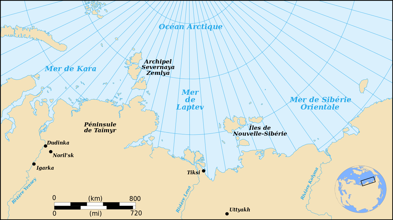
English: Map showing the location of the Laptev Sea, part of the Arctic Ocean : French Version
Français : Carte donnant la localisation de la mer de Laptev, une partie de l'océan Arctique : version française |
| Date | |
| Source | travail personnel made with Inkscape from Image:Laptev Sea map.png |
| Author | Pinpin |
| Other versions |
 |
This W3C-unspecified vector image was created with Inkscape .

|
This SVG file contains embedded text that can be translated into your language, using any capable SVG editor, text editor or the SVG Translate tool. For more information see: About translating SVG files. |
Licensing
[edit]
I, the copyright holder of this work, hereby publish it under the following licenses:

|
Permission is granted to copy, distribute and/or modify this document under the terms of the GNU Free Documentation License, Version 1.2 or any later version published by the Free Software Foundation; with no Invariant Sections, no Front-Cover Texts, and no Back-Cover Texts. A copy of the license is included in the section entitled GNU Free Documentation License. |
This file is licensed under the Creative Commons Attribution-Share Alike 3.0 Unported, 2.5 Generic, 2.0 Generic and 1.0 Generic license.
- You are free:
- to share – to copy, distribute and transmit the work
- to remix – to adapt the work
- Under the following conditions:
- attribution – You must give appropriate credit, provide a link to the license, and indicate if changes were made. You may do so in any reasonable manner, but not in any way that suggests the licensor endorses you or your use.
- share alike – If you remix, transform, or build upon the material, you must distribute your contributions under the same or compatible license as the original.
You may select the license of your choice.
File history
Click on a date/time to view the file as it appeared at that time.
| Date/Time | Thumbnail | Dimensions | User | Comment | |
|---|---|---|---|---|---|
| current | 17:40, 4 December 2007 | | 1,498 × 839 (305 KB) | Pinpin (talk | contribs) | {{Information |Description={{en|Map showing the location of the Laptev Sea, part of the Arctic Ocean : French Version}} {{fr|Carte donnant la localisation de la mer de Laptev, une partie de l'océan Arctique : version française}} |Source=travail personne |
You cannot overwrite this file.
File usage on Commons
The following 3 pages use this file:
File usage on other wikis
The following other wikis use this file:
- Usage on avk.wikipedia.org
- Usage on fr.wikipedia.org
- Usage on ro.wikipedia.org