File:LakeBlvd3.pdf
Jump to navigation
Jump to search

Size of this JPG preview of this PDF file: 664 × 599 pixels. Other resolutions: 266 × 240 pixels | 532 × 480 pixels | 851 × 768 pixels | 1,135 × 1,024 pixels | 2,269 × 2,048 pixels | 7,993 × 7,214 pixels.
Original file (7,993 × 7,214 pixels, file size: 19.11 MB, MIME type: application/pdf)
Captions
Captions
Add a one-line explanation of what this file represents
Summary
[edit]| Description |
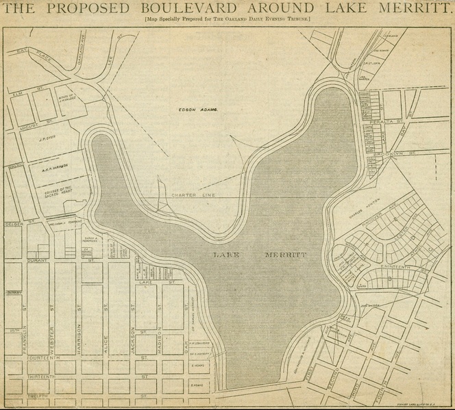
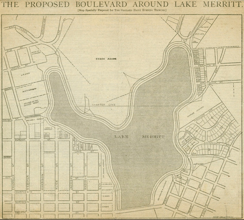
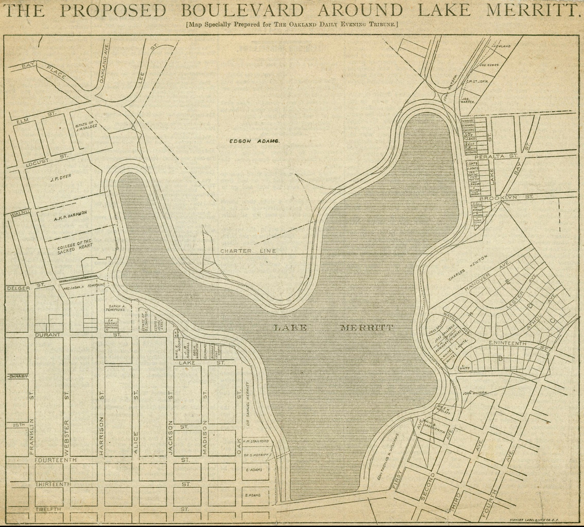
English: Scale not given. The map, clipped from the Oakland Daily Evening Tribune of June 6, 1885 (p. 1) , shows the route of a boulevard proposed for the shores of Lake Merritt under a plan supported by Mayor Melvin C. Chapman. The map designates land holdings of Edson Adams, A. K. P. Harmon, the Sisters of the Holy Names (College of the Sacred Heart), Charles Newton, Sarah A. Tompkins, Samuel Merritt, Gen. Thomas A. Williams, et al. |
| Date | |
| Source | http://content.cdlib.org/ark:/13030/kt4d5nd22w/?layout=metadata |
| Author | Oakland Daily Evening Tribune |
Licensing
[edit]This media file is in the public domain in the United States. This applies to U.S. works where the copyright has expired, often because its first publication occurred prior to January 1, 1929, and if not then due to lack of notice or renewal. See this page for further explanation.
|
 | |
 |
This image might not be in the public domain outside of the United States; this especially applies in the countries and areas that do not apply the rule of the shorter term for US works, such as Canada, Mainland China (not Hong Kong or Macao), Germany, Mexico, and Switzerland. The creator and year of publication are essential information and must be provided. See Wikipedia:Public domain and Wikipedia:Copyrights for more details.
|
File history
Click on a date/time to view the file as it appeared at that time.
| Date/Time | Thumbnail | Dimensions | User | Comment | |
|---|---|---|---|---|---|
| current | 18:47, 24 September 2014 |  | 7,993 × 7,214 (19.11 MB) | Junkyardsparkle (talk | contribs) | Full resolution. |
| 12:39, 17 August 2009 | No thumbnail | 0 × 0 (1.21 MB) | Critical Chris (talk | contribs) | {{Information |Description={{en|1=Scale not given. The map, clipped from the Oakland Daily Evening Tribune of June 6, 1885 (p. 1) , shows the route of a boulevard proposed for the shores of Lake Merritt under a plan supported by Mayor Melvin C. Chapman. T |
You cannot overwrite this file.
File usage on Commons
There are no pages that use this file.