File:La Barbade une des Antilles aux Anglois, divisée par paroisses. LOC 74691675.tif
Jump to navigation
Jump to search

Size of this JPG preview of this TIF file: 633 × 600 pixels. Other resolutions: 253 × 240 pixels | 507 × 480 pixels | 811 × 768 pixels | 1,081 × 1,024 pixels | 2,162 × 2,048 pixels | 3,670 × 3,476 pixels.
Original file (3,670 × 3,476 pixels, file size: 36.5 MB, MIME type: image/tiff)
Captions
Captions
Add a one-line explanation of what this file represents
Summary
[edit]| Description |
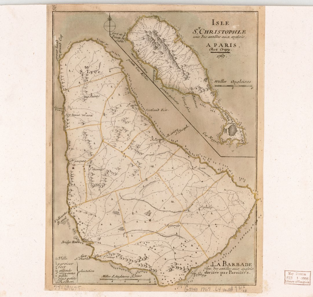
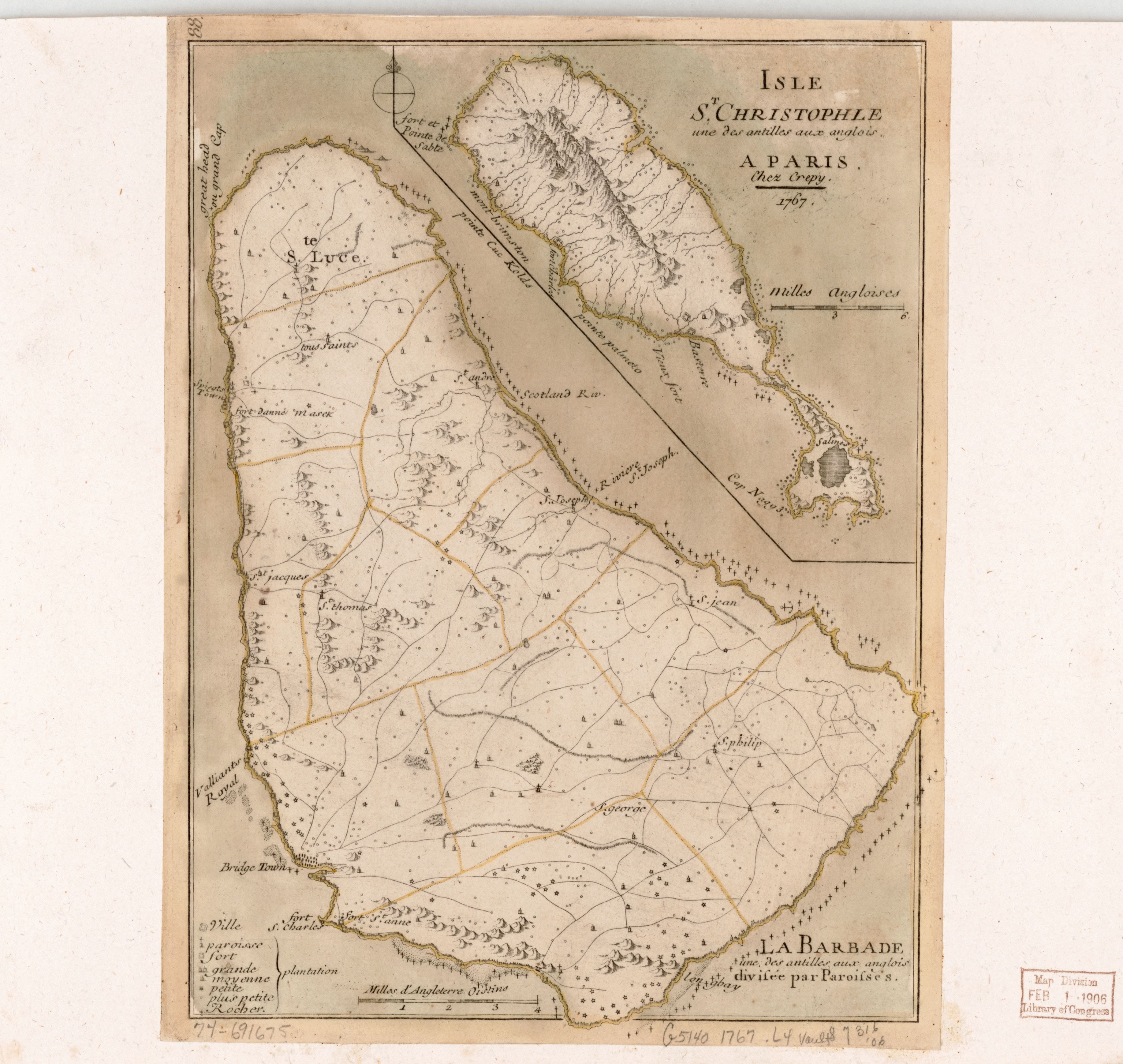
English: Scale ca. 1:110,000. Hand colored. Relief shown pictorially and by hachures. "88." Includes inset "Isle St. Christophle [sic] une des Antilles aux Anglois." LC Maps of North America, 1750-1789, 2091 Available also through the Library of Congress Web site as a raster image. Vault AACR2:100; 651/1; 651/2 |
||
| Title | La Barbade une des Antilles aux Anglois, divisée par paroisses. | ||
| Shelf ID | G5140 1767 .L4 | ||
| Date | |||
| Source | https://www.loc.gov/item/74691675/ | ||
| Author | [Le Rouge, Georges-Louis]; Crépy (Firm) | ||
| Permission (Reusing this file) |
|
||
| Other versions |
|
||
| Location | Saint Kitts. · Saint Kitts · Barbados. · Barbados | ||
| Part of | Military Battles And Campaigns · American Memory · Catalog · Geography And Map Division · American Revolution And Its Era: Maps And Charts Of North America And The West Indies, 1750-1789 | ||
| Subject | Maps · Early Works To 1800 · Saint Kitts · Barbados |


Licensing
[edit]|
This is a faithful photographic reproduction of a two-dimensional, public domain work of art. The work of art itself is in the public domain for the following reason:
The official position taken by the Wikimedia Foundation is that "faithful reproductions of two-dimensional public domain works of art are public domain".
This photographic reproduction is therefore also considered to be in the public domain in the United States. In other jurisdictions, re-use of this content may be restricted; see Reuse of PD-Art photographs for details. | ||||
File history
Click on a date/time to view the file as it appeared at that time.
| Date/Time | Thumbnail | Dimensions | User | Comment | |
|---|---|---|---|---|---|
| current | 16:11, 23 August 2019 |  | 3,670 × 3,476 (36.5 MB) | Fæ (talk | contribs) | LOC Maps https://www.loc.gov/item/74691675/ #4710 |
You cannot overwrite this file.
File usage on Commons
The following page uses this file: