File:Kreuz Nispert 71 (1).jpg
Original file (3,024 × 4,032 pixels, file size: 5.58 MB, MIME type: image/jpeg)
Captions
Captions
Summary
[edit].jpg&action=edit§ion=1)
| Description |
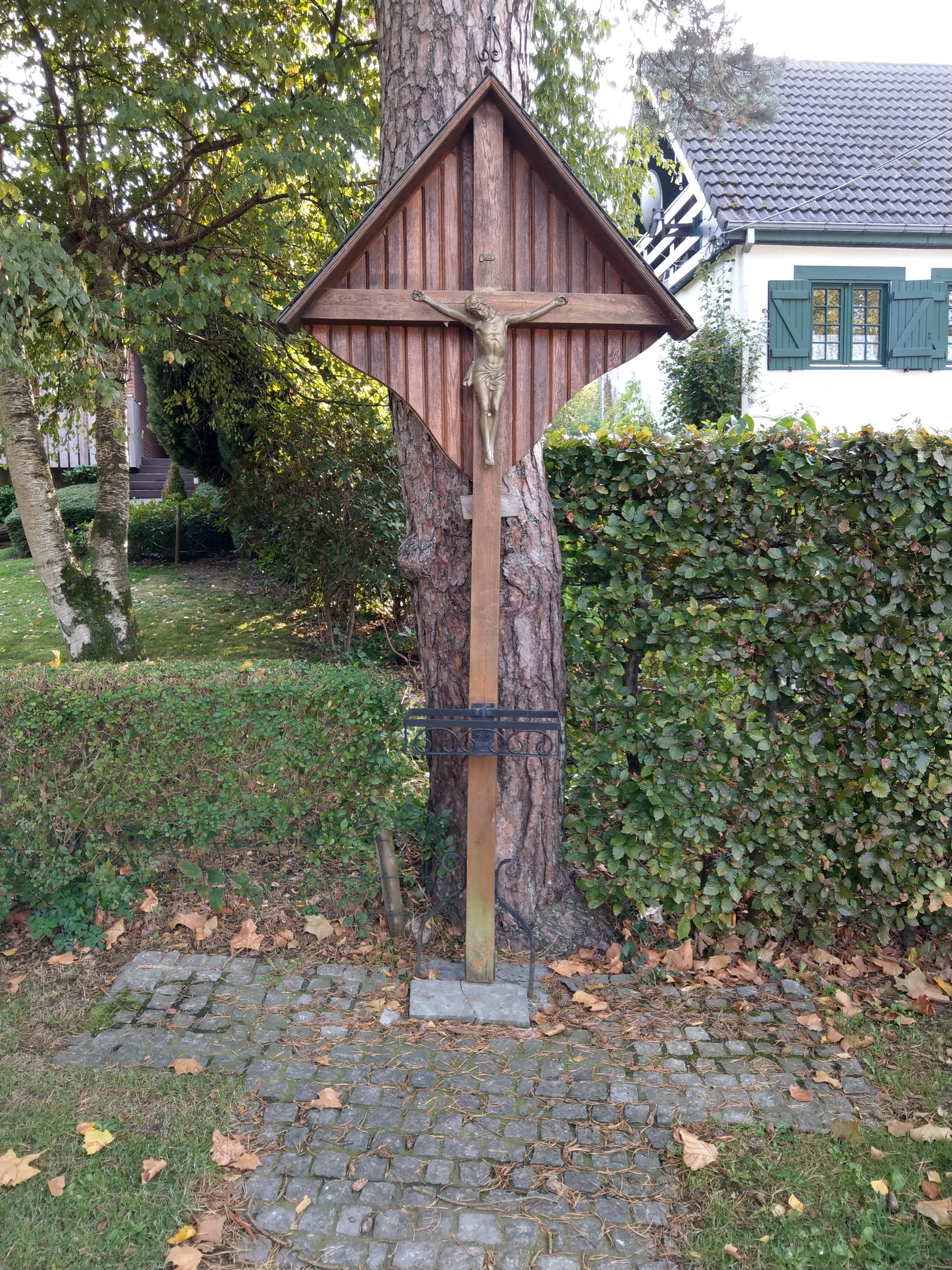
Deutsch: Es handelt sich möglicherweise um ein Kreuz zum Gedenken an einen tödlich Unfall. Es ist nicht sicher, dass es dieses Kreuz ist. Es könnte aber auch ein weiteres Kreuz auf dieser Straße sein.
1842 wurde auf der Straße ein zweijähriges Kind von einem Fuhrmann überfahren. Das Kind rollte einen Abhang hinunter und kam mit dem Kopf unter ein Rad der Karre. Français : Ce pourrait être une croix commémorant un accident mortel. Ce pourrait aussi être une autre croix sur cette route.
En 1842, un enfant de deux ans fut renversé par un charretier dans la rue. L'enfant a dévalé une pente et sa tête à été écrasée par une roue de la charrette. Nederlands: Het kan een kruis zijn ter herdenking van een dodelijk ongeval.Het zou ook een ander kruis op deze weg kunnen zijn.
In 1842 werd een twee jaar oude jongen omvergeworpen door een voerman op straat. Het kind rende een helling af en zijn hoofd werd overreden door een wiel van de kar. English: It could be a cross commemorating a fatal accident. It could also be another cross on this road. In 1842, a two-year-old boy was overthrown by a carter in the street. The child ran down a slope and his head was run over by a wheel of the cart. |
| Date | |
| Source | Own work |
| Author | LeFagnard |
| Openstreetmap entry | Link to Openstreetmap |
| Object location | | View this and other nearby images on: OpenStreetMap |
|---|
.jpg¶ms=050.631143_N_0006.052062_E_globe:Earth_class:object_type:object_source:OSM_&language=en)
| Camera location | | View this and other nearby images on: OpenStreetMap |
|---|
.jpg¶ms=050.631143_N_0006.052062_E_globe:Earth_type:camera__&language=en)
Licensing
[edit].jpg&action=edit§ion=2)
- You are free:
- to share – to copy, distribute and transmit the work
- to remix – to adapt the work
- Under the following conditions:
- attribution – You must give appropriate credit, provide a link to the license, and indicate if changes were made. You may do so in any reasonable manner, but not in any way that suggests the licensor endorses you or your use.
- share alike – If you remix, transform, or build upon the material, you must distribute your contributions under the same or compatible license as the original.
File history
Click on a date/time to view the file as it appeared at that time.
| Date/Time | Thumbnail | Dimensions | User | Comment | |
|---|---|---|---|---|---|
| current | 10:10, 9 October 2018 | | 3,024 × 4,032 (5.58 MB) | LeFagnard (talk | contribs) | User created page with UploadWizard |
You cannot overwrite this file.
File usage on Commons
The following page uses this file:
File usage on other wikis
The following other wikis use this file:
- Usage on de.wikipedia.org
.jpg&oldid=906069184)