File:Kremlenagrad - Castellum Urbis Moskvae (1664).jpg
Jump to navigation
Jump to search
Size of this preview: 781 × 600 pixels. Other resolutions: 313 × 240 pixels | 625 × 480 pixels | 1,000 × 768 pixels | 1,280 × 983 pixels | 2,560 × 1,966 pixels | 5,500 × 4,223 pixels.
Original file (5,500 × 4,223 pixels, file size: 3.61 MB, MIME type: image/jpeg)
Captions
Captions
Add a one-line explanation of what this file represents
Summary
[edit].jpg&action=edit§ion=1)
| Description |
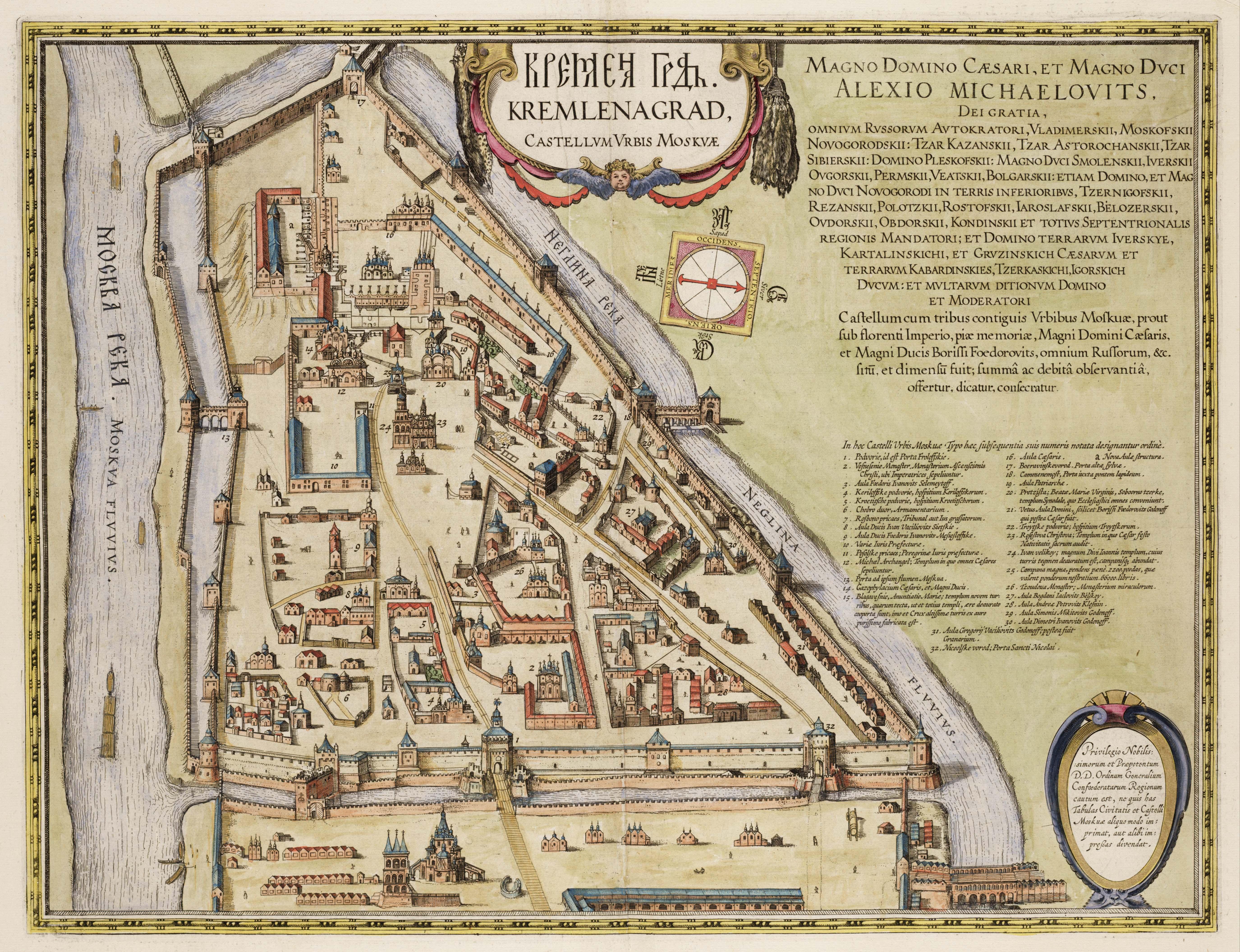
English: Map of the Kremlin in Moscow.
Русский: Это Кремленаград - карта Московского кремля 1600-1605 годов. Кремль представлен здесь в виде неправильного треугольника; в некоторых местах идёт не одна стена, а две или три; многие здания имеют иную форму, чем до Годунова или же после; кое-где видны даже деревянные мостовые. |
| Date | |
| Source | Atlas van Loon |
| Author | Unknown author |
Licensing
[edit].jpg&action=edit§ion=2)
|
This work is in the public domain in its country of origin and other countries and areas where the copyright term is the author's life plus 100 years or fewer. This work is in the public domain in the United States because it was published (or registered with the U.S. Copyright Office) before January 1, 1929. | |
| This file has been identified as being free of known restrictions under copyright law, including all related and neighboring rights. | |
File history
Click on a date/time to view the file as it appeared at that time.
| Date/Time | Thumbnail | Dimensions | User | Comment | |
|---|---|---|---|---|---|
| current | 15:57, 15 October 2008 | | 5,500 × 4,223 (3.61 MB) | Kweniston (talk | contribs) | {{Information |Description={{en|1=Map of the Kremlin in Moscow.}} |Source=Atlas van Loon |Author=unknown |Date=1649 |Permission= |other_versions= }} <!--{{ImageUpload|full}}--> Category:Old maps of Moscow Category:Atlas van Loon |
You cannot overwrite this file.
File usage on Commons
There are no pages that use this file.
File usage on other wikis
The following other wikis use this file:
- Usage on ru.wikipedia.org
.jpg&oldid=824252698)