File:Komitat Kokelburg-Josephinische Landesaufnahme 1769-1773.jpg
Jump to navigation
Jump to search

Size of this preview: 800 × 524 pixels. Other resolutions: 320 × 209 pixels | 640 × 419 pixels | 1,024 × 670 pixels | 1,280 × 838 pixels | 2,560 × 1,676 pixels | 11,748 × 7,690 pixels.
Original file (11,748 × 7,690 pixels, file size: 17.77 MB, MIME type: image/jpeg)
Captions
Captions
Add a one-line explanation of what this file represents
| Warning | The original file is very high-resolution. It might not load properly or could cause your browser to freeze when opened at full size. |
|---|
Summary
[edit]| Description |
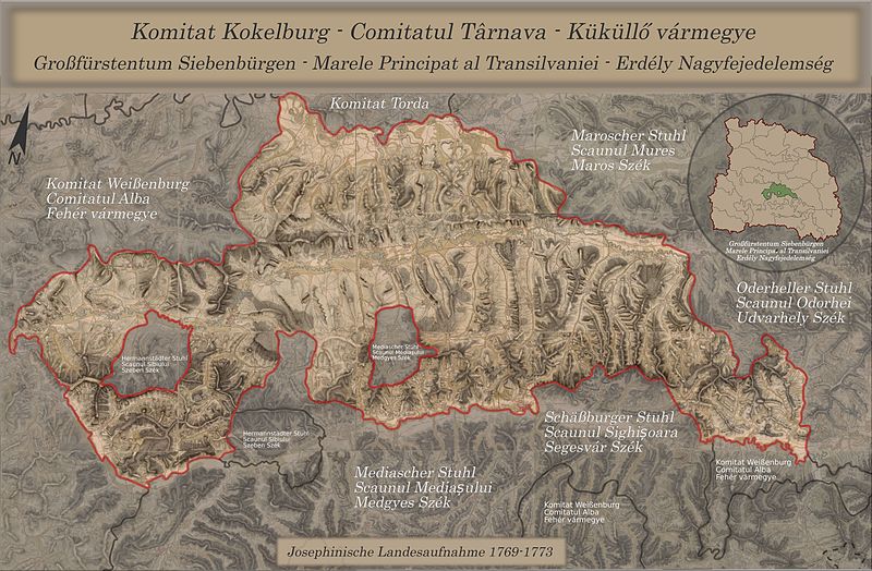
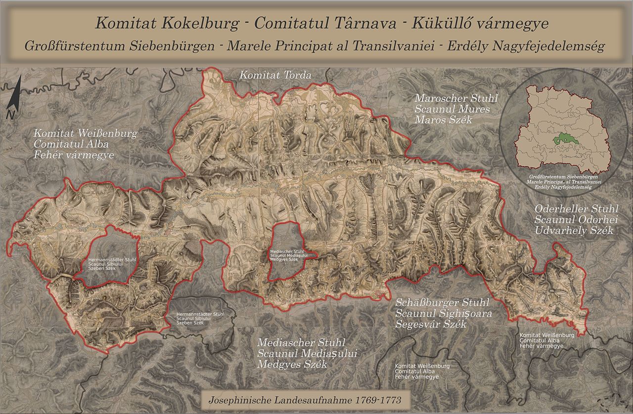
English: Komitat Kokelburg; composed from maps of the Josephinische Landesaufnahme, 1769-1773
Deutsch: Komitat Kokelburg; zusammengesetzt aus Karten der Josephinischen Landesaufnahme, 1769-1773
Română: Comitatul Tarnave; compus din harti de la ridicarea iosefina Josephinischen Landesaufnahme, 1769-1773 |
||
| Date | |||
| Source |
|
||
| Author | DietG | ||
| Permission (Reusing this file) |
I, the copyright holder of this work, hereby publish it under the following licenses: This file is licensed under the Creative Commons Attribution-Share Alike 3.0 Unported license.
You may select the license of your choice. |

Clickable Map of the Grand Duchy of Transylvania
[edit]
File history
Click on a date/time to view the file as it appeared at that time.
| Date/Time | Thumbnail | Dimensions | User | Comment | |
|---|---|---|---|---|---|
| current | 21:57, 5 September 2010 | | 11,748 × 7,690 (17.77 MB) | DietG (talk | contribs) | Some corrections |
| 18:37, 19 June 2010 |  | 12,143 × 7,767 (23.48 MB) | DietG (talk | contribs) | Enhanced map: annotations, corrections etc. | |
| 22:31, 18 June 2010 |  | 12,143 × 7,767 (17.12 MB) | DietG (talk | contribs) | {{Information |Description={{en|1=Komitat Kokelburg; composed from maps of the Josephinischen Landesaufnahme from 1769-1773}} {{de|1=Komitat Kokelburg; zusammengesetzt aus Karten der Josephinischen Landesaufnahme von 1769-1773}} |Source={{own}} |Author=[[ |
You cannot overwrite this file.
File usage on Commons
There are no pages that use this file.
File usage on other wikis
The following other wikis use this file:
- Usage on de.wikipedia.org
- Usage on hu.wikipedia.org
- Usage on nl.wikipedia.org
- Usage on ro.wikipedia.org