Category:1770s maps of Transylvania
Jump to navigation
Jump to search
Media in category "1770s maps of Transylvania"
The following 11 files are in this category, out of 11 total.
-
 Dreizehn Sächsische Dörfer.jpg 2,609 × 2,131; 1.24 MB
-
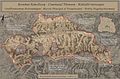
 Grand Ducy of Transylvania (mini).jpg 800 × 602; 510 KB
-
 GrandDuchyOfTransylvania Josephinische Landaufnahme.jpg 7,063 × 5,315; 14.27 MB
-
 Josephinische Landaufnahme Transylvania.jpg 2,114 × 1,643; 531 KB
-
 Komitat Kokelburg-Josephinische Landesaufnahme 1769-1773.jpg 11,748 × 7,690; 17.77 MB
-
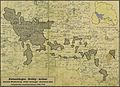 Komitat Weißenburg - Großfürstentum Siebenbuergen 1769-1773.jpg 2,156 × 1,558; 1.21 MB
-
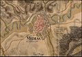 Mediasch-Josephinische Landesaufnahme 1769-1773.jpg 1,280 × 899; 495 KB
-
 Sachsenland Nord-Josephinische Landesaufnahme 1769-1773.jpg 825 × 750; 421 KB
-
 Sachsenland-Josephinische Landesaufnahme 1769-1773.jpg 1,950 × 2,250; 1.32 MB
-
 Siebenbürgen-Josephinische Landesaufnahme 1769-1773.jpg 3,500 × 2,620; 2.6 MB
-
 Szeklerland-Josephinische Landesaufnahme 1769-1773.jpg 1,950 × 1,700; 1.21 MB


.jpg)