File:Kingdom of Dalmatia-1868.png
Jump to navigation
Jump to search
No higher resolution available.
Kingdom_of_Dalmatia-1868.png (542 × 502 pixels, file size: 35 KB, MIME type: image/png)
Captions
Captions
Add a one-line explanation of what this file represents
- Created by: User:ZyMOS for Wiki Atlas of World History
- Derived from: File:Map_of_the_Kingdom_of_Croatia_(1868).png
.png)
Derived from:
Summary
[edit]
| Description |
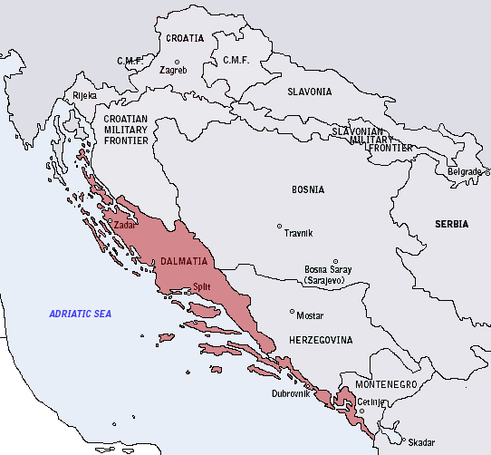
English: Map of the Kingdom of Croatia (red) in late 1867 and early 1868 (before the Croatian-Hungarian Nagodba and the establishment of the Kingdom of Croatia-Slavonia). The Kingdom of Slavonia was independent of Croatia at the time, but was under its control for most of the existence of both Kingdoms. |
| Date | |
| Source | Own work |
| Author | DIREKTOR |
Licensing
[edit]
| I, the copyright holder of this work, release this work into the public domain. This applies worldwide. In some countries this may not be legally possible; if so: I grant anyone the right to use this work for any purpose, without any conditions, unless such conditions are required by law. |
File history
Click on a date/time to view the file as it appeared at that time.
| Date/Time | Thumbnail | Dimensions | User | Comment | |
|---|---|---|---|---|---|
| current | 21:46, 17 March 2011 | | 542 × 502 (35 KB) | ZyMOS (talk | contribs) | ---- *Created by: User:ZyMOS for [http://historyatlas.wikia.com/wiki/ Wiki Atlas of World History] *Derived from: http://commons.wikimedia.org/wiki/File:Map_of_the_Kingdom_of_Croatia_%281868%29.png ---- Derived from: == {{int:filedesc}} == {{Informati |
You cannot overwrite this file.
File usage on Commons
The following page uses this file:
- File:Kingdom of Dalamatia-1868.png (file redirect)
File usage on other wikis
The following other wikis use this file:
- Usage on da.wikipedia.org
- Usage on fr.wikipedia.org
- Usage on hr.wikipedia.org
- Usage on pl.wikipedia.org
- Usage on ru.wikipedia.org