Category:Maps of sanjaks of the Ottoman Empire
Jump to navigation
Jump to search
Subcategories
This category has only the following subcategory.
Media in category "Maps of sanjaks of the Ottoman Empire"
The following 44 files are in this category, out of 44 total.
-

-
-
 Belgrade pashaluk BG.png 756 × 552; 28 KB
-
 Belgrade pashaluk-ar.png 836 × 481; 42 KB
-
 Belgrade pashaluk.png 863 × 670; 69 KB
-
 Belgrade pashaluk mk.png 865 × 500; 41 KB
-
 BajalatoDeBelgrado.svg 842 × 484; 172 KB
-
 Belgrádi pasalik.png 756 × 552; 15 KB
-
 Bosnia1878.svg 662 × 684; 475 KB
-
 Bosnie et Sandjak 1904 ES.svg 2,005 × 2,066; 344 KB
-
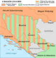 Bosnie et Sandjak 1904 hu.png 800 × 824; 166 KB
-
 Bosnie et Sandjak 1904 mk.svg 2,000 × 1,826; 132 KB
-
 Bosnie et Sandjak 1904.svg 2,000 × 1,826; 139 KB
-
 Bosznia és Szandzsák 1904.svg 2,000 × 1,826; 139 KB
-
 ColtonOttomanSerbia.jpg 704 × 786; 330 KB
-
 Ottoman vojvodina01-sr.png 944 × 978; 92 KB
-
 Ottoman vojvodina01.png 944 × 978; 107 KB
-
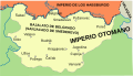
 Elayet of temesvar-sr.png 833 × 1,075; 109 KB
-
 Elayet of temesvar.png 833 × 1,075; 123 KB
-

-
 Kingdom of Dalmatia-1868.png 542 × 502; 35 KB
-
 Kosovo Vilayet — Memalik-i Mahruse-i Shahane-ye Mahsus Mukemmel ve Mufassal Atlas (1907).jpg 2,133 × 1,653; 1.89 MB
-
 Map of the Kingdom of Croatia (1868).png 542 × 502; 40 KB
-
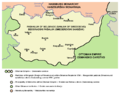
 Ottoman Empire Administrative Divisions, Karassi Sanjak.png 435 × 371; 33 KB
-
 Ottoman Empire Administrative Divisions-es.svg 1,725 × 1,868; 5.5 MB
-
 Ottoman Empire Administrative Divisions-tr.png 3,549 × 3,845; 3.16 MB
-
 Ottoman Empire Administrative Divisions-tr.svg 1,725 × 1,868; 2.19 MB
-
 Ottoman Empire Administrative Divisions.png 4,455 × 4,840; 2.1 MB
-
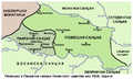
 Pozega pakrac 1606 en.png 720 × 431; 47 KB
-
 Pozega pakrac 1606 sr.png 720 × 431; 45 KB
-

-
 Sancak of Gumultzina (Komotini).png 712 × 539; 57 KB
-
 Sanjak of Albania Map 1431-es.svg 378 × 666; 320 KB
-
 Sanjak of Albania Map 1431.svg 378 × 666; 27 KB
-
 Sanjak of Novibazar-es.svg 2,306 × 1,987; 242 KB
-
 Sanjak of Novibazar-sr.png 786 × 888; 61 KB
-
 Sanjak of Novibazar.png 786 × 888; 75 KB
-
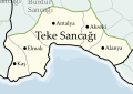 Sanjak of Teke.svg 1,132 × 800; 2.21 MB
-
 Sanjaks and Vilayets of the Ottoman Empire, 1914.png 2,341 × 1,631; 592 KB
-
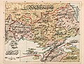
 SDUK - Turkey I. Containing the Northern Provinces.jpg 6,336 × 5,104; 13.48 MB
-
 SDUK - Turkey II. Containing the Northern Part of Greece.jpg 5,764 × 3,916; 3.96 MB
-
 SDUK - Turkey III. Containing the Southern part of Greece and Candia.jpg 6,325 × 4,829; 11.28 MB
-
 Srbsko Ottoman XVIII-es.svg 792 × 1,019; 131 KB
-
 Srbsko Ottoman XVIII.svg 792 × 1,019; 131 KB

.jpg)


.jpg)

.jpg)
.png)


.jpg)
.png)


