File:Kartenblatt 470 Sayda.jpg
Jump to navigation
Jump to search
Size of this preview: 559 × 599 pixels. Other resolutions: 224 × 240 pixels | 448 × 480 pixels | 717 × 768 pixels | 956 × 1,024 pixels | 1,911 × 2,048 pixels | 3,225 × 3,456 pixels.
Original file (3,225 × 3,456 pixels, file size: 2.53 MB, MIME type: image/jpeg)
Captions
Captions
Add a one-line explanation of what this file represents
Summary
[edit]
| Description |
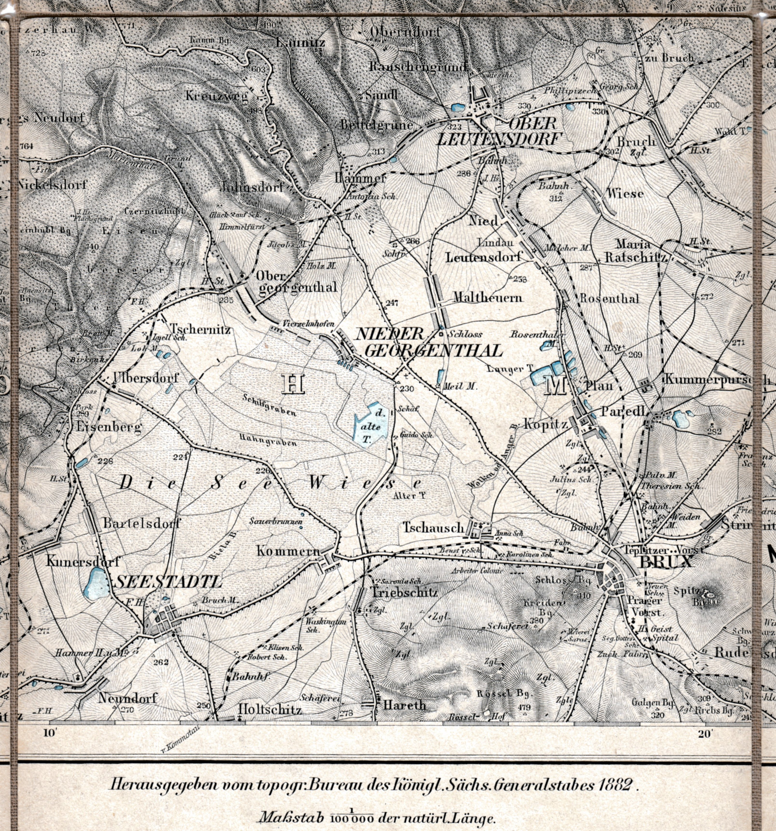
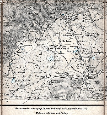
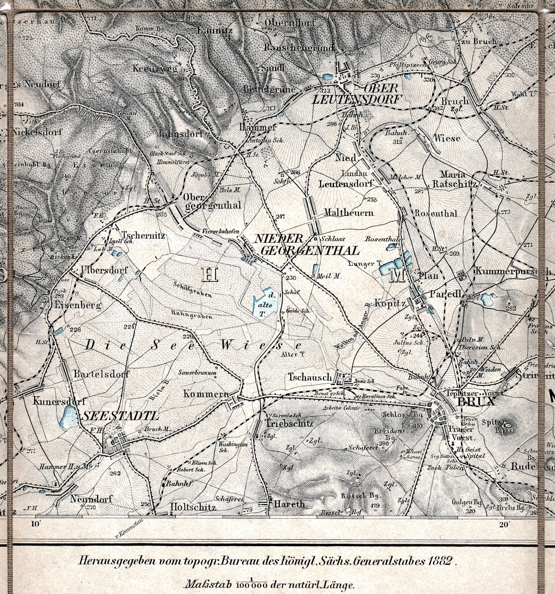
Deutsch: Karte des Deutschen Reiches, Blatt 470 Sayda (Ausschnitt), Maßstab 1:100.000 |
| Date | |
| Source | Karte des Deutschen Reiches, Blatt 470 Sayda |
| Author | Kgl. Sächs. Generalstab, namentlich unbekannt |
|
This work is in the public domain in its country of origin and other countries and areas where the copyright term is the author's life plus 70 years or fewer. | |
| This file has been identified as being free of known restrictions under copyright law, including all related and neighboring rights. | |
|
This work is in the public domain in its country of origin and other countries and areas where the copyright term is the author's life plus 70 years or fewer. This work is in the public domain in the United States because it was published (or registered with the U.S. Copyright Office) before January 1, 1929. | |
| This file has been identified as being free of known restrictions under copyright law, including all related and neighboring rights. | |
File history
Click on a date/time to view the file as it appeared at that time.
| Date/Time | Thumbnail | Dimensions | User | Comment | |
|---|---|---|---|---|---|
| current | 18:51, 3 October 2020 | | 3,225 × 3,456 (2.53 MB) | Lysippos (talk | contribs) | {{Information |description ={{de|1=Karte des Deutschen Reiches, Blatt 470 Sayda (Ausschnitt), Maßstab 1:100.000}} |date =1882 |source =Karte des Deutschen Reiches, Blatt 470 Sayda |author =Kgl. Sächs. Generalstab, namentlich unbekannt }} {{PD-old}} Category:1880s maps of Saxony Category:19th-century maps of Bohemia |
You cannot overwrite this file.
File usage on Commons
There are no pages that use this file.
File usage on other wikis
The following other wikis use this file:
- Usage on de.wikipedia.org