File:Karte Pustertal.svg
Jump to navigation
Jump to search

Size of this PNG preview of this SVG file: 800 × 529 pixels. Other resolutions: 320 × 212 pixels | 640 × 423 pixels | 1,024 × 677 pixels | 1,280 × 847 pixels | 2,560 × 1,694 pixels | 1,037 × 686 pixels.
Original file (SVG file, nominally 1,037 × 686 pixels, file size: 268 KB)
Captions
Captions
Add a one-line explanation of what this file represents
Summary
[edit]| Description |
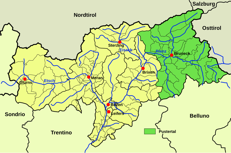
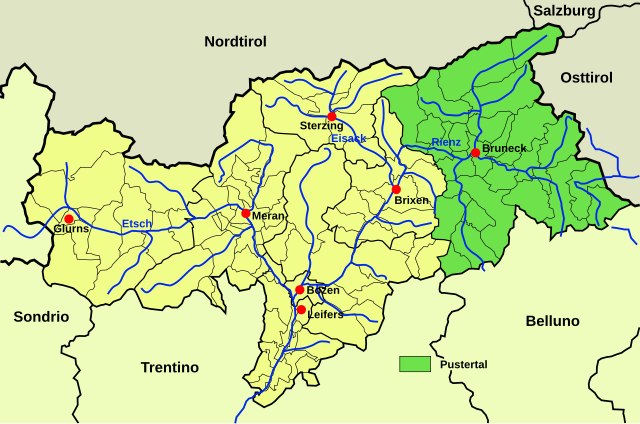
Deutsch: Südtirolkarte mit dem Pustertal markiert. English: Map of South Tirol with Pustertal marked. |
||
| Date | |||
| Source |
This file was derived from: Karte Pustertal.png by Fedi This file was derived from: Italy Bolzano-Bozen location map.svg by NordNordWest |
||
| Author | Furfur | ||
| Permission (Reusing this file) |
I, the copyright holder of this work, hereby publish it under the following licenses:
This file is licensed under the Creative Commons Attribution-Share Alike 4.0 International license.
You may select the license of your choice. |

File history
Click on a date/time to view the file as it appeared at that time.
| Date/Time | Thumbnail | Dimensions | User | Comment | |
|---|---|---|---|---|---|
| current | 19:02, 14 May 2024 | | 1,037 × 686 (268 KB) | Furfur (talk | contribs) | == {{int:filedesc}} == {{Information |Description={{de|Südtirolkarte mit dem Pustertal markiert.}}{{en|Map of South Tirol with Pustertal marked.}} |Source={{Derived from|Karte Pustertal.png|by=Fedi|k=de}} {{Derived from|Italy Bolzano-Bozen location map.svg|by=NordNordWest}} |Date=2024-05-14 |Author={{U|Furfur}} |Permission={{self|GFDL|cc-by-sa-4.0}} }} Category:Maps of South Tyrol Category:Maps of valleys of the Alps in Italy Category:German language SVG maps |
You cannot overwrite this file.
File usage on Commons
The following 2 pages use this file:
File usage on other wikis
The following other wikis use this file:
- Usage on de.wikipedia.org