File:Karta-"Karta öfver Svenska arktiska expeditionernas forskningsområde åren 1837-80 - Sjöhistoriska museet - 1994-20.tif
Jump to navigation
Jump to search

Size of this JPG preview of this TIF file: 800 × 566 pixels. Other resolutions: 320 × 226 pixels | 640 × 453 pixels | 1,024 × 724 pixels | 1,280 × 905 pixels | 2,560 × 1,811 pixels | 4,823 × 3,411 pixels.

Original file (4,823 × 3,411 pixels, file size: 32.29 MB, MIME type: image/tiff, 2 pages)
Captions
Captions
Add a one-line explanation of what this file represents
| Artist |
C. E. Dahlman |
|||||||
| Object type | Karta | |||||||
| Description |
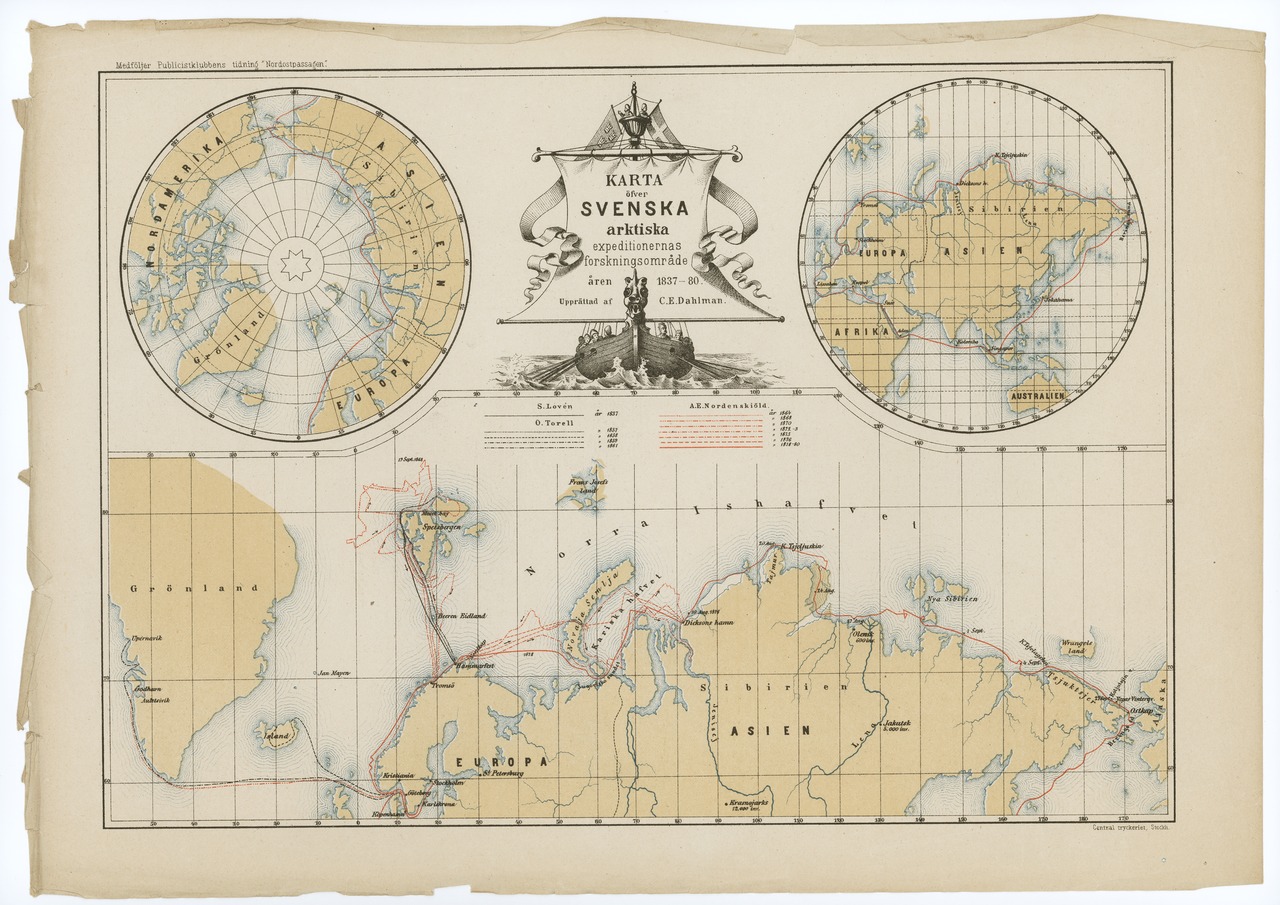
Svenska: Karta: "Karta öfver Svenska arktiska expeditionernas forskningsområde åren 1837-80." Norra halvklotet. |
|||||||
| Original caption | Benämning: Karta
Motivbeskrivning: "Karta öfver Svenska arktiska expeditionernas forskningsområde åren 1837-80." Norra halvklotet Motiv-ämnesord: Norra halvklotet Ämnesord: Nordenskiölds arktiska expedition, Upptäcksresande |
|||||||
| Date | 1880 | |||||||
| Medium | paper | |||||||
| Collection | ||||||||
| Accession number | ||||||||
| Source/Photographer | Sjöhistoriska museet | |||||||
| Permission (Reusing this file) |
|
|||||||


File history
Click on a date/time to view the file as it appeared at that time.
| Date/Time | Thumbnail | Dimensions | User | Comment | |
|---|---|---|---|---|---|
| current | 06:40, 8 September 2015 |  | 4,823 × 3,411, 2 pages (32.29 MB) | SMMUploader (talk | contribs) | {{Artwork |artist = C. E. Dahlman |title = |object type = Karta |description = {{sv|Karta: "Karta öfver Svenska arktiska expeditionernas forskningsområde åren 1837-80." Norra halvklotet.}} |other_... |
You cannot overwrite this file.
File usage on Commons
The following 2 pages use this file: