File:Kansas City Southern Railway system map.svg
Jump to navigation
Jump to search

Size of this PNG preview of this SVG file: 800 × 457 pixels. Other resolutions: 320 × 183 pixels | 640 × 366 pixels | 1,024 × 585 pixels | 1,280 × 731 pixels | 2,560 × 1,463 pixels | 1,400 × 800 pixels.
Original file (SVG file, nominally 1,400 × 800 pixels, file size: 543 KB)
Captions
Captions
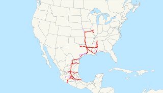
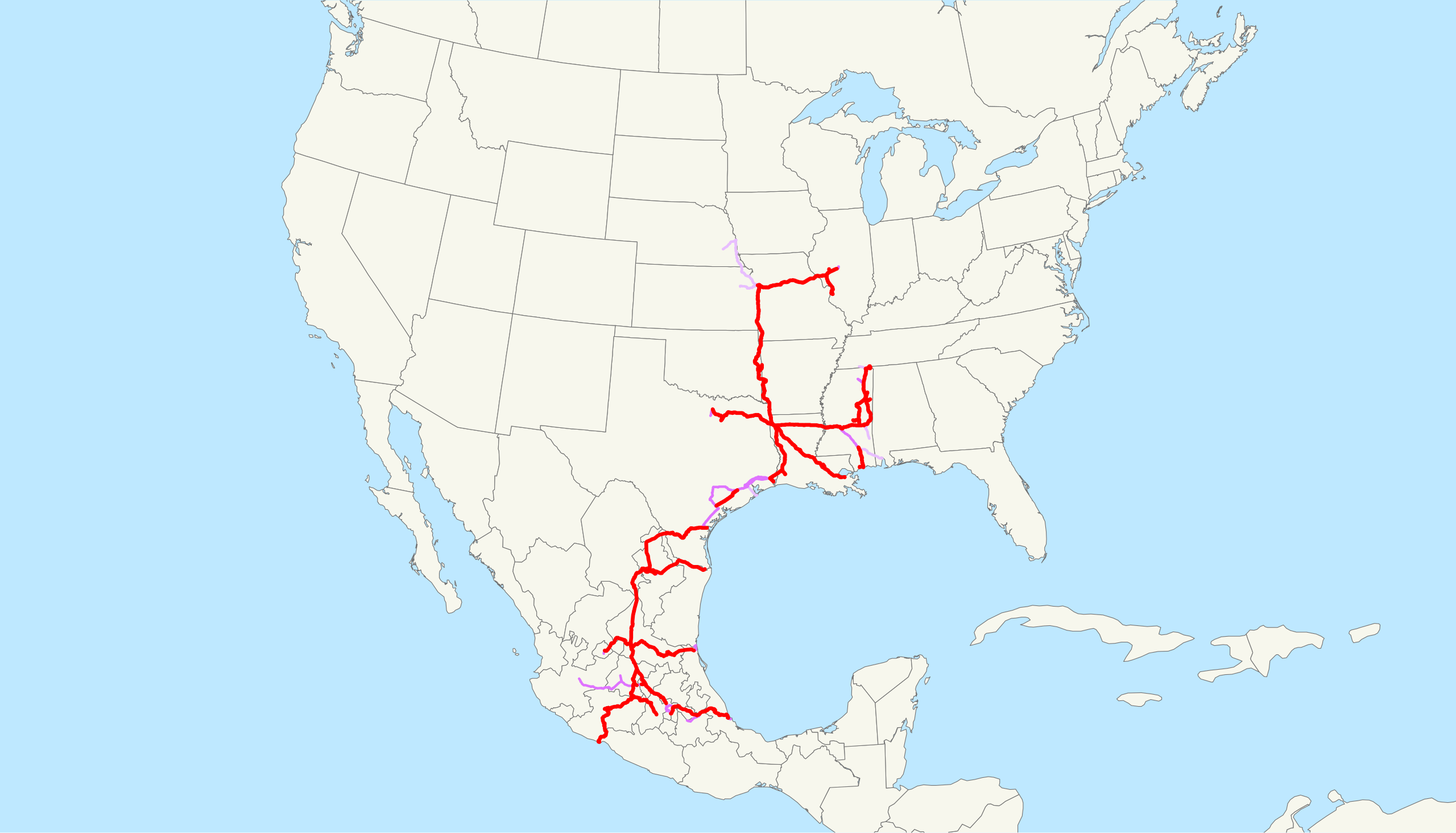
A map of the Kansas City Southern Railway as of 2009, with trackage rights in purple (haulage rights are lighter)
Summary
[edit]
| Description | This is a map of the Kansas City Southern Railway as of 2009, with trackage rights in purple (haulage rights are lighter). Email me if you would like a copy of the GIS data I created (modified from Bureau of Transportation Statistics North American Transportation Atlas Data) or if you see any errors. |
| Date | 20 February 2009 (original upload date) |
| Source | No machine-readable source provided. Own work assumed (based on copyright claims). |
| Author | No machine-readable author provided. NE2 assumed (based on copyright claims). |
Licensing
[edit]
| I, the copyright holder of this work, release this work into the public domain. This applies worldwide. In some countries this may not be legally possible; if so: I grant anyone the right to use this work for any purpose, without any conditions, unless such conditions are required by law. |
File history
Click on a date/time to view the file as it appeared at that time.
| Date/Time | Thumbnail | Dimensions | User | Comment | |
|---|---|---|---|---|---|
| current | 13:09, 23 February 2009 | | 1,400 × 800 (543 KB) | NE2 (talk | contribs) | Changed the display of lines owned by the government for the purposes of passenger rail, so that if KCS is the primary freight operator it is not shown as trackage rights. |
| 04:30, 20 February 2009 |  | 1,400 × 800 (542 KB) | NE2 (talk | contribs) | == Summary == This is a map of the Kansas City Southern Railway as of 2009, with trackage rights in purple (haulage rights are lighter). Email me if you would like a copy of the GIS dat |
You cannot overwrite this file.
File usage on Commons
The following 2 pages use this file:
File usage on other wikis
The following other wikis use this file:
- Usage on de.wikipedia.org
- Usage on en.wikipedia.org
- Usage on es.wikipedia.org
- Usage on fr.wikipedia.org
- Usage on hu.wikipedia.org
- Usage on id.wikipedia.org
- Usage on it.wikipedia.org
- Usage on ja.wikipedia.org
- Usage on ko.wikipedia.org
- Usage on nl.wikipedia.org
- Usage on pt.wikipedia.org
- Usage on www.wikidata.org
- Usage on zh.wikipedia.org