Category:System maps of U.S. railroads
Jump to navigation
Jump to search
Subcategories
This category has the following 6 subcategories, out of 6 total.
Media in category "System maps of U.S. railroads"
The following 52 files are in this category, out of 52 total.
-
 1901 Wisconsin Central map (Wisconsin highlighted).jpg 1,224 × 1,446; 945 KB
-
 1901 Wisconsin Central map.jpg 1,282 × 1,494; 944 KB
-
 Apache Railway system map.svg 1,400 × 800; 885 KB
-
 Appanoose County Community Railroad system map.svg 1,400 × 800; 405 KB
-
 Arizona and California Railroad system map.svg 1,400 × 800; 1.08 MB
-
 Arizona Central Railroad system map.svg 1,400 × 800; 693 KB
-
 Arizona Eastern Railway system map.svg 1,400 × 800; 1 MB
-
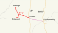
 Arkansas Midland Railroad system map.svg 1,400 × 800; 1.03 MB
-
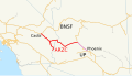
 Arkansas-Oklahoma Railroad system map.svg 1,400 × 800; 616 KB
-
 AT&L Railroad system map.svg 1,400 × 800; 95 KB
-
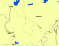
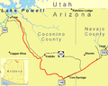 Black Mesa and Lake Powell RR Map.png 1,500 × 1,200; 109 KB
-
 BNSF Railway system map CA Keddie-Wye.png 367 × 408; 89 KB
-
 BNSF Railway system map.svg 1,400 × 800; 1.62 MB
-
 Bnsfmap.png 300 × 235; 26 KB
-
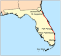
 Brightline Train Florida.svg 389 × 800; 252 KB
-
 Burlington Route System Map.png 503 × 610; 22 KB
-
 CanadianNationalRailwayNetworkMap.png 462 × 320; 15 KB
-
 CanadianPacificRailwayNetworkMap.png 444 × 309; 33 KB
-
 Colorado Midland Railway map.jpg 1,122 × 915; 357 KB
-
 Copr map.png 672 × 489; 807 KB
-
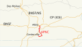
 CP KCS Overview Map.jpg 2,000 × 1,294; 181 KB
-
 CSX map.svg 1,152 × 684; 2.31 MB
-
 CSX Transportation system map.svg 1,400 × 800; 1.31 MB
-
 Csxmap.png 400 × 372; 34 KB
-
 CTRR map.png 916 × 717; 20 KB
-
 DMIR Map.png 1,082 × 872; 17 KB
-
 Dmvw-map.png 1,978 × 1,146; 3.65 MB
-
 Dvs-map.png 228 × 330; 183 KB
-
 Elgin, Joliet and Eastern Railway system map (2008).svg 1,400 × 800; 562 KB
-
 Fecmap.png 400 × 371; 15 KB
-
 GFRR map.png 592 × 684; 36 KB
-
 Iatr-map.png 870 × 317; 12 KB
-
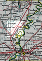
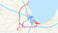
 Jacksonville railroads.png 1,734 × 1,354; 112 KB
-
 Kansas City Southern Railway system map (US only).svg 1,400 × 800; 496 KB
-
 Kansas City Southern Railway system map.svg 1,400 × 800; 543 KB
-
 Kcsmap.png 298 × 300; 23 KB
-
 KSC NASA Railroad map.jpg 1,050 × 1,181; 327 KB
-
 MARC Train lines.svg 609 × 462; 1.73 MB
-
 Marctrainmap.svg 609 × 462; 1.83 MB
-
 MNNR Map.png 1,082 × 872; 52 KB
-
 MSWY Map.png 561 × 557; 25 KB
-
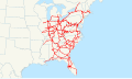
 Norfolk Southern Railway system map.svg 1,400 × 800; 1.53 MB
-
 Nsmap.png 397 × 400; 36 KB
-
 PSAP-Map.jpg 828 × 886; 225 KB
-
 Reading Blue Mountain and Northern Railroad system map.svg 1,400 × 800; 1.65 MB
-
 Route map of Chicago North Western Line 1944.jpg 2,311 × 1,578; 1.6 MB
-
 Texmex-map.png 1,732 × 1,060; 3.11 MB
-
 Union Pacific Railroad system map.svg 1,400 × 800; 1.56 MB
-
 Upmap.png 500 × 389; 158 KB
-
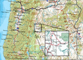
 Willamette Valley Railway system map.svg 1,400 × 800; 1.18 MB
-
 Wisconsin Central 1998 map.png 968 × 1,160; 161 KB
-
 Yreka Western Railroad system map.svg 1,400 × 800; 479 KB
.jpg)


.svg)


.svg)


