File:Josephinische Landesaufnahme Schwanberg.jpg
Jump to navigation
Jump to search

Size of this preview: 800 × 519 pixels. Other resolutions: 320 × 208 pixels | 640 × 415 pixels | 1,024 × 665 pixels | 1,280 × 831 pixels | 2,560 × 1,662 pixels | 8,424 × 5,468 pixels.
Original file (8,424 × 5,468 pixels, file size: 10.01 MB, MIME type: image/jpeg)
Captions
Captions
Add a one-line explanation of what this file represents
Summary
[edit]
| Description |
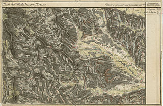
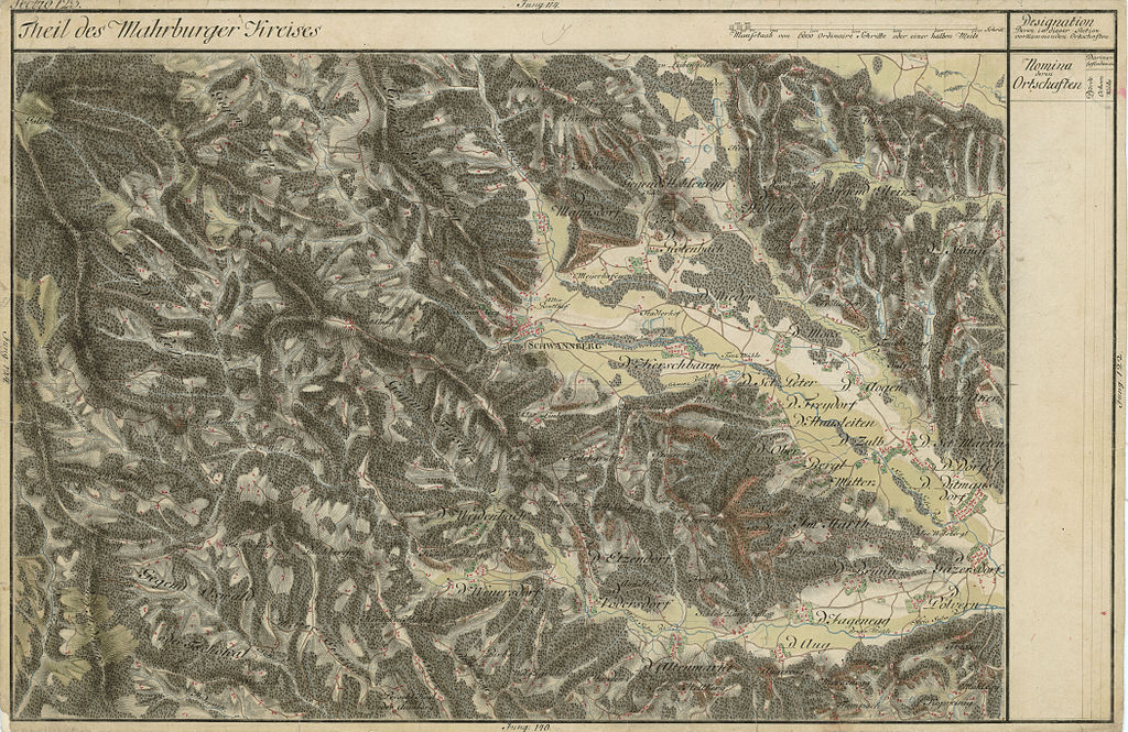
Deutsch: historische Landkarte BIXa054 section 123 Josephinische Landesaufnahme: Gebiet von Schwanberg und Umgebung, Steiermark, Österreich |
| Date | Landesaufnahme: von 1764 bis 1787. |
| Source | Josephinische Landesaufnahme |
| Author | historische Militärkarte der österreichisch-ungarischen Monarchie |
| Permission (Reusing this file) |
freies Werk |
Licensing
[edit]
|
This work is in the public domain in its country of origin and other countries and areas where the copyright term is the author's life plus 70 years or fewer. | |
| This file has been identified as being free of known restrictions under copyright law, including all related and neighboring rights. | |
File history
Click on a date/time to view the file as it appeared at that time.
| Date/Time | Thumbnail | Dimensions | User | Comment | |
|---|---|---|---|---|---|
| current | 19:42, 1 September 2008 | | 8,424 × 5,468 (10.01 MB) | Josef Moser (talk | contribs) | {{Information |Description=historische Landkarte BIXa054 section 123 Josephinische Landesaufnahme: Gebiet von Schwanberg und Umgebung, Steiermark, Österreich |Source=Josephinische Landesaufnahme |Date=Landesaufnahme: von 1764 bis 1787. |Author=historisc |
You cannot overwrite this file.
File usage on Commons
The following page uses this file:
File usage on other wikis
The following other wikis use this file:
- Usage on de.wikipedia.org