Category:First Military Mapping Survey of Austrian Empire
Jump to navigation
Jump to search
Internationalization
Deutsch: Josephinische Landesaufnahme
English: 1st Military Mapping Survey of Austria
Magyar: I. katonai felmérés
Română: Ridicarea topografică iozefină
English: Maps were created between 1764 and 1768 and rectified between 1780 and 1783. Scale 1:28 800.
- See:
- Category:First Military Mapping Survey of Austrian Empire (1764 – 1768), called „Josephinische Landesaufnahme“ or „1. Landesaufnahme“
- Category:Second Military Mapping Survey of Austrian Empire (1836 – 1852), called „Franziszeische Landesaufnahme“ or „2. Landesaufnahme“
- Category:3rd Military Mapping Survey of Austria-Hungary (1868 – 1880), called „Franzisco-Josephinische Landesaufnahme“ or „3. Landesaufnahme“
Clickable maps
[edit]-
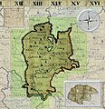
 Arad County
 -
 Bihor, Solnoc, Crasna County
 -
 Maramureş County
 -
 Grand Duchy of Transylvania
 -
 Banat region
 -
 Sătmar County
 -
 Gros Honter County
 -
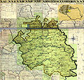
 Kingdom of Hungary


.jpg)


| NO WIKIDATA ID FOUND! Search for First Military Mapping Survey of Austrian Empire on Wikidata | |
| Upload media |
Subcategories
This category has the following 4 subcategories, out of 4 total.
Media in category "First Military Mapping Survey of Austrian Empire"
The following 52 files are in this category, out of 52 total.
-
 Budapest 1785.png 1,186 × 599; 1.6 MB
-
 Crangul Mieilor 1789 Battle of Ramnic.png 1,276 × 1,058; 1.52 MB
-
 Duisitzkar Josephinische Landesaufnahme.jpg 2,000 × 1,617; 541 KB
-
 Focsani 1789 Austrian deployment.png 996 × 1,016; 1.39 MB
-
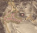 Füzér az első katonai felmérés idején.jpg 601 × 525; 82 KB
-
 Giglachseen Josephinische Landesaufnahme.jpg 1,979 × 1,272; 353 KB
-
 Gledisova.jpg 1,387 × 825; 300 KB
-
 Gárdony-első-katonai-felmérés-térképe.jpg 838 × 681; 196 KB
-
 Iborfia-első-katonai-felmérés-térképe.jpg 666 × 673; 154 KB
-
 Image-Josephinische Landesaufnahme 113 Weinebene und Speikkogel.jpg 8,472 × 5,460; 16.21 MB
-
 Josephinische Landaufnahme 1764 Brigittenau.jpg 1,425 × 1,030; 489 KB
-
 Josephinische Landesaufnahme 097 Hebalm Rosenkogel.jpg 8,416 × 5,486; 17.48 MB
-
 Josephinische Landesaufnahme 098 Preitenegg.jpg 8,464 × 5,498; 17.69 MB
-
 Josephinische Landesaufnahme 114 Deutschlandsberg.jpg 8,448 × 5,483; 17.74 MB
-
 Josephinische Landesaufnahme Aspang.JPEG 7,424 × 4,919; 21.57 MB
-
 Josephinische Landesaufnahme Aspnang, Edlitz, Pittental.JPEG 7,408 × 4,933; 23.05 MB
-
 Josephinische Landesaufnahme Gablitz Laab.JPEG 7,360 × 4,902; 15.43 MB
-
 Josephinische Landesaufnahme Gloggnitz, Kirchberg.JPEG 7,424 × 4,985; 22.07 MB
-
 Josephinische Landesaufnahme Gross Enzersdorf.JPEG 7,424 × 4,969; 13.15 MB
-
 Josephinische Landesaufnahme Kirchschlag in der Buckligen Welt.JPEG 7,448 × 4,958; 16.2 MB
-
 Josephinische Landesaufnahme Liesing Laxenburg Himberg.JPEG 7,400 × 4,954; 13.49 MB
-
 Josephinische Landesaufnahme Mooskirchen Grazer Feld.jpg 8,448 × 5,471; 9.02 MB
-
 Josephinische Landesaufnahme Prein.JPEG 7,400 × 4,973; 16.14 MB
-
 Josephinische Landesaufnahme Puchberg, Schneeberg.JPEG 7,360 × 4,928; 22.37 MB
-
 Josephinische Landesaufnahme Rax, Höllental, Naßwald.jpg 7,360 × 4,955; 33.89 MB
-
 Josephinische Landesaufnahme Schwanberg.jpg 8,424 × 5,468; 10.01 MB
-
 Josephinische Landesaufnahme Semmering, Prein steirische Seite.JPEG 8,440 × 5,489; 19.84 MB
-
 Josephinische Landesaufnahme Stainz Wildon.jpg 8,392 × 5,449; 11.71 MB
-
 Josephinische Landesaufnahme Sulz Alland Perchtoldsdorf.JPEG 7,384 × 4,915; 17.15 MB
-
 Josephinische Landesaufnahme Wechsel Kranichberg.JPEG 7,392 × 4,923; 17.57 MB
-
 Josephinische Landesaufnahme Wien.jpeg 7,320 × 4,874; 20.16 MB
-
 Josephinische Landesaufnahme Wismath.JPEG 7,408 × 4,972; 16.92 MB
-
 JosLA Leibnitz.jpg 8,448 × 5,473; 12.13 MB
-
 Kaiserwald Josephinische Landesaufnahme.jpg 5,000 × 7,657; 11.17 MB
-
 Kápolnásnyék-első-katonai-felmérés-térképe.jpg 838 × 681; 184 KB
-
 Nadap-első-katonai-felmérés-térképe.jpg 838 × 681; 266 KB
-
 Oberkärnten Karte Surgant um 1750.jpg 2,388 × 2,008; 2.49 MB
-
 Pusztaszabolcs-első-katonai felmérésének-térképe.jpg 839 × 681; 158 KB
-
 Pákozd-első-katonai-felmérés-térképe.jpg 837 × 680; 238 KB
-
 Pázmánd-első-katonai-felmérés-térképe.jpg 838 × 681; 212 KB
-
 Senec - First Military Survey (1763-1787).png 1,167 × 636; 1.28 MB
-
 September 1789 Austrian forces deployment near Ciorasti.png 1,158 × 695; 952 KB
-
 Seregélyes-első-katonai-felmérés-térképe.jpg 838 × 680; 198 KB
-
 Sukoró-első-katonai-felmérés-térképe.jpg 838 × 681; 219 KB
-
 Szabadegyháza-első-katonai-felmérés-térképe.jpg 838 × 681; 150 KB
-
 Sárbogárd-első-katonai-felmérése.jpg 839 × 680; 194 KB
-
 Sárosd-első-katonai-felmérés-térképe.jpg 838 × 680; 165 KB
-
 Söréd-első-katonai-felmérés-térképe.jpg 835 × 680; 211 KB
-
 Velence-első-katonai-felmérés-térképe.jpg 838 × 681; 206 KB
-
 Vereb-első-katonai-felmérés-térképe.jpg 838 × 681; 239 KB
-
 Zichyújfalu-1.-katonai-felmérés-térképe.jpg 838 × 681; 134 KB
-
 Свитазів (загальний план). Перша військова карта (1779-1783).jpg 1,185 × 650; 645 KB


.png)


._%D0%9F%D0%B5%D1%80%D1%88%D0%B0_%D0%B2%D1%96%D0%B9%D1%81%D1%8C%D0%BA%D0%BE%D0%B2%D0%B0_%D0%BA%D0%B0%D1%80%D1%82%D0%B0_(1779-1783).jpg)