File:Italie antique, partie méridionale.png
Jump to navigation
Jump to search

Size of this preview: 732 × 600 pixels. Other resolutions: 293 × 240 pixels | 586 × 480 pixels | 938 × 768 pixels | 1,250 × 1,024 pixels | 2,501 × 2,048 pixels | 3,486 × 2,855 pixels.
Original file (3,486 × 2,855 pixels, file size: 24.39 MB, MIME type: image/png)
Captions
Captions
Add a one-line explanation of what this file represents
Summary
[edit]
| Description |
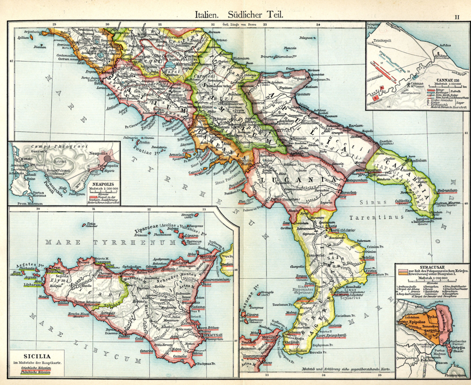
Français : Italie antique, partie méridionale (F. W. Putzger). |
||||||
| Date | s. d. | ||||||
| Source | INTERNET ARCHIVE: Putzgers Historischer Schul-Atlas - Ancient and Medieval History Maps ==> Italie antique, partie méridionale. | ||||||
| Author | fr:Friedrich Wilhelm Putzger (1849-1913). | ||||||
| Permission (Reusing this file) |
|
||||||
Licensing
[edit]
|
This work is in the public domain in its country of origin and other countries and areas where the copyright term is the author's life plus 100 years or fewer. | |
| This file has been identified as being free of known restrictions under copyright law, including all related and neighboring rights. | |
File history
Click on a date/time to view the file as it appeared at that time.
| Date/Time | Thumbnail | Dimensions | User | Comment | |
|---|---|---|---|---|---|
| current | 17:05, 11 February 2021 | | 3,486 × 2,855 (24.39 MB) | Budelberger (talk | contribs) | Reverted to version as of 22:34, 18 January 2021 (UTC) |
| 22:57, 18 January 2021 |  | 293 × 240 (155 KB) | Budelberger (talk | contribs) | Réduction. | |
| 22:34, 18 January 2021 |  | 3,486 × 2,855 (24.39 MB) | Budelberger (talk | contribs) | {{Information |Description = {{fr|1=Italie antique, partie méridionale (F. W. Putzgers).}} |Source = [https://archive.org/details/PutzgersHistorischerSchul-Atlas-AncientAndMedievalHistoryMaps INTERNET ARCHIVE: Putzgers Historischer Schul-Atlas - Ancient and Medieval History Maps] ==> [https://ia802304.us.archive.org/6/items/PutzgersHistorischerSchul-Atlas-AncientAndMedievalHistoryMaps/Italy.%20Southern%20Part.png Italie antique, partie méridionale]. |Date = s. d. |Author... |
You cannot overwrite this file.
File usage on Commons
There are no pages that use this file.
File usage on other wikis
The following other wikis use this file:
- Usage on fr.wiktionary.org