Category:Putzgers Historischer Schul-Atlas
Jump to navigation
Jump to search
 Cover of a Swiss edition (1924) | |||||
| Upload media | |||||
| Instance of |
| ||||
|---|---|---|---|---|---|
| |||||
English: Friedrich Wilhelm Putzger ( 10 Januar 1849 in Siebenlehn - 3 August 1913 in Plauen) was a German teacher who updated the Physikalisch-statistischer Atlas des deutschen Reiches (Richard Andree, Oskar Peschel, Verlag Velhagen & Klasing) and in 1877 in Leipzig first published the F. W. Putzgers Historischer Schul-Atlas intended for use in schools.
Due to its low price, it was a success, and still common in schools. The current edition is Putzger – Atlas und Chronik zur Weltgeschichte [2., erweiterte Ausgabe]. Cornelsen, Berlin 2009.
Web: maproom.org links to scans of the maps from the 1905 (29th) edition of F. W. Putzgers Historischer Schul-Atlas.Subcategories
This category has the following 2 subcategories, out of 2 total.
D
Media in category "Putzgers Historischer Schul-Atlas"
The following 76 files are in this category, out of 76 total.
-
 (Putzger) Europe 1559.jpg 3,946 × 3,048; 2.11 MB
-
 (Putzger) Prussia, 1415-1806.jpg 4,072 × 3,118; 2.27 MB
-
 Visigoti563.jpg 921 × 1,260; 1 MB
-

-
 Achter-Pommeren.png 541 × 399; 277 KB
-
 Ancient Greece, Northern Part (Putzger).jpg 3,507 × 2,824; 3.21 MB
-
 Ancient Greece, Southern Part (Putzger).jpg 3,507 × 2,834; 2.73 MB
-
 Ansbach-Bayreuth.png 361 × 359; 44 KB
-
 Antikes Alexandria Karte.JPG 1,694 × 1,314; 611 KB
-
 Assyrer.JPG 610 × 370; 71 KB
-
 BadenPutzger1905.jpg 899 × 1,404; 587 KB
-
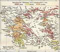
 BalkVolkPutzger1898.jpg 2,033 × 1,890; 2.96 MB
-
 Brandenburg-Preußen1688.JPG 615 × 442; 69 KB
-
 Deutsches Reich - Reichskreiseinteilung 1500.jpg 550 × 1,118; 329 KB
-
 Deutschl&Oberitalien.1477.jpg 3,600 × 2,920; 4.01 MB
-
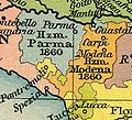 Emilia Occidentale 1815.jpg 367 × 334; 54 KB
-
 Europe in 1740.jpg 797 × 552; 753 KB
-
 Franken-um-800.jpg 1,344 × 1,280; 1.02 MB
-
 Fränkisch-Alemannische Mark.jpg 957 × 735; 626 KB
-
 Germania1648.jpg 3,432 × 2,514; 4.86 MB
-
 Germanisch-Slawisch-Ungarisches Mitteleuropa um 1000.jpg 602 × 821; 574 KB
-
 Greece at the start of the Peloponnesian War (Putzger).png 2,897 × 1,779; 11.13 MB
-
 Hanse-Orden.png 1,263 × 753; 210 KB
-
 HerodotWorld.jpg 1,165 × 684; 634 KB
-
 Historischer Schul-Atlas 1901.1.jpg 2,227 × 2,744; 1.49 MB
-
 Historischer Schul-Atlas 1901.2.jpg 3,207 × 2,452; 2.48 MB
-
 Italie antique, partie méridionale.png 3,486 × 2,855; 24.39 MB
-
 Kampfgebiete 1675 bis 1679.JPG 800 × 415; 71 KB
-
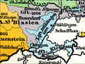 Karte Klettgau 1806.PNG 813 × 614; 1.1 MB
-
 Karthago Scipio.JPG 1,097 × 1,161; 303 KB
-
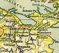 Kenchreai Lechaion.jpg 493 × 441; 167 KB
-
 Kingdom of Bohemia during the Hussite Wars.jpg 1,151 × 861; 468 KB
-
 Kleinasien I.jpg 3,053 × 1,706; 886 KB
-
 Kleinasien II.jpg 3,046 × 1,690; 933 KB
-
 Kleinasien III.jpg 3,038 × 1,706; 891 KB
-
 Lordship of Anholt.png 533 × 408; 516 KB
-
 Map of East Prussia 1648.jpg 478 × 554; 75 KB
-
 Mecklenburg 1648.jpg 527 × 355; 367 KB
-
 Mylendonk map 1789.jpg 789 × 964; 640 KB
-
 Métaure Atlas Historique Schul-Atlas, 1905.JPG 1,137 × 913; 334 KB
-
 NapoleonischeZeit.1.jpg 2,820 × 3,612; 4.56 MB
-
 Nord Italia1815.jpg 990 × 649; 183 KB
-
 Ordensland1410.png 694 × 733; 130 KB
-
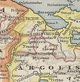
 Peloponnes Putzger klein.jpg 1,708 × 1,267; 304 KB
-
 Peloponnes text de.png 2,546 × 1,984; 837 KB
-
 Plateje.jpg 387 × 369; 97 KB
-
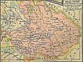
 Polska i Litwa za Władysława Jagiełły (1927).jpg 3,465 × 2,726; 8.52 MB
-
 Pommerellen.png 288 × 226; 132 KB
-
 Pommern1477.JPG 844 × 606; 98 KB
-
 Putzger 1900 Deutschland und Italien 1803.jpg 1,366 × 2,151; 3.02 MB
-
 Putzger 1924.jpg 1,369 × 2,025; 1.1 MB
-
 Putzger Creta.jpg 2,436 × 1,069; 680 KB
-
 Putzger Griechische Stämme.jpg 3,206 × 2,808; 5.8 MB
-
 Putzger Kleinasien Zuschnitt.jpg 3,804 × 2,835; 6.76 MB
-
 Putzger Kleinasien.jpg 5,385 × 3,539; 11.89 MB
-
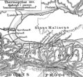
 Putzger Thermopylae.jpg 1,692 × 1,614; 1.86 MB
-
 Putzger Umgegend von Troia.jpg 1,777 × 1,314; 1.53 MB
-

-
 Reichsherrschaft Bonndorf 1806 V2.PNG 582 × 495; 773 KB
-
 Reichskreise.jpg 550 × 1,118; 160 KB
-
 Samogitië.png 335 × 274; 163 KB
-
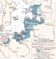
 Schweden.Russland.Polen.OrientalischeFrage.jpg 3,536 × 2,816; 4.44 MB
-
 Sikyon.jpg 500 × 513; 210 KB
-
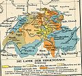 Svizzera.jpg 1,072 × 991; 491 KB
-
 Thermopylen.png 382 × 356; 71 KB
-
 Triballi in Illyria.jpg 750 × 867; 158 KB
-
 Vandali.jpg 1,477 × 2,032; 2.56 MB
-
 VolkerkartevonMittel-undSudosteuropa.jpg 1,024 × 960; 183 KB
-
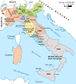
 Völkerkarte von Mittel- und Südosteuropa. Italien 1815 bis zur Gegenwart (1905)-es.svg 2,722 × 2,998; 1.03 MB
-
 Völkerkarte von Mittel- und Südosteuropa. Italien 1815 bis zur Gegenwart (1905).jpg 1,574 × 1,886; 600 KB
-
-
 Weltreich-Mongolen.JPG 767 × 545; 155 KB
-
 WyprawyKrzyzowe.JPG 1,758 × 1,449; 1.36 MB
-
 WuerttembergPutzger1905.jpg 1,407 × 1,785; 526 KB
-

-
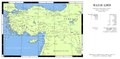 Карта Малой Азии.png 8,500 × 4,137; 3.76 MB
_Europe_1559.jpg)
_Prussia,_1415-1806.jpg)


.jpg)
.jpg)


.png)


.jpg)


-es.svg)
.jpg)
Simplificado-es.svg)


