File:Intercommunalités Morbihan 2022.svg
Jump to navigation
Jump to search

Size of this PNG preview of this SVG file: 720 × 599 pixels. Other resolutions: 288 × 240 pixels | 577 × 480 pixels | 923 × 768 pixels | 1,230 × 1,024 pixels | 2,460 × 2,048 pixels | 812 × 676 pixels.
Original file (SVG file, nominally 812 × 676 pixels, file size: 428 KB)
Captions
Captions
Add a one-line explanation of what this file represents
Summary
[edit]
| Description |
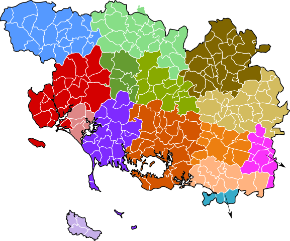
English: Map of groups of communes in Morbihan department, France. Composition on 1st January 2022.
Français : Carte des intercommunalités du département du Morbihan, France. Composition au 1er janvier 2022 :
|
| Date | |
| Source | File:Intercommunalités Morbihan 2017.svg |
| Author | Ddesco75 (à partir du fichier de Pymouss) |
| Permission (Reusing this file) |
Based on GEOFLA® 2016 v2.2 Communes France Métropolitaine, a work of Institut géographique national, licensed under the Licence Ouverte. |
Licensing
[edit]
I, the copyright holder of this work, hereby publish it under the following license:
This file is licensed under the Creative Commons Attribution-Share Alike 4.0 International license.
- You are free:
- to share – to copy, distribute and transmit the work
- to remix – to adapt the work
- Under the following conditions:
- attribution – You must give appropriate credit, provide a link to the license, and indicate if changes were made. You may do so in any reasonable manner, but not in any way that suggests the licensor endorses you or your use.
- share alike – If you remix, transform, or build upon the material, you must distribute your contributions under the same or compatible license as the original.
File history
Click on a date/time to view the file as it appeared at that time.
| Date/Time | Thumbnail | Dimensions | User | Comment | |
|---|---|---|---|---|---|
| current | 21:09, 21 September 2022 | | 812 × 676 (428 KB) | Ddesco75 (talk | contribs) | Uploaded own work with UploadWizard |
You cannot overwrite this file.
File usage on Commons
There are no pages that use this file.
File usage on other wikis
The following other wikis use this file:
- Usage on fr.wikipedia.org