File:Indiana Locator Map with US.PNG
Jump to navigation
Jump to search
No higher resolution available.
Indiana_Locator_Map_with_US.PNG (292 × 297 pixels, file size: 14 KB, MIME type: image/png)
Captions
Captions
Add a one-line explanation of what this file represents
Summary
[edit]
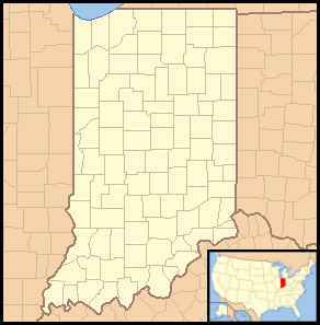
| Description | Locator Map of Indiana, United States |
| Date | |
| Source | taken from US Census website [1] and modified by User:VerruckteDan, User:Ruhrfisch, User:Huebi, and User:Appraiser |
| Author | US Census, User:VerruckteDan, User:Ruhrfisch, User:Huebi, and User:Appraiser |
| Permission (Reusing this file) |
US Census / US Government work is public domain, my modifications licensed under the GNU Free Documentation License |
Licensing
[edit]

|
Permission is granted to copy, distribute and/or modify this document under the terms of the GNU Free Documentation License, Version 1.2 or any later version published by the Free Software Foundation; with no Invariant Sections, no Front-Cover Texts, and no Back-Cover Texts. A copy of the license is included in the section entitled GNU Free Documentation License. |
| This file is licensed under the Creative Commons Attribution-Share Alike 3.0 Unported license. | ||
| Attribution: We, Ruhrfisch and Appraiser | ||
| ||
| This licensing tag was added to this file as part of the GFDL licensing update. |
This file is licensed under the Creative Commons Attribution-Share Alike 2.5 Generic license.
- You are free:
- to share – to copy, distribute and transmit the work
- to remix – to adapt the work
- Under the following conditions:
- attribution – You must give appropriate credit, provide a link to the license, and indicate if changes were made. You may do so in any reasonable manner, but not in any way that suggests the licensor endorses you or your use.
- share alike – If you remix, transform, or build upon the material, you must distribute your contributions under the same or compatible license as the original.
You may select the license of your choice.
and
This image or file is a work of a United States Census Bureau employee, taken or made as part of that person's official duties. As a work of the U.S. federal government, the image is in the public domain.
|
 |
File history
Click on a date/time to view the file as it appeared at that time.
| Date/Time | Thumbnail | Dimensions | User | Comment | |
|---|---|---|---|---|---|
| current | 21:47, 8 March 2008 | | 292 × 297 (14 KB) | Appraiser (talk | contribs) | == Summary == {{Information| |Description= Locator Map of Indiana, United States |Source= taken from US Census website [http://factfinder.census.gov/] and modified by User:Ruhrfisch, User:Huebi, and User:Appraiser |Date= March 2008 |Author= U |
| 03:10, 3 March 2008 |  | 288 × 293 (14 KB) | Appraiser (talk | contribs) | == Summary == {{Information| |Description= Locator Map of Indiana, United States |Source= taken from US Census website [http://factfinder.census.gov/] and modified by User:Appraiser |Date= March 2008 |Author= US Census, Appraiser |Permission= US Cens |
You cannot overwrite this file.
File usage on Commons
There are no pages that use this file.
File usage on other wikis
The following other wikis use this file:
- Usage on be-tarask.wikipedia.org
- Usage on es.wikipedia.org
- Jardines del río Blanco
- Jardín botánico de Indiana
- Harwood Tree Improvement and Regeneration Center
- Jardines hortícolas de la Universidad de Purdue
- Jardín botánico Jerry E. Clegg
- Colección de orquídeas y banco de especies Wheeler
- Christy Woods
- Jardines y arboreto Taltree
- Invernadero botánico Foellinger-Freimann
- Centro Cultural Minnetrista
- Usage on pl.wikipedia.org
- Usage on pl.wikibooks.org
- Usage on zh-min-nan.wikipedia.org
- Indianapolis
- Fort Wayne
- Evansville
- Template:Location map USA Indiana
- Bloomfield Township (Indiana)
- Bass Lake (Indiana)
- Bright (Indiana)
- Buffalo (Indiana)
- Alexandria (Indiana)
- Anderson (Indiana)
- Angola (Indiana)
- Attica (Indiana)
- Auburn (Indiana)
- Aurora (Indiana)
- Batesville (Indiana)
- Bedford (Indiana)
- Beech Grove (Indiana)
- Berne (Indiana)
- Bicknell (Indiana)
- Bluffton (Indiana)
- Boonville (Indiana)
- Brazil (Indiana)
- Butler (Indiana)
- Advance (Indiana)
- Akron (Indiana)
- Alamo (Indiana)
- Albany (Indiana)
- Albion (Indiana)
- Alfordsville (Indiana)
- Alton (Indiana)
- Altona (Indiana)
- Ambia (Indiana)
- Amboy (Indiana)
View more global usage of this file.