Category:Location maps of Indiana
Jump to navigation
Jump to search
Media in category "Location maps of Indiana"
The following 27 files are in this category, out of 27 total.
-
 Indiana Locator Map with US.PNG 292 × 297; 14 KB
-
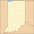 Indiana Locator Map.PNG 288 × 293; 10 KB
-
 Indiana map with national inset.png 388 × 600; 77 KB
-
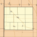 Location map for Benton County, Indiana.svg 768 × 768; 123 KB
-
 Location map of Adams County, Indiana.svg 768 × 768; 206 KB
-
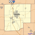 Location map of Bartholomew County, Indiana.svg 768 × 768; 192 KB
-
 Location map of Blackford County, Indiana.svg 768 × 768; 104 KB
-
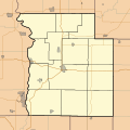
 Location map of Boone County, Indiana.svg 768 × 768; 271 KB
-
 Location map of Brown County, Indiana.svg 768 × 768; 147 KB
-
 Location map of Carroll County, Indiana.svg 768 × 768; 201 KB
-
 Location map of Cass County, Indiana.svg 768 × 768; 221 KB
-
 Location map of Clark County, Indiana.svg 768 × 768; 418 KB
-
 Location map of Clay County, Indiana.svg 896 × 768; 473 KB
-
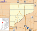
 Location map of Fountain County, Indiana.svg 768 × 768; 141 KB
-
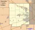 Location map of Hendricks County, Indiana.svg 896 × 768; 394 KB
-
 Location map of Martin County, Indiana.svg 768 × 768; 177 KB
-
 Location map of Washington County, Indiana.svg 768 × 768; 241 KB
-
 Locator map of Harrison County, Indiana.svg 768 × 768; 706 KB
-
 Locator map of Parke County, Indiana.svg 768 × 768; 115 KB
-
 Locator map of Tippecanoe County, Indiana.svg 768 × 768; 207 KB
-
 Locator map of Vermillion County, Indiana.svg 768 × 768; 179 KB
-
 Locator map of Warren County, Indiana.svg 896 × 768; 590 KB
-
 Map of Blackford County, Indiana.svg 768 × 768; 508 KB
-
 Map of Sullivan County Indiana Townships.svg 512 × 512; 53 KB
-
 Map of Vigo County Indiana Townships.svg 512 × 512; 66 KB
-
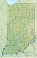
 USA Indiana location map.svg 776 × 1,200; 544 KB
-
 USA Indiana relief location map.svg 776 × 1,200; 1.38 MB


