File:IHM עין כפר.jpeg
Jump to navigation
Jump to search
Size of this preview: 800 × 429 pixels. Other resolutions: 320 × 172 pixels | 640 × 343 pixels | 1,024 × 549 pixels | 1,600 × 858 pixels.
Original file (1,600 × 858 pixels, file size: 174 KB, MIME type: image/jpeg)
Captions
Captions
Add a one-line explanation of what this file represents
Summary
[edit]
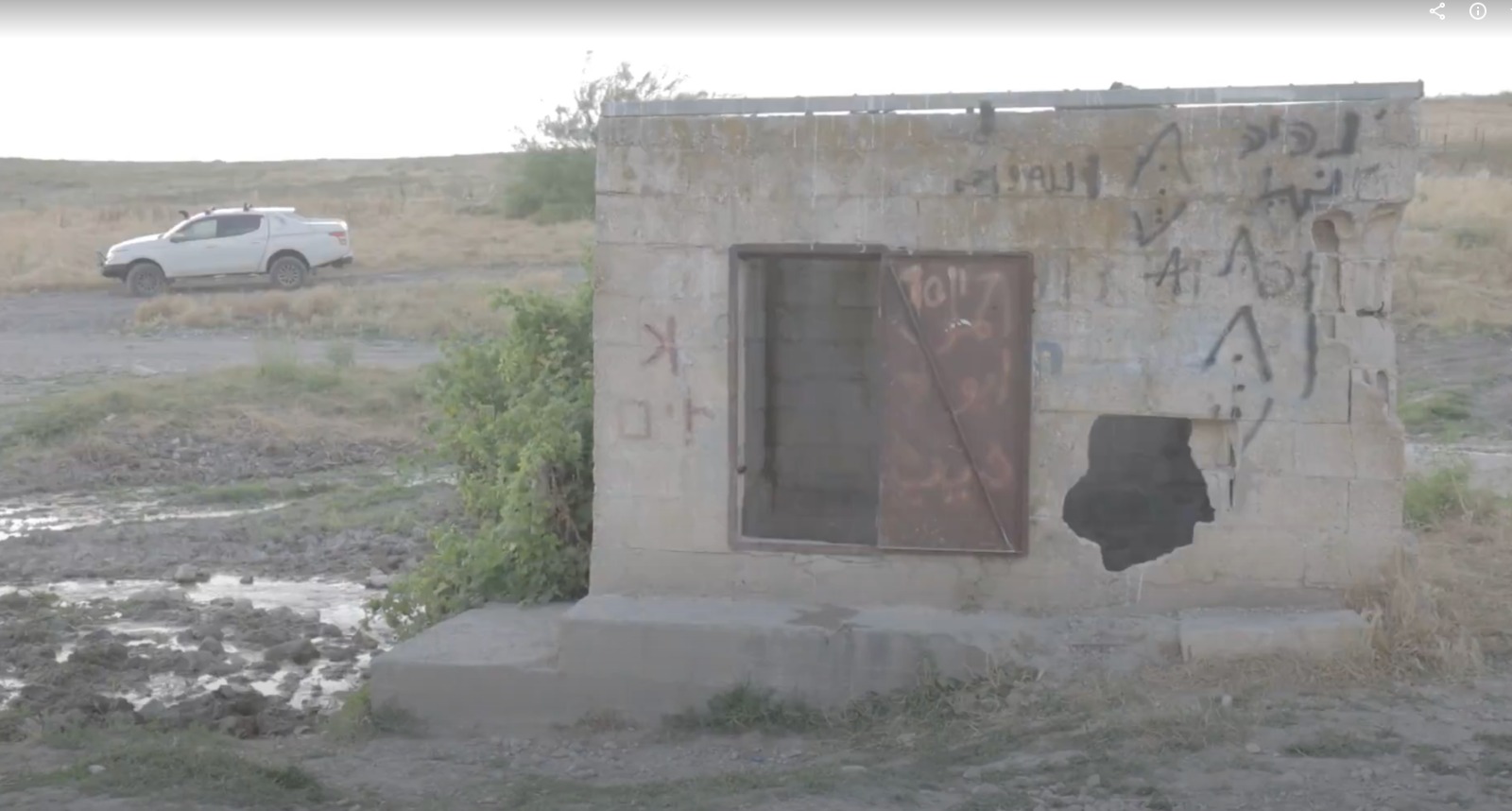
| Description | עין כפר שימש מקור המים המרכזי של תושבי הכפר הערבי אלכפרין, שחורבותיו נמצאות במעלה הגבעה. כיום משמשים המים להשקיית עדרי הבקר של תושבי הסביבה, ולכן סביבת המעיין מלוכלכת מצואה של פרות. לפני שהמים יוצאים אל השוקת ממנה שותות הפרות, הם נאגרים במבנה בטון קטן. מו |
| Date | |
| Source | Own work |
| Author | Yaniv Eliash |
Licensing
[edit]
I, the copyright holder of this work, hereby publish it under the following license:
This file is licensed under the Creative Commons Attribution-Share Alike 4.0 International license.
- You are free:
- to share – to copy, distribute and transmit the work
- to remix – to adapt the work
- Under the following conditions:
- attribution – You must give appropriate credit, provide a link to the license, and indicate if changes were made. You may do so in any reasonable manner, but not in any way that suggests the licensor endorses you or your use.
- share alike – If you remix, transform, or build upon the material, you must distribute your contributions under the same or compatible license as the original.
| Camera location | | View this and other nearby images on: OpenStreetMap |
|---|
File history
Click on a date/time to view the file as it appeared at that time.
| Date/Time | Thumbnail | Dimensions | User | Comment | |
|---|---|---|---|---|---|
| current | 15:15, 16 June 2020 | | 1,600 × 858 (174 KB) | IsraelHikingMap (talk | contribs) | =={{int:filedesc}}== {{Information |date=2020-06-16 |description=עין כפר שימש מקור המים המרכזי של תושבי הכפר הערבי אלכפרין, שחורבותיו נמצאות במעלה הגבעה. כיום משמשים המים להשקיית עדרי הבקר של תושבי הסביבה, ולכן סביבת המעיין מלוכלכת מצואה של פרות. לפני שהמים יוצאים אל השוקת ממנה שותות הפרות, הם נאגרים במבנה בטון קטן. מו |source={{own}} |author=[//www.openstreetmap.org/user/Yaniv%20Eliash Yaniv Eliash] |permission= |other versions= }} =={{int:license-header}}== {{self|cc-by-sa-4.0}}... |
You cannot overwrite this file.
File usage on Commons
The following page uses this file: