File:IHM אנדרטת ה"פוגה" 1.jpeg
Jump to navigation
Jump to search

Size of this preview: 800 × 532 pixels. Other resolutions: 320 × 213 pixels | 640 × 426 pixels | 1,024 × 681 pixels | 1,280 × 851 pixels | 1,600 × 1,064 pixels.
Original file (1,600 × 1,064 pixels, file size: 684 KB, MIME type: image/jpeg)
Captions
Captions
Add a one-line explanation of what this file represents
Summary
[edit]
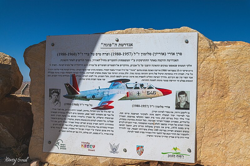
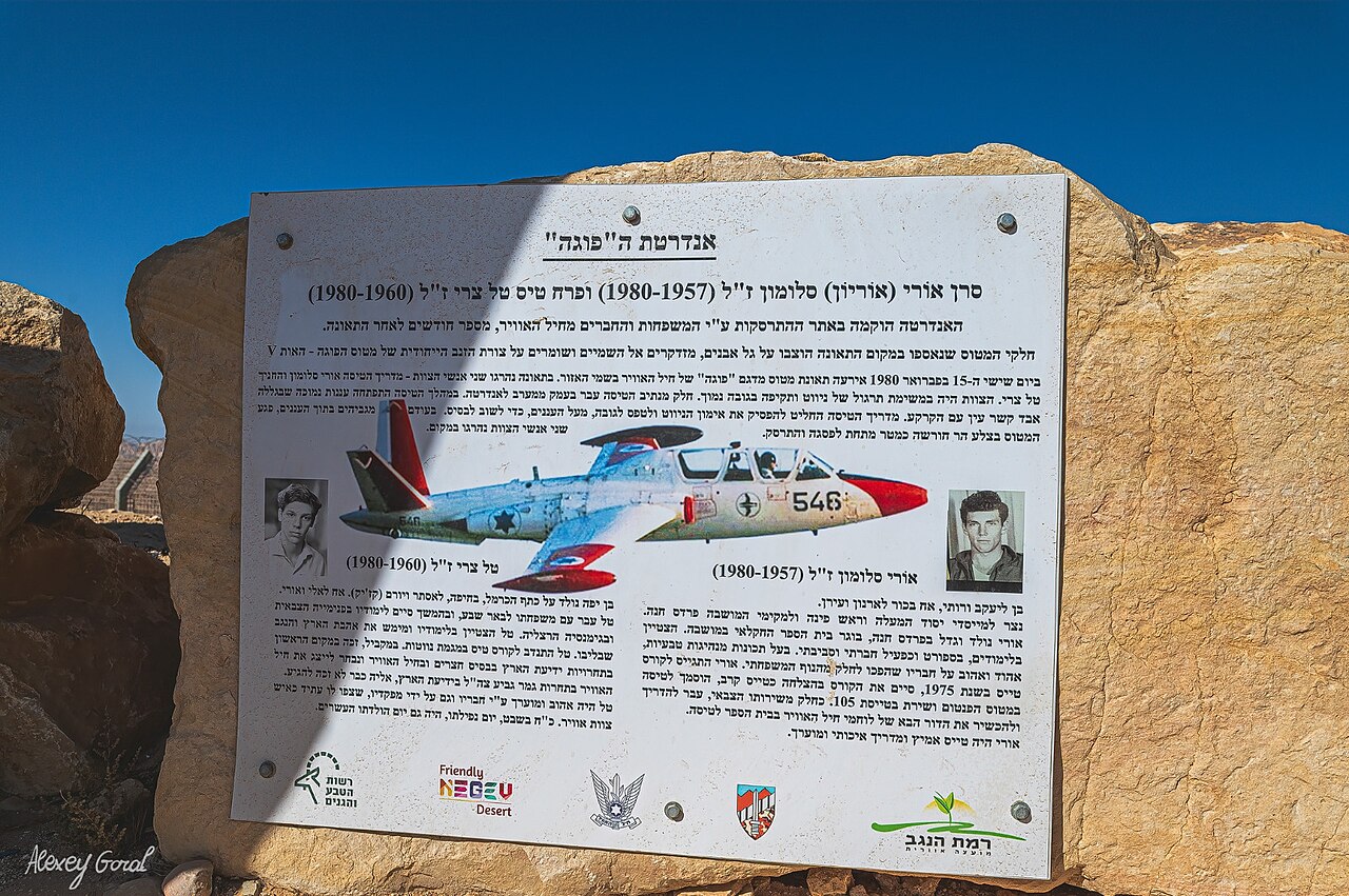
| Description | אנדרטת ה"פוגה" |
| Date | |
| Source | Own work |
| Author | GorALexeY |
| Permission (Reusing this file) |
public domain |
Licensing
[edit]
| I, the copyright holder of this work, release this work into the public domain. This applies worldwide. In some countries this may not be legally possible; if so: I grant anyone the right to use this work for any purpose, without any conditions, unless such conditions are required by law. |
| Camera location | | View this and other nearby images on: OpenStreetMap |
|---|
File history
Click on a date/time to view the file as it appeared at that time.
| Date/Time | Thumbnail | Dimensions | User | Comment | |
|---|---|---|---|---|---|
| current | 18:27, 17 September 2023 | | 1,600 × 1,064 (684 KB) | IsraelHikingMap (talk | contribs) | =={{int:filedesc}}== {{Information |date=2023-09-17 |description=אנדרטת ה"פוגה" |source={{own}} |author=[//www.openstreetmap.org/user/GorALexeY GorALexeY] |permission=public domain |other versions= }} =={{int:license-header}}== {{PD-self}} {{Location|1=30.5303929|2=34.5220458}} Category:Israel Hiking Map |
You cannot overwrite this file.
File usage on Commons
There are no pages that use this file.