File:Horsepen Creek (Little Nottoway River tributary) watershed.pdf
Jump to navigation
Jump to search

Size of this JPG preview of this PDF file: 776 × 600 pixels. Other resolutions: 311 × 240 pixels | 621 × 480 pixels | 994 × 768 pixels | 1,280 × 989 pixels | 1,650 × 1,275 pixels.
Original file (1,650 × 1,275 pixels, file size: 298 KB, MIME type: application/pdf)
Captions
Captions
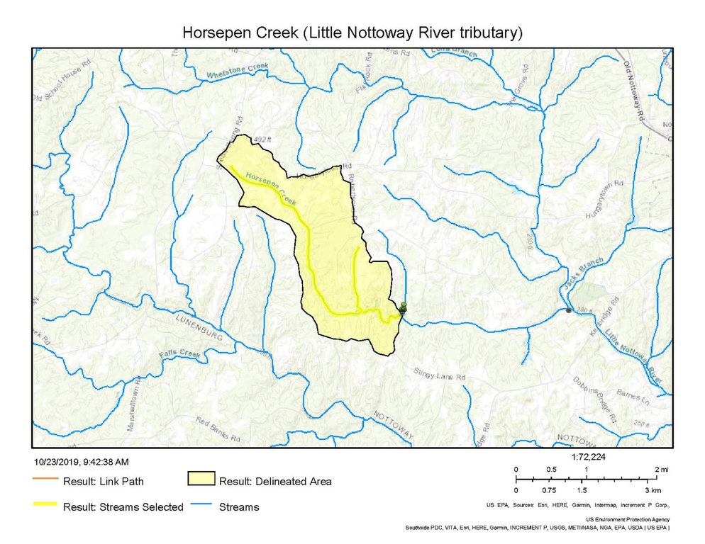
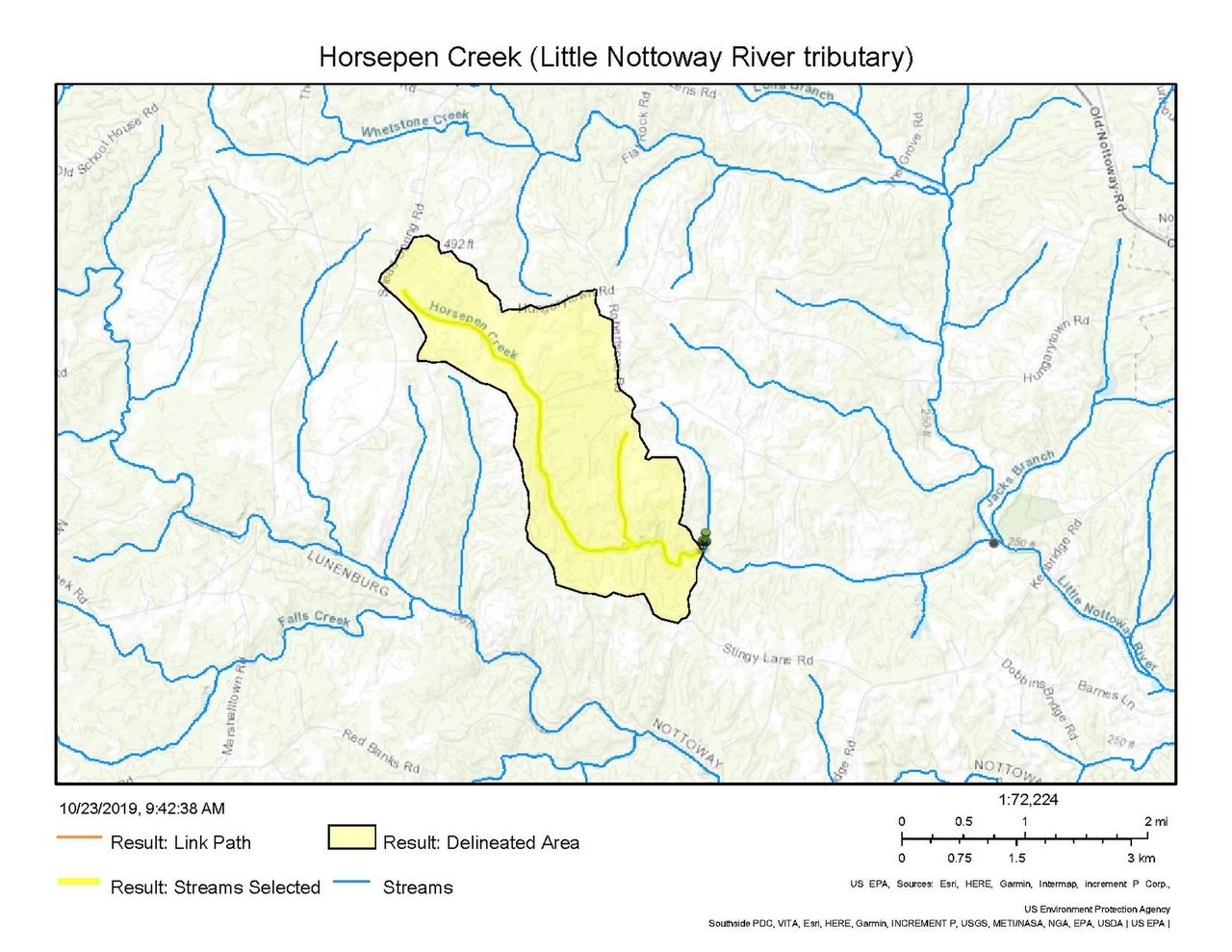
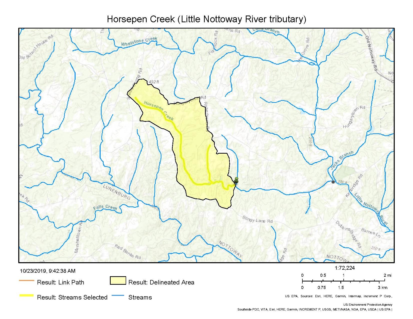
Watershed of Horsepen Creek (Little Nottoway River tributary) in Nottoway County, Virginia
Summary
[edit]| Description |
English: Depiction of the watershed of Horsepen Creek, a tributary to the Little Nottoway River in Nottoway County, Virginia. |
| Date | |
| Source | https://epa.maps.arcgis.com/apps/webappviewer/index.html?id=ada349b90c26496ea52aab66a092593b |
| Author | bcooper_EPA (US Environmental Protection Agency) |
The map comes from the Waters Geoviewer of the US EPA.
Licensing
[edit]This image (or other media) is a work of an Environmental Protection Agency employee, taken or made as part of that person's official duties. As works of the U.S. federal government, all EPA images are in the public domain.
|
||
File history
Click on a date/time to view the file as it appeared at that time.
| Date/Time | Thumbnail | Dimensions | User | Comment | |
|---|---|---|---|---|---|
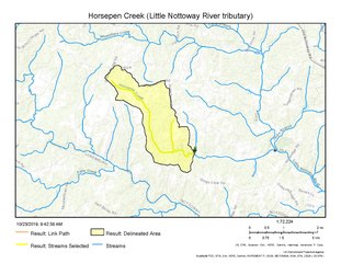
| current | 16:15, 23 October 2019 |  | 1,650 × 1,275 (298 KB) | Veg Mapper (talk | contribs) | User created page with UploadWizard |
You cannot overwrite this file.
File usage on Commons
There are no pages that use this file.
File usage on other wikis
The following other wikis use this file:
- Usage on en.wikipedia.org