File:Historical regions of Morocco.jpg
Jump to navigation
Jump to search
No higher resolution available.
Historical_regions_of_Morocco.jpg (168 × 168 pixels, file size: 19 KB, MIME type: image/jpeg)
Captions
Captions
Add a one-line explanation of what this file represents

|
This locator map image could be re-created using vector graphics as an SVG file. This has several advantages; see Commons:Media for cleanup for more information. If an SVG form of this image is available, please upload it and afterwards replace this template with
{{vector version available|new image name}}.
It is recommended to name the SVG file “Historical regions of Morocco.svg”—then the template Vector version available (or Vva) does not need the new image name parameter. |


Summary
[edit]| Description |
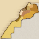
English: Map showing the Historical regions of Morocco.
Français : Carte des regions historique du Maroc.
|
| Date | |
| Source | Own work |
| Author | Nedernowhere |
| Other versions |
|

Licensing
[edit]
I, the copyright holder of this work, hereby publish it under the following license:
| This file is made available under the Creative Commons CC0 1.0 Universal Public Domain Dedication. | |
| The person who associated a work with this deed has dedicated the work to the public domain by waiving all of their rights to the work worldwide under copyright law, including all related and neighboring rights, to the extent allowed by law. You can copy, modify, distribute and perform the work, even for commercial purposes, all without asking permission.
|
File history
Click on a date/time to view the file as it appeared at that time.
| Date/Time | Thumbnail | Dimensions | User | Comment | |
|---|---|---|---|---|---|
| current | 19:43, 2 October 2011 | | 168 × 168 (19 KB) | Nedernowhere (talk | contribs) | {{Information |Description ={{en|1=Map showing the Historical regions of Morocco.}} {{fr|1=Carte des regions historique du Maroc. *Tanger, Tetouan et le Nord *Oujda et l'Est *Fès et sa région *Meknès et sa région *Rabat et sa région *Ouarzazate, Z |
You cannot overwrite this file.
File usage on Commons
There are no pages that use this file.
File usage on other wikis
The following other wikis use this file:
- Usage on ary.wikipedia.org