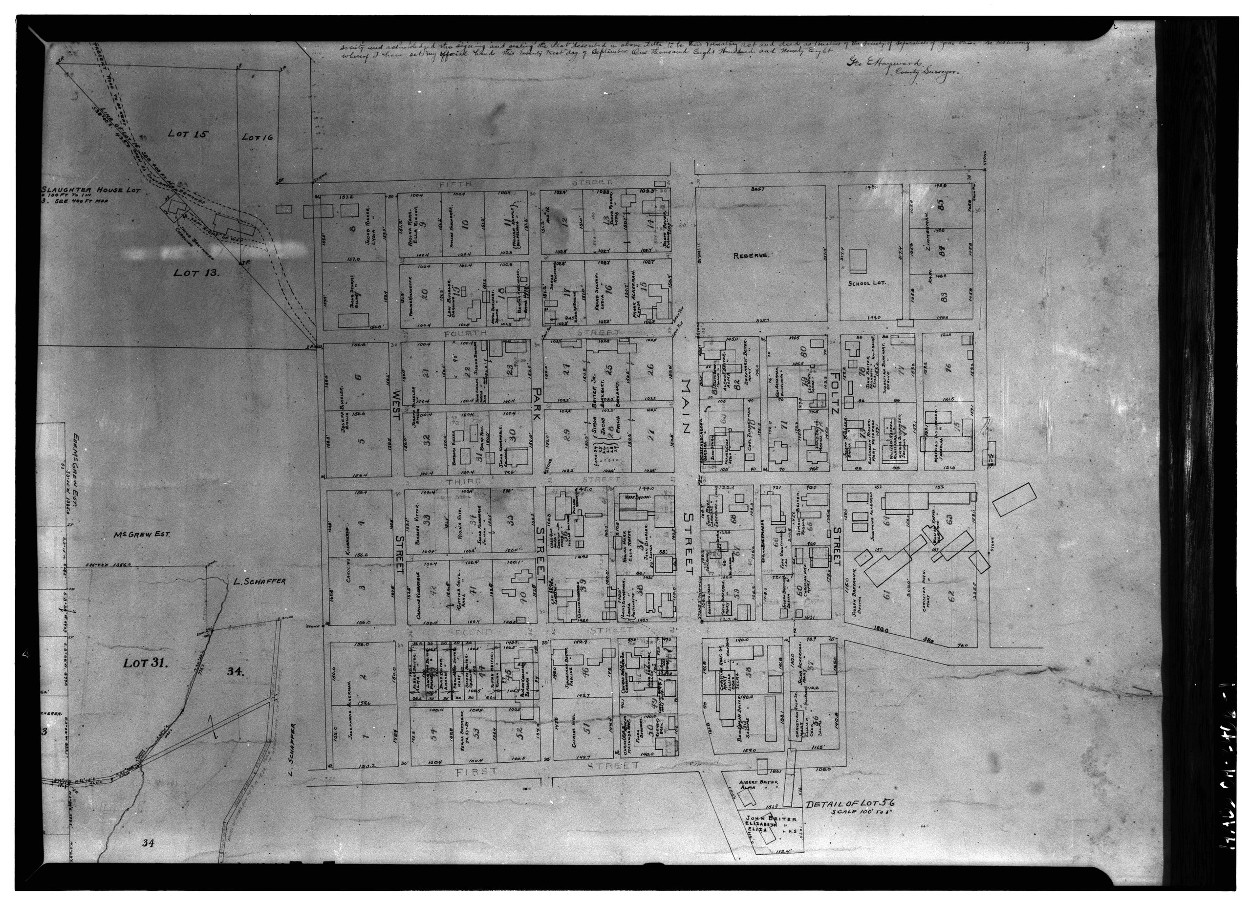
File:Historic American Buildings Survey, Carl Waite, Photographer December 1, 1936 MAP OF ZOAR. - Zoar-Maps and General History, Zoar, Tuscarawas County, OH HABS OHIO,79-ZOAR,1-1.tif
Jump to navigation
Jump to search

Size of this JPG preview of this TIF file: 800 × 578 pixels. Other resolutions: 320 × 231 pixels | 640 × 463 pixels | 1,024 × 740 pixels | 1,280 × 925 pixels | 2,560 × 1,850 pixels | 5,000 × 3,614 pixels.
Original file (5,000 × 3,614 pixels, file size: 17.24 MB, MIME type: image/tiff)
Captions
Captions
Add a one-line explanation of what this file represents
Summary
[edit]| Historic American Buildings Survey, Carl Waite, Photographer December 1, 1936 MAP OF ZOAR. - Zoar-Maps and General History, Zoar, Tuscarawas County, OH | ||||
|---|---|---|---|---|
| Title |
Historic American Buildings Survey, Carl Waite, Photographer December 1, 1936 MAP OF ZOAR. - Zoar-Maps and General History, Zoar, Tuscarawas County, OH |
|||
| Depicted place | Ohio; Tuscarawas County; Zoar | |||
| Dimensions | 5 x 7 in. | |||
| Current location |
Library of Congress Prints and Photographs Division Washington, D.C. 20540 USA http://hdl.loc.gov/loc.pnp/pp.print |
|||
| Accession number |
HABS OHIO,79-ZOAR,1-1 |
|||
| Credit line |
|
|||
| Source | https://www.loc.gov/pictures/item/oh0222.photos.129082p | |||
| Permission (Reusing this file) |
|
|||

File history
Click on a date/time to view the file as it appeared at that time.
| Date/Time | Thumbnail | Dimensions | User | Comment | |
|---|---|---|---|---|---|
| current | 12:10, 30 July 2014 |  | 5,000 × 3,614 (17.24 MB) | Fæ (talk | contribs) | GWToolset: Creating mediafile for Fæ. HABS 30 July 2014 (2601:2900) |
You cannot overwrite this file.
File usage on Commons
The following page uses this file: