File:High River Tywi levels closes minor road (except for tractors) - geograph.org.uk - 1415205.jpg
Jump to navigation
Jump to search
No higher resolution available.
High_River_Tywi_levels_closes_minor_road_(except_for_tractors)_-_geograph.org.uk_-_1415205.jpg (640 × 480 pixels, file size: 72 KB, MIME type: image/jpeg)
Captions
Captions
Add a one-line explanation of what this file represents
Summary
[edit]_-_geograph.org.uk_-_1415205.jpg&action=edit§ion=1)
| Description |
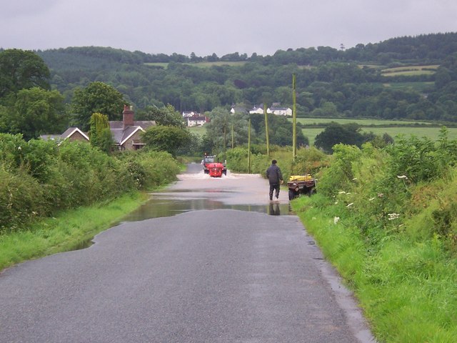
English: High River Tywi levels closes minor road (except for tractors) A period of rain over a couple of weeks culminating in very heavy rain over 16/17 July 2009 resulted in high river levels in the afternoon of 17 July. The river flowed over a minor road leading to Cilsan Bridge rendering it impassable to cars for a few hours. |
| Date | |
| Source | From geograph.org.uk |
| Author | George Causley |
| Attribution (required by the license) | George Causley / High River Tywi levels closes minor road (except for tractors) / |
| Camera location | | View this and other nearby images on: OpenStreetMap |
|---|
_-_geograph.org.uk_-_1415205.jpg¶ms=051.872700_N_-004.050000_E_globe:Earth_type:camera_source:geograph-osgb36(SN58962133)_heading:180.00&language=en)
| Object location | | View this and other nearby images on: OpenStreetMap |
|---|
_-_geograph.org.uk_-_1415205.jpg¶ms=051.871000_N_-004.050000_E_globe:Earth_class:object_type:object_source:geograph-osgb36(SN58962114)_heading:180.00&language=en)
Licensing
[edit]_-_geograph.org.uk_-_1415205.jpg&action=edit§ion=2)

|
This image was taken from the Geograph project collection. See this photograph's page on the Geograph website for the photographer's contact details. The copyright on this image is owned by George Causley and is licensed for reuse under the Creative Commons Attribution-ShareAlike 2.0 license.
|
This file is licensed under the Creative Commons Attribution-Share Alike 2.0 Generic license.
Attribution: George Causley
- You are free:
- to share – to copy, distribute and transmit the work
- to remix – to adapt the work
- Under the following conditions:
- attribution – You must give appropriate credit, provide a link to the license, and indicate if changes were made. You may do so in any reasonable manner, but not in any way that suggests the licensor endorses you or your use.
- share alike – If you remix, transform, or build upon the material, you must distribute your contributions under the same or compatible license as the original.
File history
Click on a date/time to view the file as it appeared at that time.
| Date/Time | Thumbnail | Dimensions | User | Comment | |
|---|---|---|---|---|---|
| current | 16:01, 1 March 2011 | | 640 × 480 (72 KB) | GeographBot (talk | contribs) | == {{int:filedesc}} == {{Information |description={{en|1=High River Tywi levels closes minor road (except for tractors) A period of rain over a couple of weeks culminating in very heavy rain over 16/17 July 2009 resulted in high river levels in the aftern |
You cannot overwrite this file.
File usage on Commons
There are no pages that use this file.
_-_geograph.org.uk_-_1415205.jpg&oldid=716416904)