File:Hethpool Stone Circle - geograph.org.uk - 1740347.jpg
Jump to navigation
Jump to search
Size of this preview: 800 × 600 pixels. Other resolutions: 320 × 240 pixels | 640 × 480 pixels | 1,024 × 768 pixels.
Original file (1,024 × 768 pixels, file size: 225 KB, MIME type: image/jpeg)
Captions
Captions
Add a one-line explanation of what this file represents
Summary
[edit]
| Description |
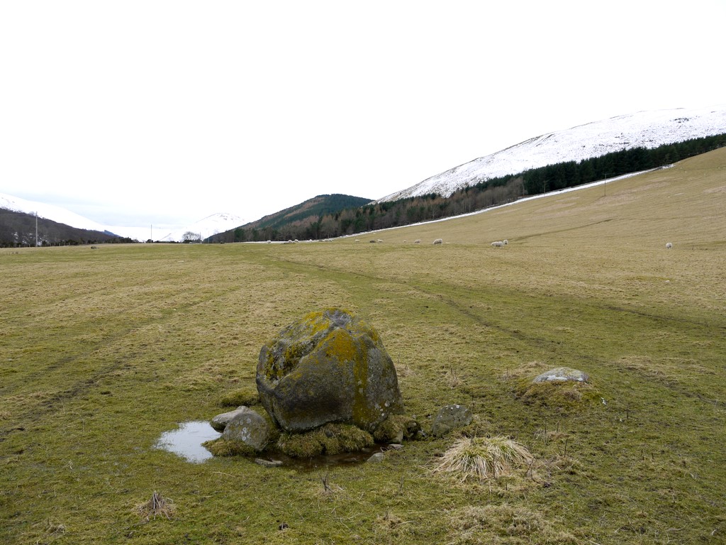
English: Hethpool Stone Circle. An array of large, rough-shaped and toppled stones that has been interpreted as being two large stone circles, dating back to the late Neolithic or Bronze Age http://ads.ahds.ac.uk/catalogue/collections/nsmr03abstracts/613.html
It is now difficult to see on the ground, or from above 1740305, as many stones are buried or have been moved, and the ground ploughed in medieval times. The grass is now patterned by the winter feed put here for the sheep. The large boulder in the foreground is thought to be part of the northern circle. See the Megalithics site for better photos, panoramas and 3D ('wobblevision') http://www.megalithics.com/england/hethpool/hethmain.htm Great Hetha is snow covered on the right. |
| Date | |
| Source | From geograph.org.uk |
| Author | Andrew Curtis |
| Attribution (required by the license) | Andrew Curtis / Hethpool Stone Circle / |
| Camera location | | View this and other nearby images on: OpenStreetMap |
|---|
_heading:202.00&language=en)
| Object location | | View this and other nearby images on: OpenStreetMap |
|---|
_heading:202.00&language=en)
Licensing
[edit]

|
This image was taken from the Geograph project collection. See this photograph's page on the Geograph website for the photographer's contact details. The copyright on this image is owned by Andrew Curtis and is licensed for reuse under the Creative Commons Attribution-ShareAlike 2.0 license.
|
This file is licensed under the Creative Commons Attribution-Share Alike 2.0 Generic license.
Attribution: Andrew Curtis
- You are free:
- to share – to copy, distribute and transmit the work
- to remix – to adapt the work
- Under the following conditions:
- attribution – You must give appropriate credit, provide a link to the license, and indicate if changes were made. You may do so in any reasonable manner, but not in any way that suggests the licensor endorses you or your use.
- share alike – If you remix, transform, or build upon the material, you must distribute your contributions under the same or compatible license as the original.
File history
Click on a date/time to view the file as it appeared at that time.
| Date/Time | Thumbnail | Dimensions | User | Comment | |
|---|---|---|---|---|---|
| current | 19:08, 5 March 2011 | | 1,024 × 768 (225 KB) | GeographBot (talk | contribs) | == {{int:filedesc}} == {{Information |description={{en|1=Hethpool Stone Circle An array of large, rough-shaped and toppled stones that has been interpreted as being two large stone circles, dating back to the late Neolithic or Bronze Age http://ads.ahds.a |
You cannot overwrite this file.
File usage on Commons
There are no pages that use this file.