File:Heilbronn Stadtplan 1834.jpg
Jump to navigation
Jump to search
Size of this preview: 570 × 599 pixels. Other resolutions: 228 × 240 pixels | 457 × 480 pixels | 731 × 768 pixels | 974 × 1,024 pixels | 1,949 × 2,048 pixels | 3,000 × 3,153 pixels.
Original file (3,000 × 3,153 pixels, file size: 4.33 MB, MIME type: image/jpeg)
Captions
Captions
Add a one-line explanation of what this file represents
Summary
[edit]
| Description |
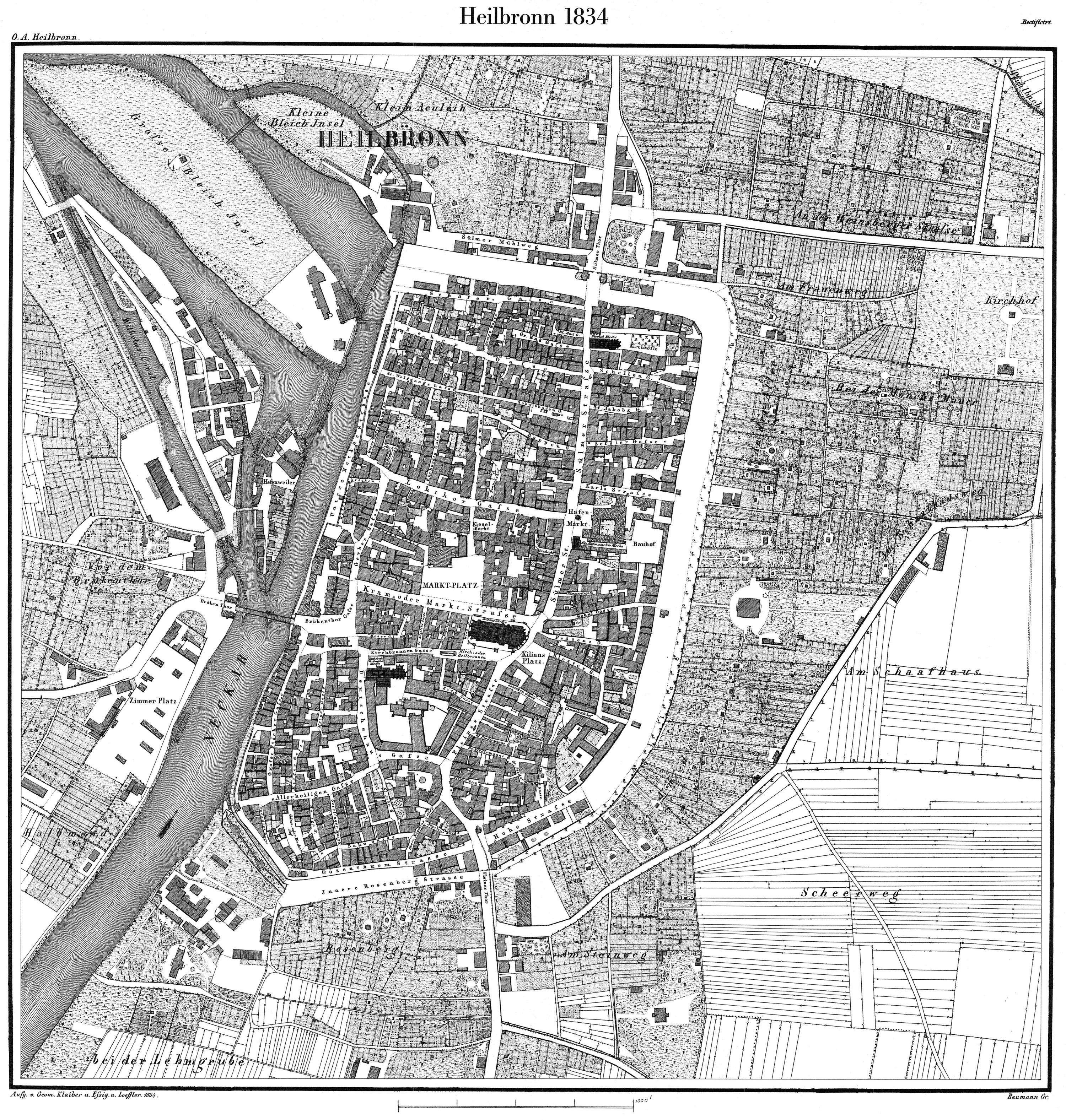
Deutsch: Heilbronner Stadtplan (Flurkarte) von 1834, Maßstab 1:2.500. Württ. Landesvermessung, NO 6011, NO 6012, NO 6111, NO 6112 English: Map of Heilbronn from 1834, scale 1:2500 |
| Date | |
| Source | Scanned from a reprint done by the Landesvermessungsamt Baden-Württemberg, Stuttgart, in 1991 |
| Author | Geom. Klaiber u. Essig u. Loeffler |
| Permission (Reusing this file) |
This image is in the public domain due to its age. |
| Other versions | Derivative works of this file: Heilbronn-pfleghoefe.jpg |
Licensing
[edit]
|
This work is in the public domain in its country of origin and other countries and areas where the copyright term is the author's life plus 70 years or fewer. | |
| This file has been identified as being free of known restrictions under copyright law, including all related and neighboring rights. | |
File history
Click on a date/time to view the file as it appeared at that time.
| Date/Time | Thumbnail | Dimensions | User | Comment | |
|---|---|---|---|---|---|
| current | 15:44, 4 April 2008 | | 3,000 × 3,153 (4.33 MB) | Rosenzweig (talk | contribs) | Cropped a bit. Thanks to Pfedelbacher for the scan. |
| 15:31, 4 April 2008 |  | 3,000 × 2,984 (3.32 MB) | Rosenzweig (talk | contribs) | Thanks to User:Pfedelbacher for the scan. {{Information |Description={{de|Heilbronner Stadtplan (Urkatasterplan) von 1834, Maßstab 1:2.500. Württ. Landesvermessung, NO 6011, NO 6012, NO 6111, NO 6112}}{{en|Map of Heilbronn from 1834, scale 1:25 |
You cannot overwrite this file.
File usage on Commons
The following 3 pages use this file:
File usage on other wikis
The following other wikis use this file:
- Usage on de.wikipedia.org