Category:Old maps of Heilbronn
Jump to navigation
Jump to search
Urban districts (cities): Freiburg · Heidelberg · Heilbronn · Karlsruhe · Mannheim · Stuttgart · Ulm
Use the appropriate category for maps showing all or a large part of Heilbronn. See subcategories for smaller areas:
| If the map shows | Category to use |
|---|---|
| Heilbronn on a recently created map | Category:Maps of Heilbronn or its subcategories |
| Heilbronn on a map created more than 70 years ago | Category:Old maps of Heilbronn or its subcategories |
| the history of Heilbronn on a recently created map | Category:Maps of the history of Heilbronn or its subcategories |
| the history of Heilbronn on a map created more than 70 years ago | Category:Old maps of the history of Heilbronn or its subcategories |
Subcategories
This category has the following 2 subcategories, out of 2 total.
Media in category "Old maps of Heilbronn"
The following 32 files are in this category, out of 32 total.
-
 Territorium der Reichsstadt Heilbronn 1578 detail Heilbronn.jpg 1,341 × 910; 1,020 KB
-
 Heilbronn Plan Stadtmauer beim Goetzenturm 1674 Johann Jacob Arhardt.jpg 800 × 462; 263 KB
-
 Heilbronn mit Böckingen Feldlagers bey Böckingen 1689.jpg 2,071 × 1,158; 636 KB
-
 Schmalkalder Heilbronn.jpg 1,834 × 1,631; 894 KB
-
 Heilbronn mit Böckingen Französisches Lager 1693.jpg 1,181 × 1,468; 564 KB
-

-
 BoeckingerSee1834.jpg 900 × 1,483; 776 KB
-
 Heilbronn Stadtplan 1834.jpg 3,000 × 3,153; 4.33 MB
-
 Historische Flurkarte von 1834 Heilbronn.jpg 2,117 × 2,065; 1.26 MB
-
 Plan zur Stadterweiterung von Heilbronn von Louis de Millas von 1840.jpg 2,029 × 2,521; 1.16 MB
-
 Württ. Nordbahn Heilbronn Varianten 1845 nummeriert.png 1,000 × 1,088; 996 KB
-
 Württ. Nordbahn Heilbronn Varianten 1845.png 1,000 × 1,088; 681 KB
-
 Heilbronn Stadtplan 1858-2.jpg 3,165 × 3,290; 6.72 MB
-
 Heilbronn Stadtplan 1858.jpg 3,130 × 3,261; 3.05 MB
-
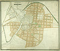
 Stadtplan von Heilbronn aus dem Jahre 1877.jpg 2,119 × 1,838; 821 KB
-
-
 Plan der Stadt Heilbronn von 1895.jpg 2,074 × 1,876; 1.8 MB
-
 Gewesteter Ortsbauplan von Heilbronn-Böckingen 1901.jpg 2,095 × 1,200; 398 KB
-
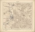 Topographische Karte 1 25000 Blatt 23 (6821) Heilbronn 1902 2.jpg 8,718 × 8,118; 24.28 MB
-
 Heilbronn Stadtplan 1903.jpg 4,086 × 3,432; 2.46 MB
-

-
 Der Wilhelms-Canal in Heilbronn 1821.jpg 2,162 × 906; 405 KB
-

-

-

-
 Heilbronn oestliches Umland 1578.jpg 8,750 × 5,915; 11.4 MB
-
 Heilbronn Stadtbauplan 1887.jpg 3,079 × 2,746; 6.84 MB
-
 Heilbronn, Präsenzgasse-Schulgasse vor 1873.jpg 403 × 212; 67 KB
-
 KarmeliterklosterHeilbronn.jpg 1,155 × 906; 779 KB
-
 Schmalkalder Klingenberg Horkheim Sontheim.jpg 2,073 × 1,040; 687 KB
-
 Territorium der Reichsstadt Heilbronn 1578 detail Galgen.jpg 918 × 717; 693 KB
-
 Territorium der Reichsstadt Heilbronn 1578.jpg 5,922 × 3,989; 8.94 MB


_Heilbronn_1902_2.jpg)


