File:Gygerkarte Region Zürich.tiff
Jump to navigation
Jump to search

Size of this PNG preview of this TIF file: 720 × 600 pixels. Other resolutions: 288 × 240 pixels | 576 × 480 pixels | 922 × 768 pixels | 1,229 × 1,024 pixels | 2,458 × 2,048 pixels | 3,972 × 3,309 pixels.
Original file (3,972 × 3,309 pixels, file size: 50.15 MB, MIME type: image/tiff)
Captions
Captions
Add a one-line explanation of what this file represents
Summary
[edit]| Description |
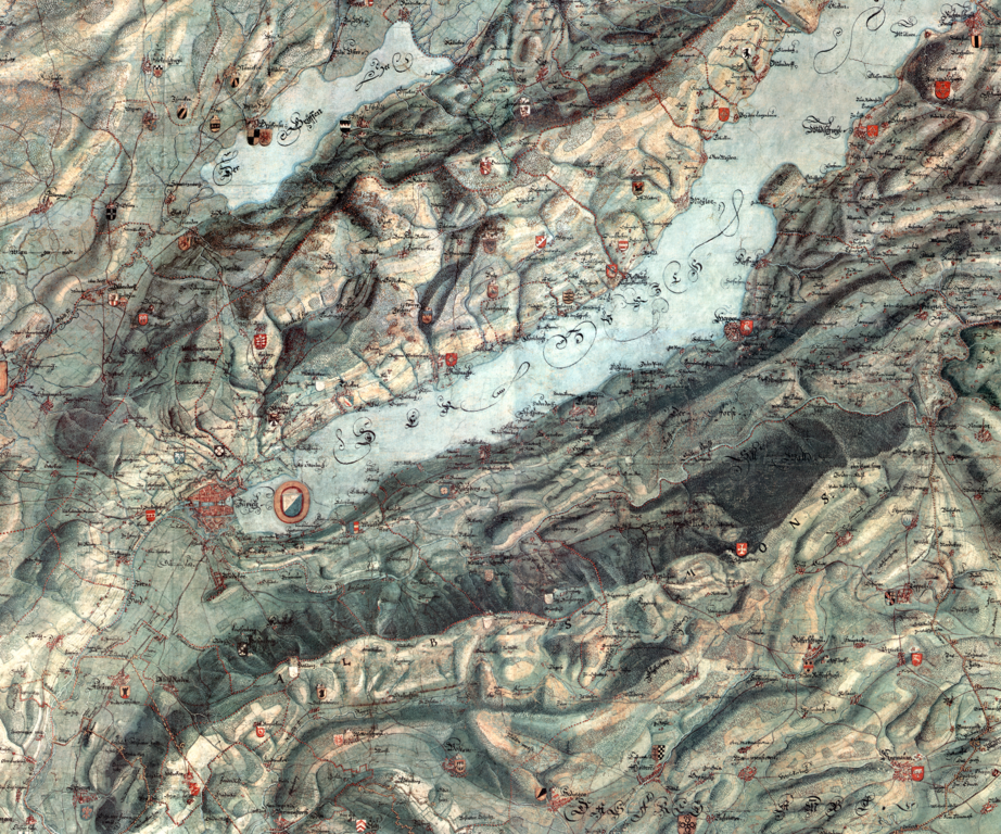
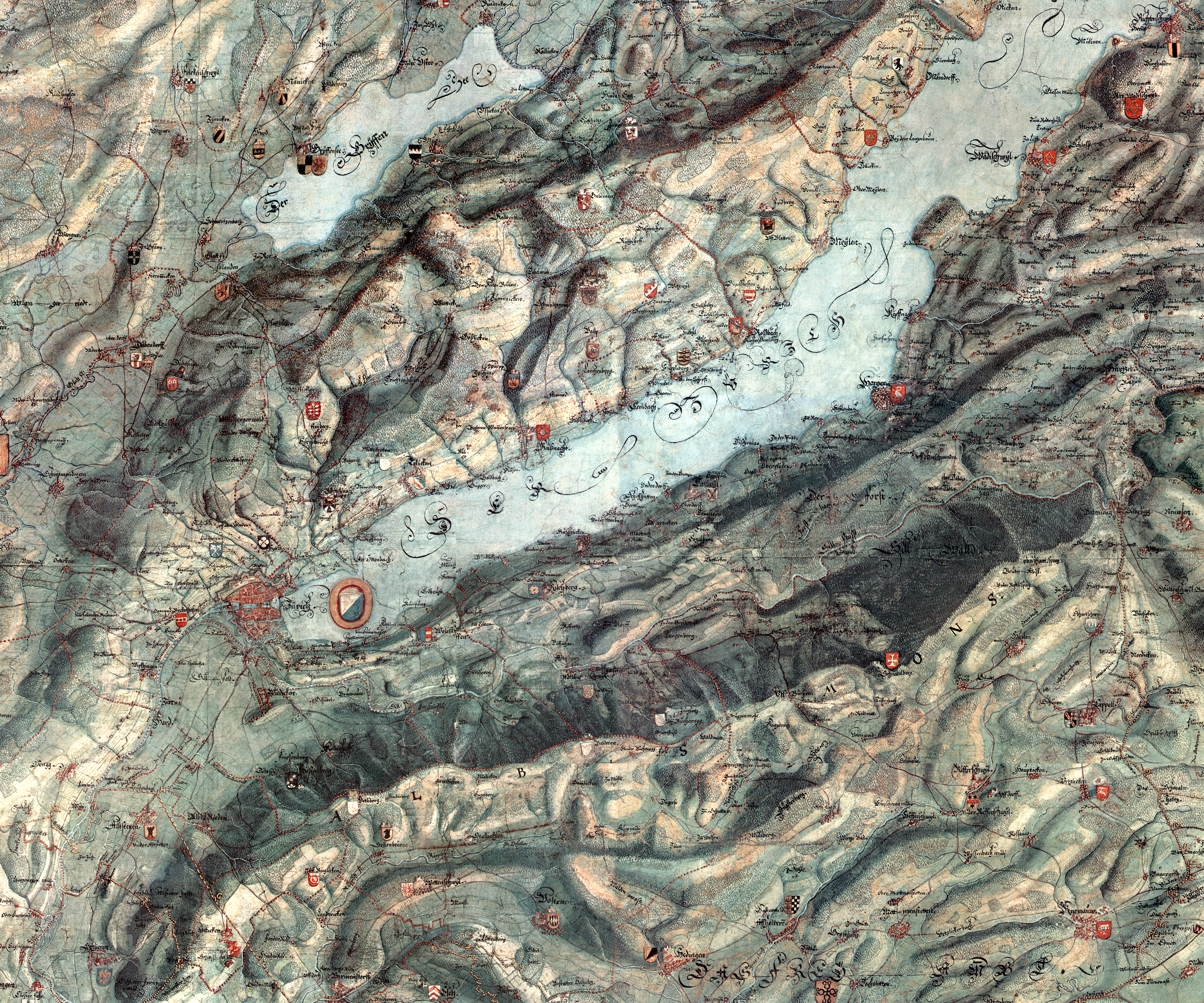
Einer loblichen Statt Zürich eigenthümlich zugehörige Graff und Herrschaften, Stett, Land, und Gebiett. Sampt deroselben anstossenden benachbarten Landen, und gemeinen Landvogteigen. Mit Bergen und Talen, Höltzern und Wälden, Wasseren, Strassen und Landmarcken. Alles nach Geometrischer anleitung Abgetragen, auff disen Plan gebracht, und vollendet Anno Christi MDCLXIIII. Zu Nutz und Ehren disem seinen lieben Vaterland, durch underschribnen [...] Die Gygerkarte von 1667, Region Zürich, Unterer Zürichsee |
|||||||||||||||||
| Date | ||||||||||||||||||
| Source | Zentralbibliothek Zürich | |||||||||||||||||
| Author |
|
|||||||||||||||||

Licensing
[edit]|
This work is in the public domain in its country of origin and other countries and areas where the copyright term is the author's life plus 100 years or fewer. | |
| This file has been identified as being free of known restrictions under copyright law, including all related and neighboring rights. | |
File history
Click on a date/time to view the file as it appeared at that time.
| Date/Time | Thumbnail | Dimensions | User | Comment | |
|---|---|---|---|---|---|
| current | 12:49, 25 October 2019 |  | 3,972 × 3,309 (50.15 MB) | Parpan05 (talk | contribs) | == {{int:filedesc}} == {{Information |Description=''Einer loblichen Statt Zürich eigenthümlich zugehörige Graff und Herrschaften, Stett, Land, und Gebiett. Sampt deroselben anstossenden benachbarten Landen, und gemeinen Landvogteigen. Mit Bergen und Talen, Höltzern und Wälden, Wasseren, Strassen und Landmarcken. Alles nach'' Geometrischer ''anleitung Abgetragen, auff disen Plan gebracht, und vollendet'' Anno Christi MDCLXIIII. ''Zu Nutz und Ehren disem seinen lieben Vaterland, durch underschr... |
You cannot overwrite this file.
File usage on Commons
There are no pages that use this file.
File usage on other wikis
The following other wikis use this file:
- Usage on de.wikipedia.org