File:Gunsgreen House - geograph.org.uk - 212238.jpg
Jump to navigation
Jump to search
No higher resolution available.
Gunsgreen_House_-_geograph.org.uk_-_212238.jpg (640 × 480 pixels, file size: 122 KB, MIME type: image/jpeg)
Captions
Captions
Add a one-line explanation of what this file represents
Summary
[edit]
| Description |
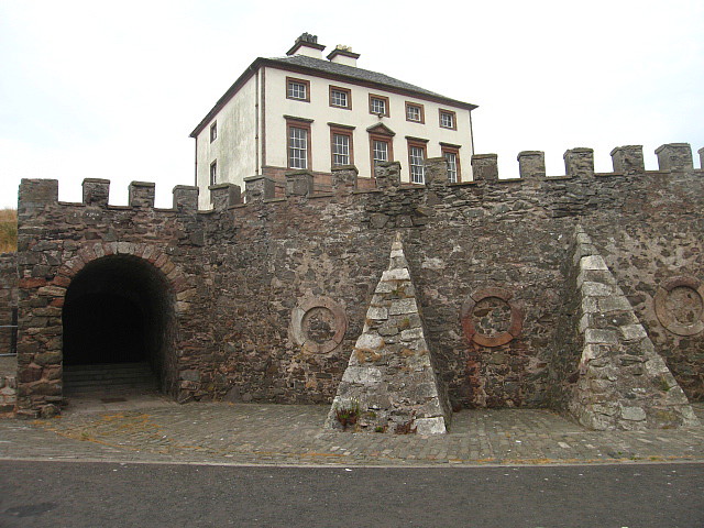
English: Gunsgreen House, Eyemouth, Borders (formerly Berwickshire), Scotland. An 18th-century merchant's villa designed by James Adam and built about 1755. It was the centre of a lucrative smuggling trade in 18th-century Eyemouth. The house was alleged to have its roofspace full of illicit tea, and hiding places built into the walls between certain rooms. |
| Date | |
| Source | From geograph.org.uk |
| Author | Lisa Jarvis |
| Attribution (required by the license) | Lisa Jarvis / Gunsgreen House / |
| Camera location | | View this and other nearby images on: OpenStreetMap |
|---|
_heading:45.00&language=en)
| Object location | | View this and other nearby images on: OpenStreetMap |
|---|
_heading:45.00&language=en)
Licensing
[edit]

|
This image was taken from the Geograph project collection. See this photograph's page on the Geograph website for the photographer's contact details. The copyright on this image is owned by Lisa Jarvis and is licensed for reuse under the Creative Commons Attribution-ShareAlike 2.0 license.
|
This file is licensed under the Creative Commons Attribution-Share Alike 2.0 Generic license.
Attribution: Lisa Jarvis
- You are free:
- to share – to copy, distribute and transmit the work
- to remix – to adapt the work
- Under the following conditions:
- attribution – You must give appropriate credit, provide a link to the license, and indicate if changes were made. You may do so in any reasonable manner, but not in any way that suggests the licensor endorses you or your use.
- share alike – If you remix, transform, or build upon the material, you must distribute your contributions under the same or compatible license as the original.
File history
Click on a date/time to view the file as it appeared at that time.
| Date/Time | Thumbnail | Dimensions | User | Comment | |
|---|---|---|---|---|---|
| current | 21:59, 31 January 2010 | | 640 × 480 (122 KB) | GeographBot (talk | contribs) | == {{int:filedesc}} == {{Information |description={{en|1=Gunsgreen House. Gunsgreen house is a 18th Century merchant's villa designed by James Adam around 1755. It was the centre of a lucrative smuggling trade in 18th Century Eyemouth. The house was alleg |
You cannot overwrite this file.
File usage on Commons
There are no pages that use this file.