File:Geological section crossing Blue Ridge at White's Gap, Rockbridge Co. Va. & extending 10 miles beyond Hunterville (sic), Pocahontas Co., W. Va. LOC 2005625129.tif
Jump to navigation
Jump to search

Size of this JPG preview of this TIF file: 800 × 117 pixels. Other resolutions: 320 × 47 pixels | 640 × 93 pixels | 1,024 × 149 pixels | 1,280 × 187 pixels | 2,560 × 374 pixels | 23,244 × 3,392 pixels.
Original file (23,244 × 3,392 pixels, file size: 225.57 MB, MIME type: image/tiff)
Captions
Captions
Add a one-line explanation of what this file represents
Summary
[edit]| Description |
English: Pen-and-ink, pencil, and watercolor, mounted on cloth. LC Civil War maps (2nd ed.), H222 Available also through the Library of Congress web site as raster image. In upper right corner: No. 36. In pencil on verso: 227 crossed out. |
||
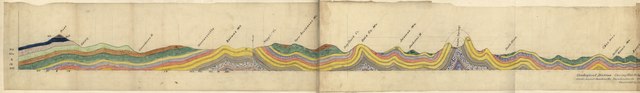
| Title | Geological section crossing Blue Ridge at White's Gap, Rockbridge Co. Va. & extending 10 miles beyond Hunterville [sic], Pocahontas Co., W. Va. | ||
| Shelf ID | G3883.R6C5 188- .C3 | ||
| Date | 1880s | ||
| Source | https://www.loc.gov/item/2005625129/ | ||
| Author | Campbell, J. L. (John Lyle); Ruffner, W. H. | ||
| Permission (Reusing this file) |
|
||
| Other versions |
|
||
| Location | United States · Rockbridge County · Pocahontas County · West Virginia · Virginia | ||
| Part of | Military Battles And Campaigns · Hotchkiss Map Collection · Catalog · American Memory · Geography And Map Division | ||
| Subject | Rockbridge County (Va.) · Maps, Manuscript · Pocahontas County (W. Va.) · Virginia · United States · Rockbridge County · West Virginia · Geological Cross Sections · Pocahontas County |

Licensing
[edit]|
This is a faithful photographic reproduction of a two-dimensional, public domain work of art. The work of art itself is in the public domain for the following reason:
The official position taken by the Wikimedia Foundation is that "faithful reproductions of two-dimensional public domain works of art are public domain".
This photographic reproduction is therefore also considered to be in the public domain in the United States. In other jurisdictions, re-use of this content may be restricted; see Reuse of PD-Art photographs for details. | ||||
File history
Click on a date/time to view the file as it appeared at that time.
| Date/Time | Thumbnail | Dimensions | User | Comment | |
|---|---|---|---|---|---|
| current | 22:59, 22 May 2018 | 23,244 × 3,392 (225.57 MB) | Fæ (talk | contribs) | LOC Maps https://www.loc.gov/item/2005625129/ #13490 |
You cannot overwrite this file.
File usage on Commons
The following page uses this file:
,_Pocahontas_Co.,_W._Va._LOC_2005625129.jpg)