File:Geographisk Charta öfwer Landswägarne igenom Skaraborgs Lähn.jpg
Jump to navigation
Jump to search

Size of this preview: 785 × 599 pixels. Other resolutions: 315 × 240 pixels | 629 × 480 pixels | 1,006 × 768 pixels | 1,280 × 977 pixels | 2,560 × 1,955 pixels | 8,862 × 6,766 pixels.
Original file (8,862 × 6,766 pixels, file size: 5.79 MB, MIME type: image/jpeg)
Captions
Captions
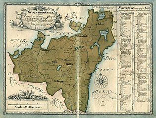
Geographical map of the country roads through Skaraborg county.
Summary
[edit]| Description |
Svenska: Geografisk karta över landsvägarna genom Skaraborgs län år 1731.
English: Geographical map of the country roads through Skaraborg county in 1731. |
||||||||||||||||||||||||||
| Date | |||||||||||||||||||||||||||
| Source |
|
||||||||||||||||||||||||||
| Creator |
Torsten Lohm |
||||||||||||||||||||||||||
| Permission (Reusing this file) |
|
||||||||||||||||||||||||||
| Georeferencing | If inappropriate please set warp_status = skip to hide. | ||||||||||||||||||||||||||


Licensing
[edit]
|
This work is in the public domain in its country of origin and other countries and areas where the copyright term is the author's life plus 70 years or fewer. | |
| This file has been identified as being free of known restrictions under copyright law, including all related and neighboring rights. | |
File history
Click on a date/time to view the file as it appeared at that time.
| Date/Time | Thumbnail | Dimensions | User | Comment | |
|---|---|---|---|---|---|
| current | 11:59, 28 October 2022 | | 8,862 × 6,766 (5.79 MB) | Helene Holmberg (Riksarkivet Sverige) (talk | contribs) | Uploaded a work by Torsten Lohm from https://sok.riksarkivet.se/arkiv/f4swfKECwaUYE2gM9tIm91 with UploadWizard |
You cannot overwrite this file.
File usage on Commons
The following page uses this file:
File usage on other wikis
The following other wikis use this file:
- Usage on en.wikipedia.org
- Usage on sv.wikipedia.org
- Usage on www.wikidata.org