File:Geographical and statistical map of Poland and Hungary. (IA bp 33100).pdf


Original file (3,272 × 2,583 pixels, file size: 5.98 MB, MIME type: application/pdf, 2 pages)
Captions
Captions
Summary
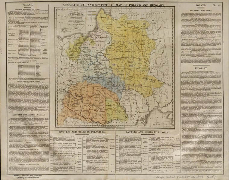
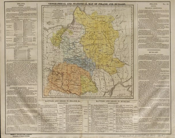
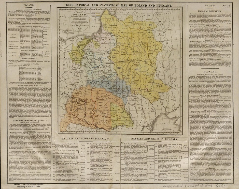
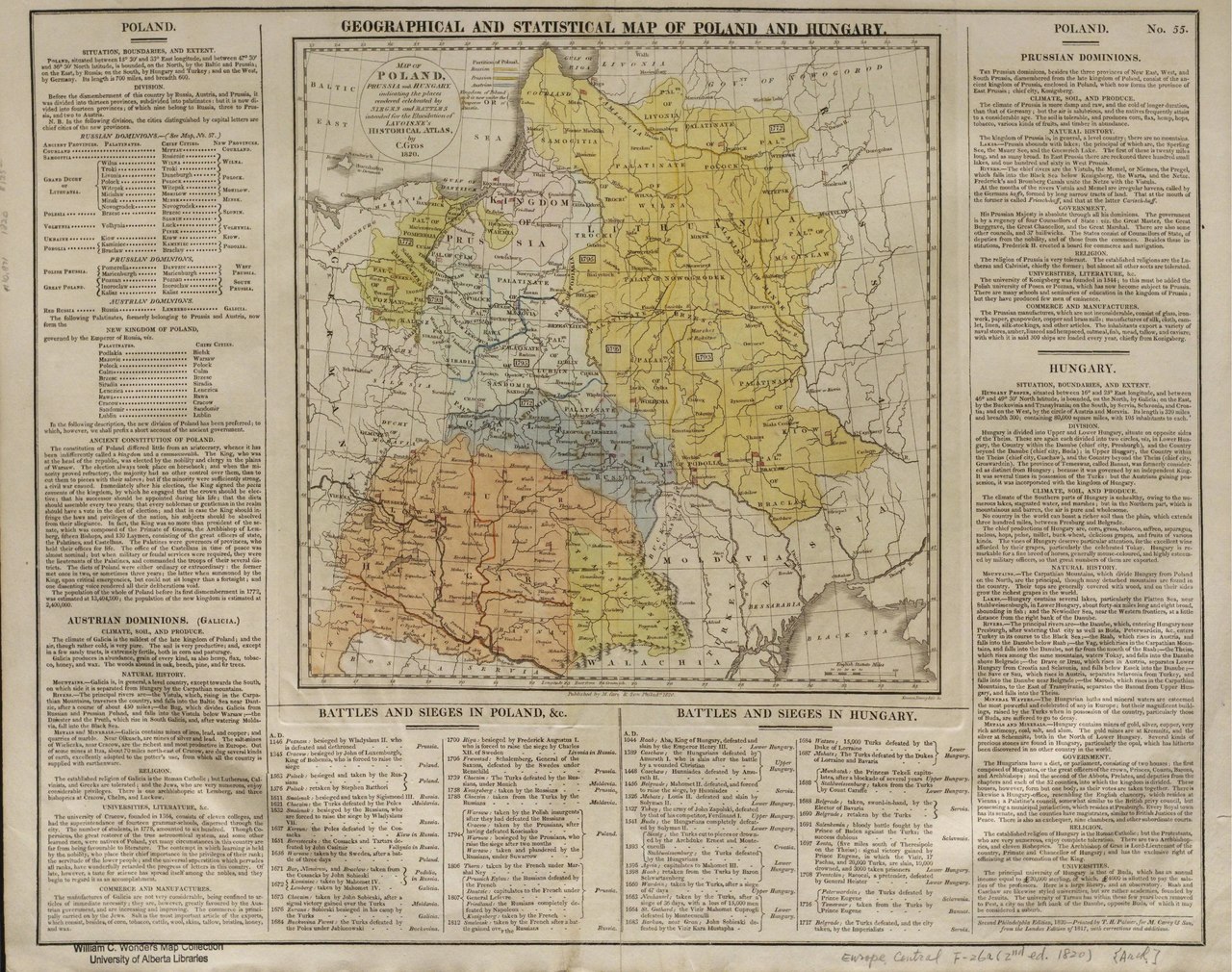
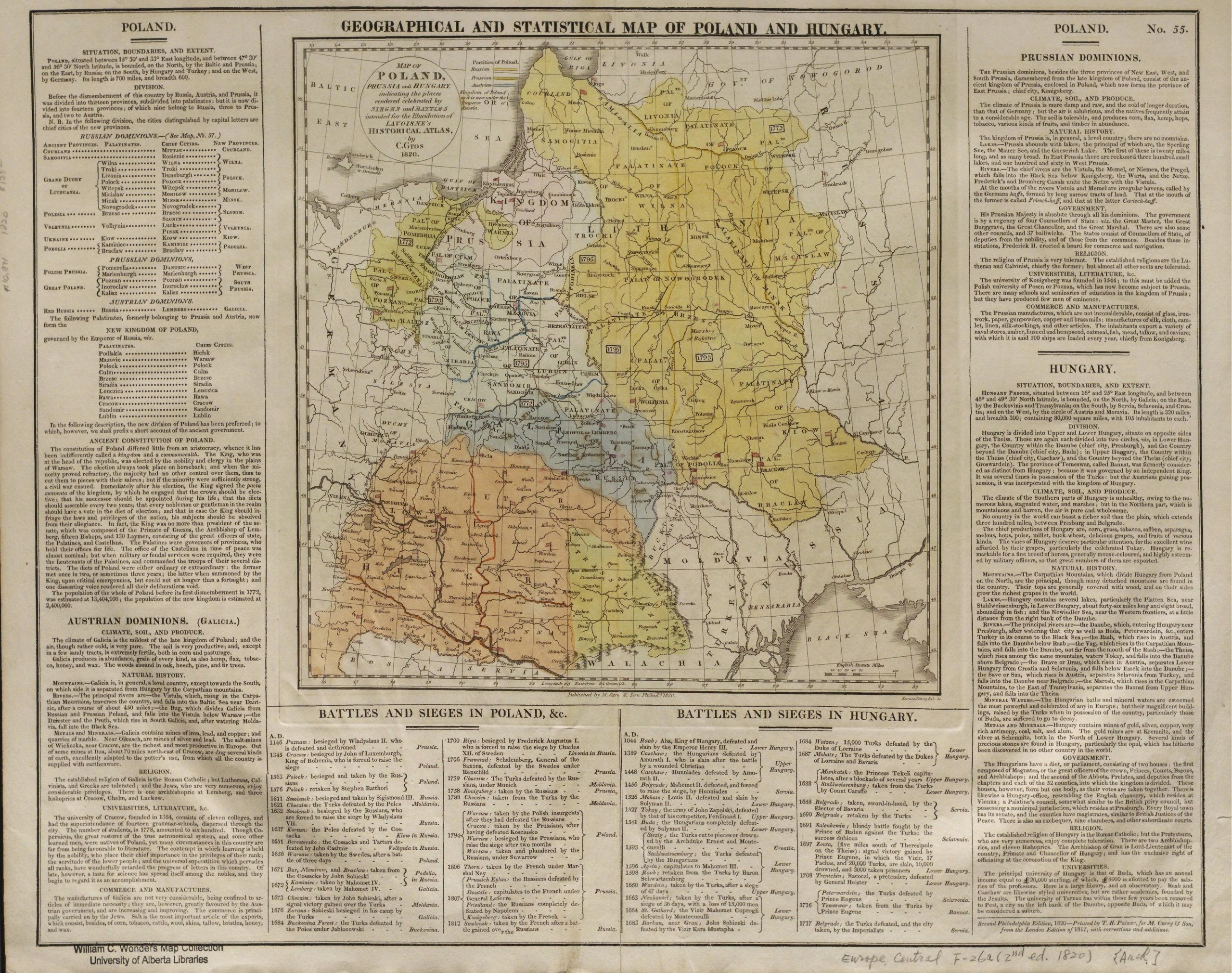
[edit]| Geographical and statistical map of Poland and Hungary.
( |
|
|---|---|
| Title |
Geographical and statistical map of Poland and Hungary. |
| Publisher |
M. Carey & Son, Philadelphia |
| Description |
C.1 from the Whistance-Smith Collection.;Library has: 2c.;Hand col., 29 x 30 cm. on sheet 43 x 54 cm.;Also includes lists of battles and sieges and their dates.;Includes descriptive text of Poland after the partitions and of its territories allotted to Austria, Prussia and Russia.;Alternate title (in cartouche) - "Map of Poland, Prussia and Hungary indicating the places rendered celebrated by sieges and battles intended for elucidation of Lavoisne's historical atlas, by C. Gros 1820.";"No. 55" in upper right.;C.2 from Horvath Collection: No.XXB Subjects: Europe, Central--Political geography |
| Language | English |
| Publication date | 2nd ed 1820 |
| Current location |
IA Collections: wcw_gale; wcw; university_of_alberta_libraries; toronto |
| Accession number |
bp_33100 |
| Notes | Scale: Ca. 1:5,068,800 |
| Source | |
Licensing
[edit]|
This work is in the public domain in its country of origin and other countries and areas where the copyright term is the author's life plus 70 years or fewer. | |
| This file has been identified as being free of known restrictions under copyright law, including all related and neighboring rights. | |
File history
Click on a date/time to view the file as it appeared at that time.
| Date/Time | Thumbnail | Dimensions | User | Comment | |
|---|---|---|---|---|---|
| current | 13:02, 27 August 2021 |  | 3,272 × 2,583, 2 pages (5.98 MB) | Fæ (talk | contribs) | IA Query "collection:(wcw) date:[1000 TO 1899]" bp_33100 Category:William C. Wonders Map Collection (COM:IA books#query) (1820 #298) |
You cannot overwrite this file.
File usage on Commons
The following page uses this file: