File:Front of the Lost River Diversion Dam House, facing northeast. - Klamath Basin Project, Lost River Diversion Dam House, Lost River near intersection of State Highway 140 and HAER ORE,18-KLAFA,1B-5.tif
Jump to navigation
Jump to search

Size of this JPG preview of this TIF file: 764 × 600 pixels. Other resolutions: 306 × 240 pixels | 612 × 480 pixels | 979 × 768 pixels | 1,280 × 1,005 pixels | 2,560 × 2,009 pixels | 5,000 × 3,924 pixels.
Original file (5,000 × 3,924 pixels, file size: 18.71 MB, MIME type: image/tiff)
Captions
Captions
Add a one-line explanation of what this file represents
Summary
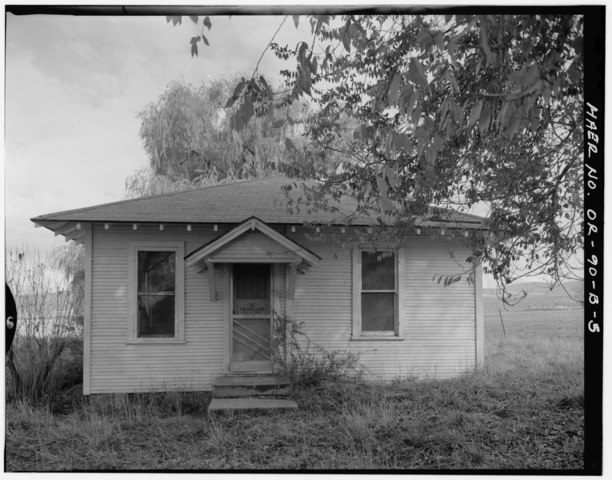
[edit]| Front of the Lost River Diversion Dam House, facing northeast. - Klamath Basin Project, Lost River Diversion Dam House, Lost River near intersection of State Highway 140 and Hill Road, Klamath Falls, Klamath County, OR | ||||
|---|---|---|---|---|
| Title |
Front of the Lost River Diversion Dam House, facing northeast. - Klamath Basin Project, Lost River Diversion Dam House, Lost River near intersection of State Highway 140 and Hill Road, Klamath Falls, Klamath County, OR |
|||
| Depicted place | Oregon; Klamath County; Klamath Falls | |||
| Date | Documentation compiled after 1968 | |||
| Dimensions | 4 x 5 in. | |||
| Current location |
Library of Congress Prints and Photographs Division Washington, D.C. 20540 USA http://hdl.loc.gov/loc.pnp/pp.print |
|||
| Accession number |
HAER ORE,18-KLAFA,1B-5 |
|||
| Credit line |
|
|||
| Notes |
|
|||
| Source | https://www.loc.gov/pictures/item/or0451.photos.355029p | |||
| Permission (Reusing this file) |
|
|||

| Object location | | View this and other nearby images on: OpenStreetMap |
|---|
File history
Click on a date/time to view the file as it appeared at that time.
| Date/Time | Thumbnail | Dimensions | User | Comment | |
|---|---|---|---|---|---|
| current | 09:25, 2 August 2014 |  | 5,000 × 3,924 (18.71 MB) | Fæ (talk | contribs) | GWToolset: Creating mediafile for Fæ. HABS 2014-08-01 2601-2900 missing |
You cannot overwrite this file.
File usage on Commons
The following page uses this file: