File:From the Rio Grande to the Pacific Ocean - from explorations and surveys LOC 98688421.tif
Jump to navigation
Jump to search

Size of this JPG preview of this TIF file: 800 × 361 pixels. Other resolutions: 320 × 144 pixels | 640 × 289 pixels | 1,024 × 462 pixels | 1,280 × 578 pixels | 2,560 × 1,156 pixels | 15,389 × 6,949 pixels.
Original file (15,389 × 6,949 pixels, file size: 305.95 MB, MIME type: image/tiff)
Captions
Captions
Add a one-line explanation of what this file represents
Summary
[edit]| Warning | The original file is very high-resolution. It might not load properly or could cause your browser to freeze when opened at full size. |
|---|
| Description |
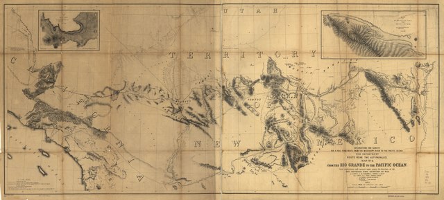
English: Scale 1:950,400. At head of title: Route near the 35th Parallel. Map no. 2. Relief shown by hachures. From U.S. War Department, Explorations and Surveys for a Railroad route from the Mississippi River to the Pacific Ocean. Topographical Maps . . . to Illustrate the Various Reports . . . (Washington, 1859) LC Railroad maps, 153 Description derived from published bibliography. Insets: Sketch of Aztec Pass. Drawn by C. Mahon. From a sketch by A. H. Campbell, Civil Engineer. 12 x 17 cm.--Sketch of Campbell's Pass from Agua Azul to Salt Spring. Drawn by C. Mahon. 13 x 32 cm. Available also through the Library of Congress Web site as a raster image. |
||
| Title | From the Rio Grande to the Pacific Ocean : from explorations and surveys | ||
| Shelf ID | G4301.P3 1853 .H6 | ||
| Date | |||
| Source | https://www.loc.gov/item/98688421/ | ||
| Author | Hoffman, J. D.; Davis, Jefferson; Whipple, Amiel Weeks; Ives, J. C.; Siebert, Selmar; United States. War Department | ||
| Permission (Reusing this file) |
|
||
| Other versions |
|
||
| Location | United States · Southwest, New | ||
| Part of | American Memory · Catalog · Railroad Maps, 1828-1900 · Geography And Map Division · Transportation And Communication | ||
| Subject | United States · Maps · Railroads · Southwest, New · Surveying |


Licensing
[edit]|
This is a faithful photographic reproduction of a two-dimensional, public domain work of art. The work of art itself is in the public domain for the following reason:
The official position taken by the Wikimedia Foundation is that "faithful reproductions of two-dimensional public domain works of art are public domain".
This photographic reproduction is therefore also considered to be in the public domain in the United States. In other jurisdictions, re-use of this content may be restricted; see Reuse of PD-Art photographs for details. | ||||
File history
Click on a date/time to view the file as it appeared at that time.
| Date/Time | Thumbnail | Dimensions | User | Comment | |
|---|---|---|---|---|---|
| current | 14:40, 31 May 2018 |  | 15,389 × 6,949 (305.95 MB) | Fæ (talk | contribs) | LOC Maps https://www.loc.gov/item/98688421/ #16309 |
You cannot overwrite this file.
File usage on Commons
The following page uses this file: