File:Forder Creek - geograph.org.uk - 1191436.jpg
Jump to navigation
Jump to search
No higher resolution available.
Forder_Creek_-_geograph.org.uk_-_1191436.jpg (640 × 357 pixels, file size: 58 KB, MIME type: image/jpeg)
Captions
Captions
Add a one-line explanation of what this file represents
Summary
[edit]
| Description |
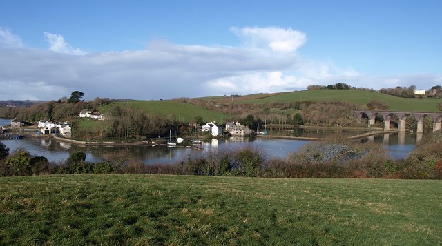
English: Forder Creek On the left is the River Lynher, into which the creek flows. The hamlet by the creek is Antony Passage. In the centre is a tidal mill, with its pond upstream below the railway viaduct on the main line to Penzance. Above the viaduct on the extreme right is part of Trematon Castle; the 1807 stucco house (described as "Higher Lodge" at https://historicengland.org.uk/listing/the-list/list-entry/1140409 ) and the gatehouse. Seen from Churchtown Farm Community nature reserve. For all the photos taken from this spot, see https://www.geograph.org.uk/gridref/SX4157?viewcenti=SX417573&nl=1&user=5089 . |
| Date | |
| Source | From geograph.org.uk |
| Author | Derek Harper |
| Attribution (required by the license) | Derek Harper / Forder Creek / |
| Camera location | | View this and other nearby images on: OpenStreetMap |
|---|
_heading:292.00&language=en)
| Object location | | View this and other nearby images on: OpenStreetMap |
|---|
_heading:292.00&language=en)
Licensing
[edit]

|
This image was taken from the Geograph project collection. See this photograph's page on the Geograph website for the photographer's contact details. The copyright on this image is owned by Derek Harper and is licensed for reuse under the Creative Commons Attribution-ShareAlike 2.0 license.
|
This file is licensed under the Creative Commons Attribution-Share Alike 2.0 Generic license.
Attribution: Derek Harper
- You are free:
- to share – to copy, distribute and transmit the work
- to remix – to adapt the work
- Under the following conditions:
- attribution – You must give appropriate credit, provide a link to the license, and indicate if changes were made. You may do so in any reasonable manner, but not in any way that suggests the licensor endorses you or your use.
- share alike – If you remix, transform, or build upon the material, you must distribute your contributions under the same or compatible license as the original.
File history
Click on a date/time to view the file as it appeared at that time.
| Date/Time | Thumbnail | Dimensions | User | Comment | |
|---|---|---|---|---|---|
| current | 00:10, 26 February 2011 | | 640 × 357 (58 KB) | GeographBot (talk | contribs) | == {{int:filedesc}} == {{Information |description={{en|1=Forder Creek On the left is the River Lynher, into which the creek flows. The hamlet by the creek is Antony Passage. In the centre is a tidal mill, with its pond upstream below the railway viaduct o |
You cannot overwrite this file.
File usage on Commons
There are no pages that use this file.